Browse / United States / Indiana / Gary
Gary
Indianacity

Gary
Total population
64,975
Median home value
$112,400
Bachelor's+
Median income
$40,752
Founded
1906
Demographic figures from US Census Bureau · ACS 5-year estimates. Overview below cites Wikipedia and may reference a different year.
- Beach Hazards Statement · ModerateBeach Hazards Statement issued September 20 at 9:43PM CDT until September 23 at 1:00PM CDT by NWS Chicago IL
Source: NOAA National Weather Service.
City facts
Facts from Wikidata (CC0).
Overview
Gary is a city in Lake County, Indiana, United States. The population was 69,093 at the 2020 census, making it Indiana's eleventh-most populous city. The city has been historically dominated by major industrial activity and is home to U.S. Steel's Gary Works, the largest steel mill complex in North America. Gary is located along the southern shore of Lake Michigan about 25 miles (40 km) southeast of Chicago. The city is the western gateway to the Indiana Dunes National Park, and is within the Chicago area.
Read more on WikipediaHistory & geography
History
Gary, Indiana, was founded in 1906 by the U.S. Steel corporation as the home for its new plant, Gary Works. The city was named after lawyer Elbert Henry Gary, who was the founding chairman of the United States Steel Corporation. Gary was the site of civil unrest in the 1919 General Steel Strike. On October 4, 1919, a riot broke out on Broadway, the main north–south street through downtown Gary, between steel workers and strike breakers brought in from outside. Indiana governor James P. Goodrich declared martial law three days later. Shortly after that, over 4,000 federal troops under the command of Major General Leonard Wood arrived to restore order. The steel industry's jobs provided Gary with rapid growth and a diverse population within the first 26 years of its founding. In the 1920 United States census, 29.7% of Gary's population was classified as foreign-born, mostly from eastern European countries, with another 30.8% native-born with at least one foreign-born parent. By the 1930 United States census, the first census in which Gary's population exceeded 100,000, the city was the fifth largest in Indiana and comparable in size to South Bend, Fort Wayne, and Evansville. In 1930, 78.7% of the population was classified as white, with 19.3% as foreign-born and another 25.9% as native-born with at least one foreign-born parent. In addition to white internal migrants, Gary had attracted numerous African-American migrants from the South in the Great Migration, and 17.8% of the population was classified as black. Some 3.5% were classified as Mexican, now likely to be identified as Hispanic, as they included citizens and immigrants of other Spanish-speaking ethnicities. Gary's fortunes have risen and fallen with those of the steel industry. The growth of the steel…
Geography
The city is located at the southern end of the former lake bed of the prehistoric Lake Chicago and the current Lake Michigan. Most of the city's soil, nearly one foot below the surface, is pure sand. The sand beneath Gary and on its beaches is of such volume and quality that for over a century, companies have mined it, especially for the manufacture of glass. According to the United States Census Bureau, the city has a total area of , of which is land and is water. Miller Beach, Gary's easternmost neighborhood, borders Lake Station and Portage. Gary's southernmost section borders Griffith, Hobart, Merrillville, and unincorporated Ross. Gary is about from the Chicago Loop. Gary contains the western portion of Indiana Dunes National Park, including Miller Woods, the western part of Long Lake, and the Paul H. Douglas Center for Environmental Education. Much of this is within Gary's Miller Beach neighborhood, although the park's western tip extends to downtown Gary. Gary is listed by the Köppen-Geiger climate classification system as humid continental (Dfa). In July and August, the warmest months, high temperatures average 84 °F (29 °C) and peak just above 100 °F (38 °C), and low temperatures average 63 °F (17 °C). In January and February, the coldest months, high temperatures average around 29 °F (−2 °C) and low temperatures average 13 °F (−11 °C), with at least a few days of temperatures dipping below 0 °F (−18 °C). The weather in Gary is greatly regulated by its proximity to Lake Michigan. Weather varies yearly. In the summer months Gary is humid. The city's yearly precipitation averages about 1016 millimeters (40 inches). Summer is the rainiest season. Winters vary but are predominantly snowy. Snowfall…
Excerpted from the corresponding Wikipedia article (CC BY-SA).
Demographics & economy
Race & ethnicity
Source: US Census Bureau — American Community Survey, 5-year estimates.
Geography
Coordinates & boundaries from the US Census TIGER/Line shapefiles.
Climate
Current forecast
Forecast for Gary, IN from NOAA NWS API.
Air quality
Industrial & pollution facilities
Natural hazard risk
Health (adults)
Age-adjusted prevalence estimates from CDC PLACES (latest release).
Walkability
Amenities nearby
Wildlife & biodiversity
Most-observed species
- Ring-billed GullLarus delawarensis Ord, 1815 · Aves15,774
- Canada Goose (canadensis Group)Branta canadensis (Linnaeus, 1758) · Aves14,941
- American RobinTurdus migratorius Linnaeus, 1766 · Aves14,410
- Red-winged BlackbirdAgelaius phoeniceus (Linnaeus, 1766) · Aves13,787
- European StarlingSturnus vulgaris Linnaeus, 1758 · Aves12,452
- MallardAnas platyrhynchos Linnaeus, 1758 · Aves12,410
- American GoldfinchSpinus tristis (Linnaeus, 1758) · Aves11,087
- Northern CardinalCardinalis cardinalis (Linnaeus, 1758) · Aves11,076
Citizen-science & research observations from the Global Biodiversity Information Facility (GBIF).
Schools
Largest nearby schools
- Merrillville High SchoolHigh · Merrillville · 2,042 students · 16.3:1 ratio
- Hammond Central High SchoolHigh · Hammond · 1,863 students · 19.4:1 ratio
- Morton Senior High SchoolHigh · Hammond · 1,609 students · 18.5:1 ratio
- Munster High SchoolHigh · Munster · 1,564 students · 18.4:1 ratio
- 21st Century Charter Sch of GaryOther · Gary · 1,337 students · 11.6:1 ratio
- Hobart High SchoolHigh · Hobart · 1,306 students · 20.4:1 ratio
- Gary Lighthouse Charter SchoolOther · Gary · 1,127 students · 14.8:1 ratio
- East Chicago Central High SchoolHigh · East Chicago · 1,079 students · 14:1 ratio
Public K–12 schools within ~10 mi from Urban Institute Education Data Portal (NCES Common Core of Data, 2022).
Earthquake history
Most recent
- M 2.9 — 2026-07-0821 km ENE of Kenilworth, Illinois
- M 3.2 — 2013-11-041 km SSW of Lyons, Illinois
Events from the USGS Earthquake Catalog (global) (FDSN Event Web Service).
Photos
Sights & places nearby
Notable people from here


People born within ~10 km, from Wikidata (CC0). Click any name for their Wikipedia article.
Nearby places in Indiana
- Highland6.5 mi away · pop. 23,680
- Ogden Dunes8.4 mi away · pop. 1,140
- Burns Harbor11.6 mi away · pop. 2,155
- St. John12 mi away · pop. 22,567
- Winfield13.1 mi away · pop. 7,816
- Shorewood Forest13.7 mi away
- Lake Eliza14.1 mi away · pop. 545
- Cedar Lake15.9 mi away · pop. 15,295
- Lake Dalecarlia17.7 mi away · pop. 1,169
- Boone Grove19.7 mi away · pop. 30
- Hebron19.8 mi away · pop. 3,976
- Lowell21.1 mi away · pop. 11,073
Geography & sun
Elevation, sunrise/sunset and daylight from Open-Meteo. Solar climatology from NASA POWER.
Nearby airports
Public attention
Pageview totals from the Wikimedia Pageviews API.
Books about Gary
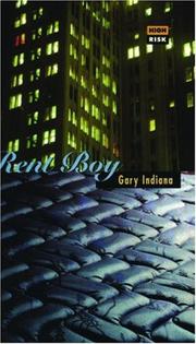
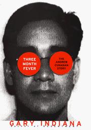





Search results from Open Library.
Recent natural events nearby
Ground air-quality sensors
Recently spotted species
Nearest stream gauge
Events
Gallery
Sources
- • Wikipedia
- • US Census Bureau (ACS 5-year estimates)
- • NOAA National Weather Service
- • Wikidata
- • USGS Earthquake Catalog (global feed)
- • NCES via Urban Institute Education Data Portal
- • GBIF (Global Biodiversity Information Facility)
- • CDC PLACES
- • Open-Meteo / sunrise-sunset.org
- • Wikipedia Pageviews API
- • Open Library