Browse / United States / Indiana / Huntington
Huntington
Indianacity

Huntington
Total population
17,030
Median home value
$119,500
Bachelor's+
Median income
$56,520
Demographic figures from US Census Bureau · ACS 5-year estimates. Overview below cites Wikipedia and may reference a different year.
City facts
Facts from Wikidata (CC0).
Overview
Huntington, known as the "Lime City", is the largest city in and the county seat of Huntington County, Indiana, United States. It is in Huntington and Union townships. It is also part of Fort Wayne, Indiana's metropolitan area. The population was 17,022 at the 2020 United States census, down from 17,391 in the 2010 United States census.
Read more on WikipediaHistory & geography
History
Huntington was named by Captain Elias Murray, a member of the legislature. The name Huntington is derived from Samuel Huntington, a judge, politician, and patriot in the American Revolution. Samuel Huntington is also known for being the third governor of Connecticut and the seventh president of the Continental Congress. Being a delegate to the Second Continental Congress, Huntington took part in voting for and signing the Declaration of Independence and the Articles of Confederation. The county of Huntington was formally organized on December 2, 1834. The city of Huntington was first established by a group of pioneers, most notably Captain Elias Murray. By 1849, Huntington contained 150 houses and a population of 700. A small number of books have been published about the history of Huntington County, the first being History of Huntington County, Indiana originally published by Brant & Fuller. Two other books about Huntington include History of Huntington County, IN by Frank Sumner Bash in 1914 (describing its historical progress, its people, and its principal interests) and Huntington County, IN: Histories and Families by Turner Publishing Company in 1993 as a result of the Huntington County Historical Society officers and board of directors meeting in summer 1992 to discuss the family history of Huntington, the glue that has held together the city and county of Huntington in the heartland of the Midwest for more than 175 years. The Wabash and Erie Canal was constructed through Huntington County in 1834 and added a major economic benefit to the area. In addition to the Wabash River cutting through Huntington (see Forks of the Wabash), this newly opened trade route accelerated the population and economic growth in Huntington.
Geography
Huntington is located on the Wabash River. According to the 2010 census, Huntington has a total area of , of which (or 98.48%) is land and (or 1.52%) is water.
Excerpted from the corresponding Wikipedia article (CC BY-SA).
Demographics & economy
Race & ethnicity
Source: US Census Bureau — American Community Survey, 5-year estimates.
Geography
Coordinates & boundaries from the US Census TIGER/Line shapefiles.
Climate
Air quality
Industrial & pollution facilities
Natural hazard risk
Health (adults)
Age-adjusted prevalence estimates from CDC PLACES (latest release).
Walkability
Amenities nearby
Wildlife & biodiversity
Schools
Largest nearby schools
- Huntington North High SchoolHigh · Huntington · 1,424 students · 15.3:1 ratio
- Crestview Middle SchoolMiddle · Huntington · 606 students · 17.3:1 ratio
- Riverview SchoolMiddle · Huntington · 503 students · 13.6:1 ratio
- Flint Springs ElementaryElementary · Huntington · 461 students · 15.4:1 ratio
- Horace Mann ElementaryElementary · Huntington · 458 students · 14.8:1 ratio
- Roanoke Elementary SchoolElementary · Roanoke · 419 students · 15.5:1 ratio
- Lincoln Elementary SchoolElementary · Huntington · 371 students · 12.4:1 ratio
- Andrews Elementary SchoolElementary · Andrews · 316 students · 12.6:1 ratio
Public K–12 schools within ~10 mi from Urban Institute Education Data Portal (NCES Common Core of Data, 2022).
Earthquake history
Photos
Sights & places nearby
Notable people from here


People born within ~10 km, from Wikidata (CC0). Click any name for their Wikipedia article.
Geography & sun
Elevation, sunrise/sunset and daylight from Open-Meteo. Solar climatology from NASA POWER.
Nearby airports
Public attention
Pageview totals from the Wikimedia Pageviews API.
Books about Huntington

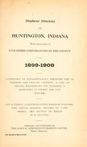

Search results from Open Library.
Recent natural events nearby
Ground air-quality sensors
Recently spotted species
Nearest stream gauge
Events
Gallery
Sources
- • Wikipedia
- • US Census Bureau (ACS 5-year estimates)
- • Wikidata
- • NCES via Urban Institute Education Data Portal
- • CDC PLACES
- • Open-Meteo / sunrise-sunset.org
- • Wikipedia Pageviews API
- • Open Library