Browse / India / Rajasthan / Jaisalmer
Jaisalmer
Rajasthancity

Jaisalmer
Total population
65,500
Founded
1156
Demographic figures from Ministry of Statistics (India). Overview below cites Wikipedia and may reference a different year.
City facts
Facts from Wikidata (CC0).
Overview
Jaisalmer, nicknamed The Golden City, is a city in the north-western Indian state of Rajasthan, located 575 kilometres (357 mi) west of the state capital Jaipur, in the heart of the Thar Desert. It serves as the administrative headquarters of Jaisalmer district. Jaisalmer is a former medieval trading center and the historic capital of the kingdom of Jaisalmer, founded in 1156 by Rawal Jaisal of the Bhati clan of Rajputs. Jaisalmer stands on a ridge of yellowish sandstone and is crowned by the World Heritage Site, Jaisalmer Fort, a sprawling hilltop citadel supported by 99 bastions. This fort contains a royal palace and several ornate Jain temples. Many of the houses and temples of both the fort and of the town below are built of finely sculptured yellow sandstone. The town has a population, including the residents of the fort, of about 78,000. Jaisalmer ranked 9th on Booking.com's Top 10 The Most Welcoming cities in the world. It is the only Indian city on the list.
Read more on WikipediaHistory & geography
History
The state of Jaisalmer had its foundations in what remains of the Empire ruled by the Bhati dynasty. Early Bhati rulers ruled over large empire stretching from Ghazni in modern-day Afghanistan to Sialkot, Lahore and Rawalpindi in modern-day Pakistan to Bhatinda, Muktsar and Hanumangarh in modern-day India. The empire crumbled over time because of continuous invasions from Central Asia. According to Satish Chandra, the Hindu Shahis of Afghanistan made an alliance with the Bhati rulers of Multhan, because they wanted to end the slave raids made by the Turkic ruler of Ghazni, however the alliance was defeated by Alp Tigin in 977 CE. Bhati dominions continued to be shifted towards the South as they ruled Multan, then finally got pushed into Cholistan and Jaisalmer where Rawal Devaraja built Dera Rawal / Derawar. Jaisalmer was the new capital founded in 1156 by Rawal Jaisal and the state took its name from the capital. On 11 December 1818 Jaisalmer became a British protectorate in the Rajputana Agency. Traditionally, in the Middle Ages, the main source of income for the kingdom was levies on caravans, but the economy was heavily affected when Bombay emerged as a major port and sea trade replaced the traditional land routes. Ranjit Singh and Bairi Sal Singh attempted to turn around the economic decline but the dramatic reduction in trade impoverished the kingdom. A severe drought and the resulting famine from 1895 to 1900, during the reign of Salivahan Singh, only made matters worse by causing widespread loss of the livestock that the increasingly agriculturally based kingdom relied upon. The attempts of Jawahir Singh (1914–1949) at modernisation were also not entirely successful in turning the kingdom's economy around, and the drylands of Jaisalmer remained backward…
Geography
Jaisalmer has a hot arid climate (Köppen BWh), and is thus prone to extremes of temperature. The temperature varies greatly from day to night in both summer and winter. The maximum summer temperature is around while the minimum is . The maximum winter temperature is usually around and the minimum is . The highest ever recorded temperature was ; the lowest ever recorded temperature being . Temperatures of up to have been recorded near the Pakistani border, but the standard conditions of this temperature recording remain unverified. The average rainfall is , although as with all of northwest India it is almost exclusively confined to the monsoon from June to September and extremely variable from year to year. As little as was recorded in 1969, but as much as in 2006, of which fell in August alone.
Excerpted from the corresponding Wikipedia article (CC BY-SA).
Geography
Coordinates & boundaries from the US Census TIGER/Line shapefiles.
Climate
Air quality
Walkability
Amenities nearby
Wildlife & biodiversity
Earthquake history
Photos
Sights & places nearby
Notable people from here
Nearby places in Rajasthan
- Pokaran62.1 mi away · pop. 23,600
- Shergarh94.5 mi away · pop. 6,100
- Gudha Malani129.2 mi away · pop. 6,330
- Chitalwana146 mi away · pop. 8,200
- Panchoo147.1 mi away · pop. 17,300
- Rohat152.8 mi away · pop. 6,900
- Kheenvsar153.6 mi away · pop. 9,600
- Bhinmal156.1 mi away · pop. 49,700
- Ahore157.5 mi away · pop. 16,900
- Sanchore158.4 mi away · pop. 25,800
- Pali169.1 mi away · pop. 230,000
- Sirohi185 mi away · pop. 39,200
Geography & sun
Elevation, sunrise/sunset and daylight from Open-Meteo. Solar climatology from NASA POWER.
Nearby airports
Public attention
Pageview totals from the Wikimedia Pageviews API.
Books about Jaisalmer
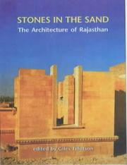
Search results from Open Library.
Recent natural events nearby
Ground air-quality sensors
Recently spotted species
Events
Gallery
Sources
- • Wikipedia
- • Wikidata
- • Open-Meteo / sunrise-sunset.org
- • Wikipedia Pageviews API
- • Open Library