Browse / United States / Indiana / Mount Vernon
Mount Vernon
Indianacity

Mount Vernon
Total population
6,400
Median home value
$163,300
Bachelor's+
Median income
$62,263
Founded
1788
Demographic figures from US Census Bureau · ACS 5-year estimates. Overview below cites Wikipedia and may reference a different year.
City facts
Facts from Wikidata (CC0).
Overview
Mount Vernon is a city in and the county seat of Posey County, Indiana, United States. Located in the state's far southwestern corner, within 15 miles (24 km) of both the southernmost or westernmost points, it is the westernmost city in the state. The southernmost is Rockport, located along the Ohio River about 40 miles (64 km) to the southeast.
Read more on WikipediaHistory & geography
History
Mount Vernon is the county seat and largest city in Posey County, named for General Thomas Posey, Governor of the Indiana Territory. He grew up at a plantation adjacent to George Washington's Mount Vernon. He was widely rumored to be Washington's illegitimate son, but this was dismissed by Posey's biographer, John Thornton Posey, a descendant. The first settler in Mount Vernon was Andrew McFaden in 1806, and the settlement was called McFaden's Bluff. It was platted as Mount Vernon in 1816, but continued to be known as McFadden's Bluff for some time. It was named in honor of Washington's Mount Vernon. A post office called Mount Vernon has been in operation since 1818. A number of historic sites have been recognized in Mount Vernon, including the Posey County Courthouse Square, Mount Vernon Downtown Historic District, Welborn Historic District and the William Gonnerman House, all of which have been placed on the National Register of Historic Places.
Geography
According to the 2010 census, Mount Vernon has a total area of , of which (or 98.25%) is land and (or 1.75%) is water. The climate in this area is characterized by hot, humid summers and generally mild to cool winters. According to the Köppen Climate Classification system, Mount Vernon has a humid subtropical climate, abbreviated "Cfa" on climate maps.
Excerpted from the corresponding Wikipedia article (CC BY-SA).
Demographics & economy
Race & ethnicity
Source: US Census Bureau — American Community Survey, 5-year estimates.
Geography
Coordinates & boundaries from the US Census TIGER/Line shapefiles.
Climate
Air quality
Industrial & pollution facilities
Natural hazard risk
Health (adults)
Age-adjusted prevalence estimates from CDC PLACES (latest release).
Walkability
Amenities nearby
Wildlife & biodiversity
Schools
Largest nearby schools
- Mount Vernon High SchoolHigh · Mount Vernon · 620 students · 11.5:1 ratio
- Mount Vernon Jr High SchoolMiddle · Mount Vernon · 487 students · 15.2:1 ratio
- West Elementary SchoolElementary · Mount Vernon · 366 students · 15.3:1 ratio
- Marrs Elementary SchoolElementary · Mount Vernon · 333 students · 15.1:1 ratio
- Farmersville Elementary SchoolElementary · Mount Vernon · 295 students · 14.8:1 ratio
Public K–12 schools within ~10 mi from Urban Institute Education Data Portal (NCES Common Core of Data, 2022).
Earthquake history
Photos
Sights & places nearby
Notable people from here


People born within ~10 km, from Wikidata (CC0). Click any name for their Wikipedia article.
Nearby places in Indiana
Geography & sun
Elevation, sunrise/sunset and daylight from Open-Meteo. Solar climatology from NASA POWER.
Nearby airports
Public attention
Pageview totals from the Wikimedia Pageviews API.
Books about Mount Vernon
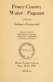




Search results from Open Library.
Recent natural events nearby
Ground air-quality sensors
Recently spotted species
Nearest stream gauge
Events
Gallery
Sources
- • Wikipedia
- • US Census Bureau (ACS 5-year estimates)
- • Wikidata
- • NCES via Urban Institute Education Data Portal
- • CDC PLACES
- • Open-Meteo / sunrise-sunset.org
- • Wikipedia Pageviews API
- • Open Library