Browse / India / Bihar / Munger
Munger
Biharcity

Munger
Total population
213,300
Demographic figures from Ministry of Statistics (India). Overview below cites Wikipedia and may reference a different year.
City facts
Facts from Wikidata (CC0).
Overview
Munger, formerly spelt as Monghyr, is a twin city and a Municipal Corporation situated in the Indian state of Bihar. It is the administrative headquarters of Munger district and Munger Division. Munger was one of the major cities in Eastern India and undivided Bengal during Mughal period and British Raj. It is one of the major political, cultural, educational and commercial centers of Bihar and Eastern India. Munger is situated about 180 km (110 mi) east of capital city Patna, about 480 km (300 mi) west of Eastern India's largest city Kolkata and 1,200 km (750 mi) from country's capital New Delhi.
Read more on WikipediaHistory & geography
History
In classical period (4th-5th century), Munger was known as "Guptagadh" or "Guptagarh". The inscription was found inscribed on a rock at the kasta-harani ghat at the north-western side of the present fort. Guptagadh was founded by Chandragupta Vikramaditya. In early medieval times, Munger was known as Mudgagiri (Sanskrit , with no diacritics). The name is derived from Sanskrit mudga, referring to the mung bean, plus giri, meaning hill. Mudgagiri was a royal residence of the Pala Empire. Sometime in the mid-800s, there was a significant battle fought at Mudgagiri between the Palas (possibly under Narayanapala) and the Pratiharas, possibly under Mihira Bhoja. Another Pratihara dynast, a feudatory ruler named Kakka, also took part in the battle, which was part of a Pratihara invasion of Bengal. Later, Munger was mentioned (as Mudgiri) as the residence of the Pala ruler Ramapala. In the 1100s, Mudgagiri seems to have been under Sena rule. A copper plate grant of the Gahadavala ruler Govindachandra indicates that he advanced as far as Mudgagiri in April 1146, and bathed in the Ganges here on the day of Akshaya Tritiya. According to R. D. Banerji, Govindachandra was likely leading a military expedition to Bengal at that point, and the expedition was evidently unsuccessful, leaving eastern Magadha under Sena control. Historically, Munger was located at a strategic bottleneck controlling the main route into Bengal from the west. To the south, travel was impeded by the steep hills; to the north, the numerous Ganges tributaries were the main obstacle. At the end of 12th century, Munger, along with Patna, was conquered by Bakhtiyar Khalji. The region served as a province of Bengal until 1330 before its annexation by Muhammad Tughlaq. From 1397 Munger was part of the Jaunpur…
Geography
The climate of Munger is subtropical (warm in summer and cold during winter). The Köppen climate classification sub-type for this climate is humid subtropical. |date=April 2014 }}
Excerpted from the corresponding Wikipedia article (CC BY-SA).
Geography
Coordinates & boundaries from the US Census TIGER/Line shapefiles.
Climate
Air quality
Walkability
Amenities nearby
Wildlife & biodiversity
Earthquake history
Photos
Sights & places nearby
Notable people from here


People born within ~10 km, from Wikidata (CC0). Click any name for their Wikipedia article.
Nearby places in Bihar
Geography & sun
Elevation, sunrise/sunset and daylight from Open-Meteo. Solar climatology from NASA POWER.
Nearby airports
Public attention
Pageview totals from the Wikimedia Pageviews API.
Books about Munger
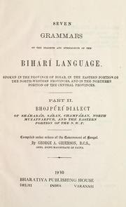

Search results from Open Library.
Recent natural events nearby
Ground air-quality sensors
Recently spotted species
Events
Gallery
Sources
- • Wikipedia
- • Wikidata
- • Open-Meteo / sunrise-sunset.org
- • Wikipedia Pageviews API
- • Open Library