Browse / United States / Indiana / Newburgh
Newburgh
Indianatown

Newburgh
Total population
3,395
Median home value
$237,600
Bachelor's+
Median income
$75,135
Demographic figures from US Census Bureau · ACS 5-year estimates. Overview below cites Wikipedia and may reference a different year.
City facts
Facts from Wikidata (CC0).
Overview
Newburgh is an incorporated town in Ohio Township, Warrick County, Indiana, United States, along the Ohio River. As of the 2020 census, Newburgh had a population of 3,344. The town is part of the larger Evansville metropolitan area, and Ohio Township, which Newburgh shares with nearby Chandler, includes the town. It is the easternmost suburb of Evansville.
Read more on WikipediaHistory & geography
History
As a town situated on the fertile banks of the Ohio River, Newburgh has a long history of human activity. Western explorers first arrived in the area in the 17th century. For centuries prior to that, it had been inhabited by the Shawnee people and was near the center of prehistoric Mississippian culture as late as 1450 A.D. He secured land grants in 1812 and in 1818 platted what became known as Sprinklesburgh (sometimes called "Mount Pleasant"). It was the first town in Warrick County. The original plat of Sprinklesburgh consisted of about 12 blocks immediately west of today's downtown Newburgh. Abner Luce founded Newburgh almost directly to the east of Sprinklesburgh in 1829. In 1841, Luce's plat was merged with Sprinkelsburgh and the name of the town was changed to Newburgh. However, when the national railway system came to southern Indiana, it bypassed Newburgh completely in favor of Evansville, beginning a permanent shift in regional economic dominance. On July 18, 1862, Newburgh was the first town north of the Mason–Dixon line to be captured by the Confederate forces during the American Civil War in what would come to be known as the Newburgh Raid. Colonel Adam "Stovepipe" Johnson, with a partisan band, crossed the Ohio River and confiscated supplies and ammunition without a shot being fired. The Confederates would have been unable to shell the city (as promised) had Newburgh put up a fight. The Confederates' cannons were an assemblage of a stove pipe, charred log, and wagon wheels. The raid convinced the federal government that it was necessary to supply Indiana with a permanent force of regular Union Army soldiers to counter future raids. Many of the structures used in this raid are still standing, including the Exchange Hotel. Newburgh's economy benefited…
Geography
Newburgh is located at . According to the 2010 census, Newburgh has a total area of , of land. Plans to expand town limits through annexation have been abandoned in favor of planning and development within the current town limits. The town's architecture includes representative examples of Italianate, Greek Revival, and Classical Revival style architecture. The climate in this area is characterized by hot, humid summers and cool to mild winters. According to the Köppen Climate Classification system, Newburgh has a humid subtropical climate (abbrev. CFA) on climate maps.
Excerpted from the corresponding Wikipedia article (CC BY-SA).
Demographics & economy
Race & ethnicity
Source: US Census Bureau — American Community Survey, 5-year estimates.
Geography
Coordinates & boundaries from the US Census TIGER/Line shapefiles.
Climate
Air quality
Industrial & pollution facilities
Natural hazard risk
Health (adults)
Age-adjusted prevalence estimates from CDC PLACES (latest release).
Walkability
Amenities nearby
Wildlife & biodiversity
Most-observed species
- Northern CardinalCardinalis cardinalis (Linnaeus, 1758) · Aves13,282
- American RobinTurdus migratorius Linnaeus, 1766 · Aves9,659
- Carolina WrenThryothorus ludovicianus (Latham, 1790) · Aves9,110
- Carolina ChickadeePoecile carolinensis (Audubon, 1834) · Aves8,827
- Tufted TitmouseBaeolophus bicolor (Linnaeus, 1766) · Aves8,705
- Red-bellied WoodpeckerMelanerpes carolinus (Linnaeus, 1758) · Aves8,290
- Downy WoodpeckerDryobates pubescens (Linnaeus, 1766) · Aves7,883
- Blue JayCyanocitta cristata (Linnaeus, 1758) · Aves7,149
Citizen-science & research observations from the Global Biodiversity Information Facility (GBIF).
Schools
Earthquake history
Photos
Sights & places nearby
Notable people from here
Nearby places in Indiana
Geography & sun
Elevation, sunrise/sunset and daylight from Open-Meteo. Solar climatology from NASA POWER.
Nearby airports
Public attention
Pageview totals from the Wikimedia Pageviews API.
Books about Newburgh
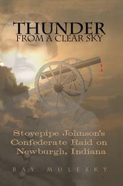
Search results from Open Library.
Recent natural events nearby
Ground air-quality sensors
Recently spotted species
Nearest stream gauge
Events
Gallery
Sources
- • Wikipedia
- • US Census Bureau (ACS 5-year estimates)
- • Wikidata
- • GBIF (Global Biodiversity Information Facility)
- • CDC PLACES
- • Open-Meteo / sunrise-sunset.org
- • Wikipedia Pageviews API
- • Open Library