Browse / United States / Indiana / Richmond
Richmond
Indianacity

Richmond
Total population
35,581
Median home value
$114,400
Bachelor's+
Median income
$45,399
Demographic figures from US Census Bureau · ACS 5-year estimates. Overview below cites Wikipedia and may reference a different year.
City facts
Overview
Richmond is a city in eastern Wayne County, Indiana, United States. Bordering the state of Ohio, it is the county seat of Wayne County. In the 2020 census, the city had a population of 35,720. It is the principal city of the Richmond micropolitan area. Situated largely within Wayne Township, its area includes a non-contiguous portion in nearby Boston Township, where Richmond Municipal Airport is located.
Read more on WikipediaHistory & geography
History
In 1806 the first European Americans in the area, Quaker families from the state of North Carolina, settled along the East Fork of the Whitewater River. This was part of a general westward migration in the early decades after the American Revolution. John Smith and Jeremiah Cox were two of the earliest settlers, and the area that was to become Richmond was originally divided into the towns of Smithville and Coxborough (also known as Jericho). Richmond is still home to several Quaker institutions, including Friends United Meeting, Richmond Friends School, Earlham College and the Earlham School of Religion. In 1818, Smithville amalgamated with Coxborough and incorporated as the town of Richmond. The name is believed to refer to the area's "rich soil" (from the Old French riche (rich/wealthy) and mont (hill)). The town was officially incorporated as a city in 1840, with John Sailor elected the first mayor. Early cinema and television pioneer Charles Francis Jenkins grew up on a farm north of Richmond, where he began inventing useful gadgets. As the Richmond Telegram reported, on June 6, 1894, Jenkins gathered his family, friends and newsmen at his cousin's jewelry store in downtown Richmond and projected a filmed motion picture for the first time in front of an audience. The motion picture was of a vaudeville entertainer performing a butterfly dance, which Jenkins had filmed himself. Jenkins filed for a patent for the Phantoscope projector in November 1894 and it was issued in March 1895. A modified version of the Phantoscope was later sold to Thomas Edison, who named it Edison's Vitascope and began projecting motion pictures in New York City vaudeville theaters, raising the curtain on American cinema. Joseph E. Maddy is credited with founding the country's first…
Geography
According to the 2010 census, Richmond has a total area of , of which (or 99.35%) is land and (or 0.65%) is water. Richmond is located about 12 miles S of Hoosier Hill, the highest point in Indiana. Richmond is noted for its rich stock of historic architecture. In 2003, a book entitled Richmond Indiana: Its Physical Development and Aesthetic Heritage to 1920 by Cornell University architectural historians, Michael and Mary Raddant Tomlan, was published by the Indiana Historical Society. Particularly notable buildings are the 1902 Pennsylvania Railroad Station designed by Daniel H. Burnham of Chicago and the 1893 Wayne County Court House designed by James W. McLaughlin of Cincinnati. Local architects of note include John A. Hasecoster, William S. Kaufman and Stephen O. Yates. The significance of the architecture has been recognized. Five large districts, such as the Depot District, and several individual buildings are listed in the National Register of Historic Places, the Historic American Buildings Survey and the Historic American Engineering Record.
Excerpted from the corresponding Wikipedia article (CC BY-SA).
Demographics & economy
Race & ethnicity
Source: US Census Bureau — American Community Survey, 5-year estimates.
Geography
Coordinates & boundaries from the US Census TIGER/Line shapefiles.
Climate
Current forecast
Forecast for Richmond, IN from NOAA NWS API.
Air quality
Industrial & pollution facilities
Natural hazard risk
Health (adults)
Age-adjusted prevalence estimates from CDC PLACES (latest release).
Walkability
Amenities nearby
Wildlife & biodiversity
Schools
Largest nearby schools
- Richmond High SchoolHigh · Richmond · 1,332 students · 16.4:1 ratio
- Test Intermediate SchoolMiddle · Richmond · 762 students · 14.4:1 ratio
- Dennis Middle SchoolMiddle · Richmond · 597 students · 13.9:1 ratio
- Northeastern Elementary SchoolElementary · Fountain City · 590 students · 14.8:1 ratio
- Centerville-Abington Elem SchoolElementary · Centerville · 552 students · 18.4:1 ratio
- Centerville Sr High SchoolHigh · Centerville · 530 students · 14.3:1 ratio
- Northeastern High SchoolHigh · Fountain City · 443 students · 16.4:1 ratio
- Rose Hamilton Elementary SchoolElementary · Centerville · 408 students · 16.3:1 ratio
Public K–12 schools within ~10 mi from Urban Institute Education Data Portal (NCES Common Core of Data, 2022).
Earthquake history
Photos
Sights & places nearby
Notable people from here


People born within ~10 km, from Wikidata (CC0). Click any name for their Wikipedia article.
Nearby places in Indiana
- Whitewater8.4 mi away
- Greens Fork8.9 mi away · pop. 436
- East Germantown13.1 mi away
- Hagerstown15.1 mi away
- Mount Auburn15.9 mi away
- Dublin16.7 mi away · pop. 870
- West College Corner18.5 mi away
- Losantville20.4 mi away · pop. 238
- Winchester23.9 mi away
- Blountsville24.3 mi away
- Glenwood26.1 mi away · pop. 429
- New Castle26.1 mi away · pop. 17,367
Geography & sun
Elevation, sunrise/sunset and daylight from Open-Meteo. Solar climatology from NASA POWER.
Nearby airports
Public attention
Pageview totals from the Wikimedia Pageviews API.
Books about Richmond


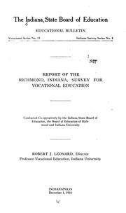

Search results from Open Library.
Recent natural events nearby
Ground air-quality sensors
Recently spotted species
Nearest stream gauge
Events
Gallery
Sources
- • Wikipedia
- • US Census Bureau (ACS 5-year estimates)
- • NOAA National Weather Service
- • Wikidata
- • NCES via Urban Institute Education Data Portal
- • CDC PLACES
- • Open-Meteo / sunrise-sunset.org
- • Wikipedia Pageviews API
- • Open Library