Browse / United States / Indiana / Shoals
Shoals
Indianatown

Shoals
Total population
679
Median home value
$151,500
Bachelor's+
Median income
$38,333
Demographic figures from US Census Bureau · ACS 5-year estimates. Overview below cites Wikipedia and may reference a different year.
City facts
Facts from Wikidata (CC0).
Overview
Shoals is a town in Center and Halbert townships and the county seat of Martin County, in the U.S. state of Indiana. The population was 677 at the 2020 census.
Read more on WikipediaHistory & geography
History
Shoals was originally called "Memphis"; under the latter name, the community was platted in 1844. The post office at Shoals has been in operation since 1869. A lynching took place at the county courthouse and jail. The Archer boys were accused of torturing and killing a local farmer and were hanged from trees in front of the jail in 1886. Shoals is known for making mother of pearl buttons during the early 20th century. They were made out of mussels from the White River.
Geography
Shoals is located south of the center of Martin County. The East Fork of the White River flows through the center of town, running south and west to join the White River northeast of Petersburg. U.S. Routes 50 and 150 pass through the center of Shoals as 4th Street, leading west to Loogootee, the only city in the county. US 50 leads northeast to Bedford, while US 150 leads southeast to Paoli. According to the U.S. Census Bureau, Shoals has a total area of , of which are land and , or 4.95%, are water.
Excerpted from the corresponding Wikipedia article (CC BY-SA).
Demographics & economy
Race & ethnicity
Source: US Census Bureau — American Community Survey, 5-year estimates.
Geography
Coordinates & boundaries from the US Census TIGER/Line shapefiles.
Climate
Air quality
Industrial & pollution facilities
Natural hazard risk
Health (adults)
Age-adjusted prevalence estimates from CDC PLACES (latest release).
Walkability
Amenities nearby
Wildlife & biodiversity
Most-observed species
- Northern CardinalCardinalis cardinalis (Linnaeus, 1758) · Aves722
- Tufted TitmouseBaeolophus bicolor (Linnaeus, 1766) · Aves623
- American CrowCorvus brachyrhynchos C.L.Brehm, 1822 · Aves621
- Red-bellied WoodpeckerMelanerpes carolinus (Linnaeus, 1758) · Aves618
- Turkey VultureCathartes aura (Linnaeus, 1758) · Aves546
- Blue JayCyanocitta cristata (Linnaeus, 1758) · Aves541
- White-breasted NuthatchSitta carolinensis Latham, 1790 · Aves515
- Carolina ChickadeePoecile carolinensis (Audubon, 1834) · Aves500
Citizen-science & research observations from the Global Biodiversity Information Facility (GBIF).
Schools
Largest nearby schools
- Shoals Community Elementary SchoolElementary · Shoals · 314 students · 18.5:1 ratio
- Loogootee Elementary SchoolElementary · Loogootee · 299 students · 16.6:1 ratio
- Loogootee High SchoolHigh · Loogootee · 241 students · 12.7:1 ratio
- Loogootee Middle SchoolMiddle · Loogootee · 210 students · 15:1 ratio
- Shoals Community High SchoolHigh · Shoals · 192 students · 14.8:1 ratio
- Shoals Middle SchoolMiddle · Shoals · 163 students · 14.8:1 ratio
Public K–12 schools within ~10 mi from Urban Institute Education Data Portal (NCES Common Core of Data, 2022).
Earthquake history
Most recent
- M 2.58 — 2025-08-092 km ESE of Cynthiana, Indiana
- M 2.6 — 2017-10-188 km SE of Lynnville, Indiana
- M 2.6 — 2017-09-164 km WNW of Lynnville, Indiana
- M 3.6 — 2012-11-207 km N of Bellmont, Illinois
- M 3.1 — 2012-05-100 km NW of Emison, Indiana
- M 2.7 — 2012-05-101 km NNW of Emison, Indiana
Events from the USGS Earthquake Catalog (global) (FDSN Event Web Service).
Photos
Sights & places nearby
Notable people from here
Nearby places in Indiana
- Cannelburg11 mi away
- Prospect11 mi away
- West Baden Springs11.9 mi away
- Dubois15.1 mi away · pop. 439
- Owensburg18.1 mi away · pop. 447
- Paoli19 mi away · pop. 3,125
- Celestine19.3 mi away · pop. 422
- Washington19.8 mi away
- Jasper20.4 mi away · pop. 15,991
- Ireland20.6 mi away · pop. 153
- Bedford21.2 mi away
- Oolitic21.4 mi away · pop. 1,522
Geography & sun
Elevation, sunrise/sunset and daylight from Open-Meteo. Solar climatology from NASA POWER.
Nearby airports
Public attention
Pageview totals from the Wikimedia Pageviews API.
Books about Shoals
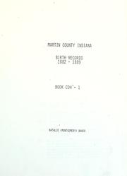

Search results from Open Library.
Recent natural events nearby
Ground air-quality sensors
Recently spotted species
Nearest stream gauge
Events
Gallery
Sources
- • Wikipedia
- • US Census Bureau (ACS 5-year estimates)
- • Wikidata
- • USGS Earthquake Catalog (global feed)
- • NCES via Urban Institute Education Data Portal
- • GBIF (Global Biodiversity Information Facility)
- • CDC PLACES
- • Open-Meteo / sunrise-sunset.org
- • Wikipedia Pageviews API
- • Open Library