Browse / India / Andhra Pradesh / Visakhapatnam
Visakhapatnam
Andhra Pradeshcity

Visakhapatnam
Total population
2,526,000
Demographic figures from Ministry of Statistics (India). Overview below cites Wikipedia and may reference a different year.
City facts
Facts from Wikidata (CC0).
Overview
Visakhapatnam is the largest and most populous city in the Indian state of Andhra Pradesh. It is between the Eastern Ghats and the coast of the Bay of Bengal. It is the second largest city on the east coast of India after Chennai, and the fourth largest in South India. It is one of the four smart cities of Andhra Pradesh selected under the Smart Cities Mission and is the headquarters of Visakhapatnam district. Vizag is popularly known as shipbuilding capital of India due to presence of multiple shipyards such as Hindustan Shipyard, Naval Dockyard and being the central naval command of the east coast. As the economic hub of Andhra Pradesh, the city hosts diversified economy with the presence of heavy industries, ports, logistics, pharmaceuticals, medtech, biotechnology, energy production, tourism, textiles, R&D and a growing information technology and financial technology center. It is also described as the City of Destiny and the Jewel of the East Coast.
Read more on WikipediaHistory & geography
History
Visakhapatnam's history stretches back to the 6th century BCE and the city finds mention in ancient texts such as the 4th century BCE writings of Pāṇini and Katyayana. Historically considered part of the Kalinga region, Legend has it that Radha and Viśakha were born on the same day and were equally beautiful. Sri Visakka Sakhi is the second most important gopi of the eight main gopis. She carries messages between Radha and Krishna and is the most expert Gopi messenger. Residents believe that an Andhra king built a temple to pay homage to his family deity Viśakha. This is now inundated under seawater near RK Beach. Another theory is that it is named after a woman disciple of Buddha named Viśakha. Later it was ruled by Kingdom of Jeypore (1535–1571), Qutb Shahis (1571–1674) and (1674–1711), Mughal Empire (1711–1724) and Nizam (1724–1757). The French (1757) and British (1765) established Factories and influence over the city. In 1794 the Battle of Padmanabham occurred between the Zamindari of Vizianagaram and the East India Company. after the battle, Vizianagaram estate was acquired by the East India company in 1802. The British East India Company fought the 1804 Battle of Vizagapatnam and it remained the under British colonial rule until Indian independence in 1947 which was a part of the Northern Circars. Hindu texts state that during the fifth century BCE, the Visakhapatnam region was part of Kalinga territory, which extended to the Godavari river. Relics found in the area also prove the existence of a Buddhist empire in the region. Kalinga later lost the territory to King Ashoka in the bloodiest battle of its time, which prompted Ashoka to embrace Buddhism. Ancient Buddhist sites, recently excavated, are scattered across Visakhapatnam, reflecting the region's…
Geography
The city is situated between the Eastern Ghats and the Bay of Bengal. Visakhapatnam is situated in Coastal Andhra Region. The city is surrounded by the Simhachalam Hill Range to the west, the Yarada Hills to the southeast, and Kambalakonda Wildlife Sanctuary to the northwest. The hills play an important role in Visakhapatnam's ecological environment and cover over 621.52 km2. * Eastern Ghats * Simhachalam Hills * Yarada Hills * Erra Matti Dibbalu * Dolphin's Nose Hills * Kailasagiri Hills Visakhapatnam has a tropical savanna climate (Köppen: Aw, closely bordering As). It receives rainfall from the South-west and North-east monsoons In October 2014 Cyclone Hudhud made landfall near Visakhapatnam. {{Weather box | location = Visakhapatnam (Dolphin's Nose) 1981–2010, extremes 1970–2005) | metric first= Yes | single line = Yes | collapsed = Yes | Jan record high C = 30.7 | Feb record high C = 35.0 | Mar record high C = 36.2 | Apr record high C = 36.1 | May record high C = 42.8 | Jun record high C = 39.8 | Jul record high C = 39.8 | Aug record high C = 36.2 | Sep record high C = 36.6 | Oct record high C = 34.5 | Nov record high C = 32.4 | Dec record high C = 31.4 | year record high C = 42.8 | Jan high C = 27.2 | Feb high C = 26.9 | Mar high C = 30.6 | Apr high C = 31.5 | May high C = 32.6 | Jun high C = 32.2 | Jul high C = 30.6 | Aug high C = 30.5 | Sep high C = 30.6 | Oct high C = 30.2 | Nov high C = 28.8 | Dec high C = 27.4 | year high C = 30.1 | Jan low C = 19.8 | Feb low C = 21.4 | Mar low C = 23.5 | Apr low C = 25.0 | May low C = 26.1 | Jun low C = 26.0 | Jul low C = 25.0 | Aug low C = 24.8 | Sep low C = 24.8 | Oct low C = 23.8 | Nov low C = 21.8 | Dec low C = 19.8 | year low C = 23.5 | Jan record low C = 15.6 | Feb record low C = 17.7 | Mar record low C =…
Excerpted from the corresponding Wikipedia article (CC BY-SA).
Geography
Coordinates & boundaries from the US Census TIGER/Line shapefiles.
Climate
Air quality
Walkability
Amenities nearby
Wildlife & biodiversity
Most-observed species
- House CrowCorvus splendens Vieillot, 1817 · Aves10,787
- Common MynaAcridotheres tristis (Linnaeus, 1766) · Aves10,395
- Large-billed CrowCorvus macrorhynchos Wagler, 1827 · Aves9,530
- Rose-ringed ParakeetPsittacula krameri (Scopoli, 1769) · Aves8,882
- Black KiteMilvus migrans (Boddaert, 1783) · Aves8,355
- Rock PigeonColumba livia J.F.Gmelin, 1789 · Aves8,018
- Asian KoelEudynamys scolopaceus (Linnaeus, 1758) · Aves7,962
- Spotted doveSpilopelia chinensis (Scopoli, 1786) · Aves7,869
Citizen-science & research observations from the Global Biodiversity Information Facility (GBIF).
Earthquake history
Events from the USGS Earthquake Catalog (global) (FDSN Event Web Service).
Photos
Sights & places nearby
Notable people from here


People born within ~10 km, from Wikidata (CC0). Click any name for their Wikipedia article.
Nearby places in Andhra Pradesh
- Sucuriju8984.9 mi away · pop. 565
- Ilha Vitória8996.4 mi away
- Acaituba9002.6 mi away
- Taperebá9003.3 mi away
- São João do Caciporé9003.8 mi away
- Furo Velho9005.9 mi away
- Braco Seco9006.7 mi away
- Paraizo9007 mi away
- Retiro Campinho9007 mi away
- Retiro Macaqueiro9007 mi away
- Furo Seco9007 mi away
- Retiro São Vicenti9007.2 mi away
Geography & sun
Elevation, sunrise/sunset and daylight from Open-Meteo. Solar climatology from NASA POWER.
Nearby airports
Public attention
Pageview totals from the Wikimedia Pageviews API.
Books about Visakhapatnam

Search results from Open Library.
Recent natural events nearby
Ground air-quality sensors
Recently spotted species
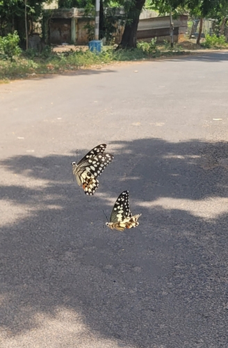
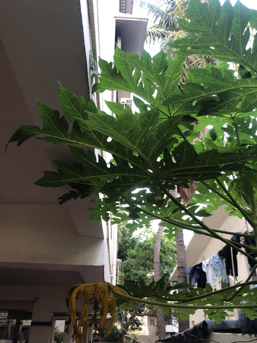

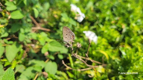





Research-grade observations from iNaturalist (within ~15 mi).
Events
Gallery
Geotagged photos within ~6 miles of Visakhapatnam, from Wikimedia Commons contributors.
 0 mi
0 mi 0 mi
0 mi 0 mi
0 mi 0.1 mi
 0.1 mi
 0.1 mi
 0.3 mi
 0.3 mi
 0.3 mi
 0.3 mi
.jpg) 0.3 mi
0.3 mi.jpg) 0.3 mi
0.3 mi.jpg) 0.3 mi
0.3 mi 0.4 mi
 0.4 mi
 0.4 mi
 0.4 mi
 0.4 mi
 0.4 mi
 0.4 mi
 0.4 mi
_departing_from_Visakhapatnam_harbor.jpg) 0.4 mi
0.4 mi 0.4 mi
_entering_Bay_of_Bengal_from_Vizag_Port.jpg) 0.4 mi
0.4 miPhotos via Wikimedia Commons — see each image page for license & attribution.
Sources
- • Wikipedia
- • Wikimedia Commons
- • Wikidata
- • USGS Earthquake Catalog (global feed)
- • GBIF (Global Biodiversity Information Facility)
- • iNaturalist
- • Open-Meteo / sunrise-sunset.org
- • Wikipedia Pageviews API
- • Open Library