Browse / Iraq / Iraq / Al Kufa
Al Kufa
Iraqcity

Al Kufa
Total population
230,000
Demographic figures from Central Statistical Organization (Iraq). Overview below cites Wikipedia and may reference a different year.
City facts
Facts from Wikidata (CC0).
Overview
Kufa, also spelled Kufah, is a city in Iraq, about 170 kilometres (110 mi) south of Baghdad, and 10 kilometres (6.2 mi) northeast of Najaf. It is located on the banks of the Euphrates River. The estimated population in 2003 was 110,000. Along with Najaf, Karbala, Mashhad, Kadhimiya, Samarra and Qom, Kufa is a holy city in Shia Islam.
Read more on WikipediaHistory & geography
History
After the Arabian hegemony and the fall of Persian Empire, and its geographic proximity to the imperial capital, Ctesiphon) at Battle of Al-Qadisiyyah in 636, Kufa was founded and given its name in 637–638 CE, about the same time as Basra. Kufa and Basra were the two amsar (garrison cities) of Iraq, serving as military bases and administrative centers. The Companion of the Prophet Saʻd ibn Abī Waqqas founded it as an encampment adjacent to the Lakhmid Arab city of Al-Hirah, and incorporated it as a city of seven divisions. Non-Arabs knew the city under alternate names: Hīrah and Aqulah, before the consolidations of ʻAbdu l-Mālik in 691. Umar, who assigned the land of the Jews in Arabia to his warriors, ordered the relocation of the Jews of Khaybar to a strip of land in Kufa, in 640. In the 640s, the Kufan commons were agitated that Umar's governor was distributing the spoils of war unfairly. In 642 ʻUmar summoned Saʻd to Medina with his accusers. Despite finding Sa'd to be innocent, Umar deposed him to avert ill feelings. At first, Umar appointed Ammar ibn Yasir and secondly Basra's first Governor Abū Mūsā al-Ashʻarī; but the Kufan instigators accepted neither. ʻUmar and the Kufans finally agreed on Al-Mughīrah ibn Shuʻbah. The city was built in a circular plan according to the Partho-Sasanian architecture. Following Umar's death (644), his successor Uthman replaced Mughirah with Al-Walid ibn Uqba in 645. This happened while the Arabs were continuing their conquest of western Persia under Uthman ibn Abi al-As from Tawwaj, but late in the 640s, these forces suffered setbacks. Uthman in 650 reorganised the Iranian frontier; both Basra and Kufa received new governors (Sa'id ibn al-'As in Kufa's case), and the east came under Basra's command while north of that…
Geography
Kufa is located on the banks of the Euphrates River. It is south of Baghdad, and northeast of Najaf.
Excerpted from the corresponding Wikipedia article (CC BY-SA).
Geography
Coordinates & boundaries from the US Census TIGER/Line shapefiles.
Climate
Air quality
Walkability
Amenities nearby
Wildlife & biodiversity
Earthquake history
Photos
Sights & places nearby
Notable people from here


People born within ~10 km, from Wikidata (CC0). Click any name for their Wikipedia article.
Nearby places in Iraq
Geography & sun
Elevation, sunrise/sunset and daylight from Open-Meteo. Solar climatology from NASA POWER.
Nearby airports
Public attention
Pageview totals from the Wikimedia Pageviews API.
Books about Al Kufa
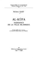

Search results from Open Library.
Recent natural events nearby
Ground air-quality sensors
Recently spotted species
Events
Gallery
Sources
- • Wikipedia
- • Wikidata
- • Open-Meteo / sunrise-sunset.org
- • Wikipedia Pageviews API
- • Open Library