Browse / Iraq / Iraq / Fallujah
Fallujah
Iraqcity

Fallujah
Total population
326,471
Demographic figures from Central Statistical Organization (Iraq). Overview below cites Wikipedia and may reference a different year.
City facts
Facts from Wikidata (CC0).
Overview
Fallujah is a city in Al Anbar Governorate, Iraq. Situated on the Euphrates River, it is located roughly 69 kilometres (43 mi) to the west of the capital city of Baghdad and 50 kilometres (31 mi) from the neighboring city of Ramadi. The city is located in the region defined as Sunni Triangle by the United States, as the majority of its residents are Sunni Arabs. In 1947, Fallujah was a small town with a relatively small population but had grown to a population of about 250,900 people by 2018.
Read more on WikipediaHistory & geography
History
The region has been inhabited for many millennia. There is evidence that the area surrounding Fallujah was inhabited in Babylonian times. The current name of the city is thought to come from its Syriac name, Pallgutha, which is derived from the word division or "canal regulator" since it was the location where the water of the Euphrates River divided into a canal. Classical authors cited the name as "Pallacottas". The name in Aramaic is Pumbedita. The region of Fallujah lies near the ancient Sassanid Persian town of Anbar, in the Sassanid province of Asōristān. The word anbar is Persian and means "warehouse". It was known as Firuz Shapur or Perisapora during the Sassanian Era. There are extensive ruins north of Fallujah which are identified with the town of Anbar. Anbar was located at the confluence of the Euphrates River with the King's Canal, today the Saqlawiyah Canal, known in early Islamic times as the Nahr Isa and in ancient times as the Nahr Malka. Subsequent shifts in the Euphrates River channel have caused it to follow the course of the ancient Pallacottas canal. The town at this site in Jewish sources was known as Nehardea and was the primary center of Babylonian Jewry until its destruction by the Palmyran ruler Odenathus in 259. The Medieval Jewish traveller Benjamin of Tudela in 1164 visited "el-Anbar which is Pumbeditha in Nehardea" and said it had 3,000 Jews living there. The region played host for several centuries to one of the most important Jewish academies, the Pumbedita Academy in the city of Pumbedita, which from 258 to 1038 along with Sura (ar-Hira) was one of the two most important centers of Jewish learning worldwide.Under the Ottoman Empire, Fallujah was a minor stop on one of the country's main roads across the desert west from Baghdad. In…
Geography
Fallujah's western boundary is the Euphrates River. The Euphrates flows from the west (Ramadi), past Fallujah, and into the Baghdad area. When the river reaches the western edge of Fallujah, it turns north, then quickly south, forming what is commonly referred to as the 'peninsula' area. There are two bridges that cross the Euphrates at Fallujah. The city's eastern boundary is Highway 1, a four-lane, divided superhighway that travels from Baghdad past Fallujah towards the west. After the sanctions imposed by the UN after the 1991 Gulf War, this highway became the main supply route for the country. Truckers and travelers from Saudi Arabia, Jordan and southern Syria all merge onto this highway prior to entering the Eastern Al Anbar province. The highway has a prominent 'cloverleaf' interchange with Highway 10 on the eastern edge of Fallujah. Highway 10, which also runs through Fallujah. It is a two-lane highway that turns into a four-lane highway once inside of Fallujah. The highway runs east-west from Baghdad through Fallujah then west towards Ramadi. A 'cloverleaf' on-ramp allows for traffic on/off Highway 1. The highway basically splits the city into two halves, north and south. The northern boundary is a railroad line that runs east-west just along the northern edge of the city. The line sits atop a 3-5 meter high berm all along the northern edge of the city, except where it crosses Highway 1. There are three major hospital locations in Fallujah. The main hospital (formerly Saddam General) is located downtown, near the west end. The second is located across the Euphrates River in an area of west Fallujah commonly referred to as the 'peninsula', (due to its shape). The third hospital is the Jordanian Field Hospital located east of the Highway 10/Highway 1…
Excerpted from the corresponding Wikipedia article (CC BY-SA).
Geography
Coordinates & boundaries from the US Census TIGER/Line shapefiles.
Climate
Air quality
Walkability
Amenities nearby
Wildlife & biodiversity
Earthquake history
Photos
Sights & places nearby
Notable people from here


People born within ~10 km, from Wikidata (CC0). Click any name for their Wikipedia article.
Nearby places in Iraq
- Masrj223.5 mi away
- Tuyserkan279.5 mi away · pop. 45,000
- Hesar-e Qujeh Baghi301.9 mi away · pop. 871
- Kabudar Ahang309.6 mi away · pop. 20,000
- Zarrin Rud314.4 mi away · pop. 5,664
- Minooshahr332.4 mi away
- Tazeh Shahr337 mi away · pop. 8,629
- Ain Isa348.9 mi away · pop. 6,730
- Waha359.1 mi away
- Naeem360.9 mi away
- Arwandkenar362.3 mi away · pop. 11,173
- Khomein363.1 mi away · pop. 72,882
Geography & sun
Elevation, sunrise/sunset and daylight from Open-Meteo. Solar climatology from NASA POWER.
Nearby airports
Public attention
Pageview totals from the Wikimedia Pageviews API.
Books about Fallujah
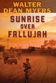
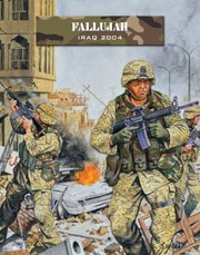
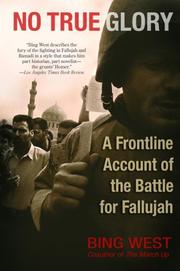
Search results from Open Library.
Recent natural events nearby
Ground air-quality sensors
Recently spotted species
Events
Gallery
Sources
- • Wikipedia
- • Wikidata
- • Open-Meteo / sunrise-sunset.org
- • Wikipedia Pageviews API
- • Open Library