Browse / Italy / Umbria / Perugia
Perugia
Umbriacity

Perugia
Total population
68,946
Air quality index
Demographic figures from ISTAT. Overview below cites Wikipedia and may reference a different year.
City facts
Sister cities
Facts from Wikidata (CC0).
Overview
Perugia is the capital city of Umbria and the province of Perugia in Central Italy, crossed by the River Tiber. The city is located about 164 km (102 mi) north of Rome and 148 km (92 mi) southeast of Florence. It covers a high hilltop and part of the valleys around the area. It has 162,467 inhabitants as of 2025.
Read more on WikipediaHistory & geography
History
Perugia was an Umbrian settlement but first appears in written history as Perusia, one of the 12 confederate cities of Etruria; in 310 or 309 BC. At that time a thirty-year indutiae (truce) was agreed upon; however, in 295 Perusia took part in the Third Samnite War and was forced, with Volsinii and Arretium (Arezzo), to sue for peace in the following year. In 216 and 205 BC, it assisted Rome in the Second Punic War, but afterwards it is not mentioned until 41–40 BC, when Lucius Antonius took refuge there, and was defeated by Octavian after a long siege, and its senators sent to their deaths. A number of lead bullets used by slingers have been found in and around the city. The city was burnt, we are told, with the exception of the temples of Vulcan and Juno—the massive Etruscan terrace-walls, naturally, can hardly have suffered at all—and the town, with the territory for a mile round, was allowed to be occupied by whoever chose. It must have been rebuilt almost at once, for several bases for statues exist, inscribed Augusto sacr(um) Perusia restituta; but it did not become a colonia, until 251–253 AD, when it was resettled as Colonia Vibia Augusta Perusia, under the emperor Trebonianus Gallus. It is hardly mentioned except by the geographers until it was the only city in Umbria to resist Totila and the Ostrogoths, who captured it and laid the city waste in 547, after a long siege, apparently after the city's Byzantine garrison evacuated. Negotiations with the besieging forces fell to the city's bishop, Herculanus, as representative of the townspeople. Totila is said to have ordered the bishop to be flayed and beheaded. St. Herculanus (Sant'Ercolano) later became the city's patron saint. In the Lombard period, Perugia is spoken of as one of the principal cities of…
Geography
Perugia is the capital city of the region of Umbria. Cities' distances from Perugia: Assisi , Siena , Florence , Rome . Though Perugia is located in the central part of Italy, the city experiences a humid subtropical climate (Köppen climate classification Cfa) similar to much of Northern Italy due to its inland location and the diverse, hilly topography of Umbria. Typically, summers are warm to hot and humid, while winters are cold with occasional snowfall. The climate in this area has mild differences between highs and lows, with adequate rainfall year-round.
Excerpted from the corresponding Wikipedia article (CC BY-SA).
Geography
Coordinates & boundaries from the US Census TIGER/Line shapefiles.
Climate
Air quality
Current readings from Open-Meteo Air Quality API (Copernicus CAMS European reanalysis).
Walkability
Amenities nearby
Wildlife & biodiversity
Most-observed species
- Hooded CrowCorvus cornix Linnaeus, 1758 · Aves337
- Eurasian BlackbirdTurdus merula Linnaeus, 1758 · Aves326
- Rock PigeonColumba livia J.F.Gmelin, 1789 · Aves316
- Western JackdawColoeus monedula (Linnaeus, 1758) · Aves291
- Eurasian MagpiePica pica (Linnaeus, 1758) · Aves278
- Common Wood-PigeonColumba palumbus Linnaeus, 1758 · Aves264
- Eurasian Collared-DoveStreptopelia decaocto (Frivaldszky, 1838) · Aves260
- Eurasian BlackcapSylvia atricapilla (Linnaeus, 1758) · Aves249
Citizen-science & research observations from the Global Biodiversity Information Facility (GBIF).
Earthquake history
Most recent
- M 4.2 — 2026-05-234 km WSW of Bolognola, Italy
- M 4.2 — 2025-09-204 km SSE of San Terenziano, Italy
- M 3.2 — 2025-03-043 km S of Bevagna, Italy
- M 4 — 2023-11-142 km ESE of Monteleone di Fermo, Italy
- M 4.2 — 2023-03-094 km S of Umbertide, Italy
- M 4.5 — 2023-03-092 km S of Umbertide, Italy
Events from the USGS Earthquake Catalog (global) (FDSN Event Web Service).
Photos
Sights & places nearby
Notable people from here


People born within ~10 km, from Wikidata (CC0). Click any name for their Wikipedia article.
Geography & sun
Elevation, sunrise/sunset and daylight from Open-Meteo. Solar climatology from NASA POWER.
Nearby airports
Public attention
Pageview totals from the Wikimedia Pageviews API.
Books about Perugia
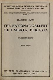

Search results from Open Library.
Recent natural events nearby
Ground air-quality sensors
Recently spotted species
Events
Gallery
Official Identifiers
ISTAT — Italian National Institute of Statistics
- ISTAT code
- 054039
- Province
- Perugia (PG)
- Region
- Umbria
- NUTS3 (2024)
- ITI21
- Codice catastale
- G478
- Province capital
- Yes
Elenco comuni italiani (CC BY 3.0 IT)
Sources
- • Wikipedia
- • Wikidata
- • Open-Meteo Air Quality (CAMS)
- • USGS Earthquake Catalog (global feed)
- • GBIF (Global Biodiversity Information Facility)
- • Open-Meteo / sunrise-sunset.org
- • Wikipedia Pageviews API
- • Open Library
- • ISTAT — Italian national statistics (Elenco comuni italiani), via istat.it (official ISTAT code, province, region, NUTS3, codice catastale)
- • ISTAT — Italian National Institute of Statistics — Elenco comuni italiani (CC BY 3.0 IT)