Browse / Italy / Umbria / Todi
Todi
Umbriatown

Todi
Total population
5,159
Demographic figures from ISTAT. Overview below cites Wikipedia and may reference a different year.
City facts
Facts from Wikidata (CC0).
Overview
Todi is a town and comune (municipality) of the province of Perugia in central Italy.
Read more on WikipediaHistory & geography
History
Todi has a legendary foundation sometimes placed as early as 2707 BC and linked to a Veii-Umbri tribe. According to one foundation legend, the first furrow was traced under the guidance of an eagle, in the area behind what is now the cathedral district. Another tradition connects the town's early development to environmental change: after the Tiber broke through the Forello gorges and the marshy valley drained, settlement is said to have expanded. Todi, ancient Tuder (Greek Τοῦδερ), was one of the most important Umbrian cities and minted its own coinage bearing the ancient name Tutere. Its name does not appear before the Roman conquest. Todi was enrolled in the Clustumina tribe. The first city walls are dated to the 2nd–1st century BC. In the late Roman period a second ring of walls was built. The elevated position of Todi made it a strong and important place during the Gothic War and after the fall of the Western Roman Empire. During the barbarian invasions it shared the fate of other Italian cities, although chronicles relate that it was spared slaughter and fire through the care and zeal of Saint Fortunatus, bishop of the city. This event is commemorated annually on 30 June with mention in the liturgical offices. In 552 Narses won a victory near Todi against the Goths, and Totila lost his life there. In 590 the exarch of Ravenna, Romanus, occupied the city along with other places in the Duchy of Rome; it then passed to the Lombards and was repeatedly contested among their dukes. Todi was sacked by the Lombards, although it avoided full-scale devastation. Christianity was spread through Saint Terentian. Over time the bishop's authority came to be recognized, and diocesan boundaries are described as following earlier Roman civic structures. After the…
Geography
Todi stands on a high hill at an elevation of above sea level, on the left bank of the Tiber, about from Perugia and from Spoleto. In 2021, 3,878 people lived in rural dispersed dwellings not assigned to any named locality. At the time, the most populous localities were Todi proper (5,159), and Ponterio-Pian di Porto (1,755).
Excerpted from the corresponding Wikipedia article (CC BY-SA).
Geography
Coordinates & boundaries from the US Census TIGER/Line shapefiles.
Climate
Air quality
Walkability
Amenities nearby
Wildlife & biodiversity
Earthquake history
Photos
Sights & places nearby
Notable people from here


People born within ~10 km, from Wikidata (CC0). Click any name for their Wikipedia article.
Nearby places in Umbria
- Ponterio-Pian di Porto1.8 mi away · pop. 1,755
- Madonna del Piano4.3 mi away · pop. 197
- Colvalenza4.7 mi away · pop. 759
- Monte Castello di Vibio4.9 mi away · pop. 495
- Massa Martana6.1 mi away · pop. 1,242
- Pantalla6.4 mi away · pop. 1,377
- San Terenziano6.6 mi away · pop. 1,055
- Civitella del Lago8 mi away · pop. 365
- Avigliano Umbro8.9 mi away · pop. 1,407
- San Venanzo9.2 mi away · pop. 892
- Giano dell'Umbria9.4 mi away · pop. 159
- Marsciano9.5 mi away · pop. 9,528
Geography & sun
Elevation, sunrise/sunset and daylight from Open-Meteo. Solar climatology from NASA POWER.
Nearby airports
Public attention
Pageview totals from the Wikimedia Pageviews API.
Books about Todi
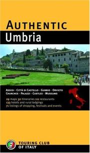
Search results from Open Library.
Recent natural events nearby
Ground air-quality sensors
Recently spotted species
Events
Gallery
Official Identifiers
ISTAT — Italian National Institute of Statistics
- ISTAT code
- 054052
- Province
- Perugia (PG)
- Region
- Umbria
- NUTS3 (2024)
- ITI21
- Codice catastale
- L188
Elenco comuni italiani (CC BY 3.0 IT)
Sources
- • Wikipedia
- • Wikidata
- • Open-Meteo / sunrise-sunset.org
- • Wikipedia Pageviews API
- • Open Library
- • ISTAT — Italian national statistics (Elenco comuni italiani), via istat.it (official ISTAT code, province, region, NUTS3, codice catastale)
- • ISTAT — Italian National Institute of Statistics — Elenco comuni italiani (CC BY 3.0 IT)