Browse / Jordan / Jordan / Petra
Petra
Jordanvillage

Petra
Demographic figures from Department of Statistics (Jordan). Overview below cites Wikipedia and may reference a different year.
City facts
Facts from Wikidata (CC0).
Overview
Petra, originally known to its inhabitants as Raqmu, is an ancient city and archaeological site in southern Jordan. Famous for its rock-cut architecture and water conduit systems, Petra is also called the "Rose City" because of the colour of the sandstone from which it is carved. The city is one of the New 7 Wonders of the World and a UNESCO World Heritage Site.
Read more on WikipediaHistory & geography
History
By 7000 BC, some of the earliest recorded farmers had settled in Beidha, a Pre-Pottery Neolithic settlement just north of Petra. Petra is listed in Egyptian campaign accounts and the Amarna letters as Pel, Sela, or Seir. The Iron Age lasted between 1200 and 600 BC; in that time, the Petra area was occupied by the Edomites. The configuration of mountains in Petra allowed for a reservoir of water for the Edomites. This made Petra a stopping point for merchants, making it an outstanding area for trade. Some wares that were traded included wines, olive oil, and wood. Initially, the Edomites were accompanied by Nomads who eventually left, but the Edomites stayed and made their mark on Petra before the emergence of the Nabataens. It is said that 10,000 men were thrown off the mountain Umm el-Biyara, but this story has been debated by scholars. The Edomite site excavated at the top of the Umm el-Biyara mountain at Petra was established no earlier than the seventh century BC (Iron II). The Nabataeans were one among several nomadic Bedouin tribes that roamed the Arabian Desert and moved with their herds to wherever they could find pasture and water. Although the Nabataeans were initially embedded in Aramaic culture, theories about them having Aramean roots are rejected by many modern scholars. Instead, archaeological, religious and linguistic evidence confirm that they are a northern Arabian tribe. Current evidence suggests that the Nabataean name for Petra was Raqēmō, variously spelled in inscriptions as rqmw or rqm. The Onomasticon of Eusebius also identified Rekem as Petra. Arabic raqama means "to mark, to decorate", so Rekeme could be a Nabataean word referring to the famous carved rock façades. In 1964, workmen clearing rubble away from the cliff at the entrance to…
Excerpted from the corresponding Wikipedia article (CC BY-SA).
Geography
Coordinates & boundaries from the US Census TIGER/Line shapefiles.
Climate
Air quality
Walkability
Amenities nearby
Wildlife & biodiversity
Most-observed species
- House SparrowPasser domesticus (Linnaeus, 1758) · Aves420
- Tristram's StarlingOnychognathus tristramii (P.L.Sclater, 1858) · Aves360
- Laughing DoveSpilopelia senegalensis (Linnaeus, 1766) · Aves331
- Pale Crag MartinPtyonoprogne obsoleta (Cabanis, 1850) · Aves325
- Mourning WheatearOenanthe lugens (Lichtenstein, 1823) · Aves280
- White-spectacled BulbulPycnonotus xanthopygos (Hemprich & Ehrenberg, 1833) · Aves279
- Rock PigeonColumba livia J.F.Gmelin, 1789 · Aves263
- BlackstartOenanthe melanura (Temminck, 1824) · Aves227
Citizen-science & research observations from the Global Biodiversity Information Facility (GBIF).
Earthquake history
Most recent
- M 4.1 — 2026-01-1514 km S of Arad, Israel
- M 4.1 — 2021-06-1540 km W of A? ?ayyibah, Jordan
- M 3.9 — 2020-12-151 km NNE of Eilat, Israel
- M 4.1 — 2014-05-2424 km NW of W?d? M?sá, Jordan
- M 4.5 — 2007-02-098 km N of Safi, Jordan
- M 4 — 2007-02-093 km WNW of Al Khinz?rah, Jordan
Events from the USGS Earthquake Catalog (global) (FDSN Event Web Service).
Photos
Sights & places nearby
Notable people from here


People born within ~10 km, from Wikidata (CC0). Click any name for their Wikipedia article.
Geography & sun
Elevation, sunrise/sunset and daylight from Open-Meteo. Solar climatology from NASA POWER.
Nearby airports
Public attention
Pageview totals from the Wikimedia Pageviews API.
Books about Petra

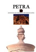

Search results from Open Library.
Recent natural events nearby
Ground air-quality sensors
Recently spotted species
Events
Notable, recurring, and historical events associated with Petra, sourced from Wikidata.
- Q3078617meeting
Source: Wikidata (CC0).
Gallery
Sources
- • Wikipedia
- • Wikidata
- • USGS Earthquake Catalog (global feed)
- • GBIF (Global Biodiversity Information Facility)
- • Open-Meteo / sunrise-sunset.org
- • Wikipedia Pageviews API
- • Open Library