Browse / United States / Kansas / Coffeyville
Coffeyville
Kansascity

Coffeyville
Total population
8,662
Median home value
$60,800
Bachelor's+
Median income
$45,670
Founded
1869
Demographic figures from US Census Bureau · ACS 5-year estimates. Overview below cites Wikipedia and may reference a different year.
City facts
Facts from Wikidata (CC0).
Overview
Coffeyville is a city in southeastern Montgomery County, Kansas, United States, located along the Verdigris River in the state's southeastern region. As of the 2020 census, the population of the city was 8,826. Coffeyville is the most populous city of Montgomery County, and the home to Coffeyville Community College. The town of South Coffeyville, Oklahoma is approximately 1 mile (1.6 km) south of the city.
Read more on WikipediaHistory & geography
History
This settlement was founded in 1869 as an Indian trading post by Col. James A. Coffey, serving the population across the border in what was then the Indian Territory. The town was stimulated in 1871 by being made a stop on the Leavenworth, Lawrence & Galveston Railroad, which connected it to other markets and developments. With the arrival of the railroad, a young surveyor, Napoleon B. Blanton, was dispatched to lay out the town. The naming of the town was left to the toss of a coin between Col. Coffey and U.S. Army Captain Blanton. Coffey won the toss and the town was officially named Coffeyville. The city was incorporated in 1872, but the charter was voided as illegal, and the city was re-incorporated in March 1873. As a frontier settlement, Coffeyville had its share of violence. On October 5, 1892, four of the Dalton Gang were killed in a shootout during an attempted bank robbery; Emmett Dalton survived with 23 gunshot wounds and later pleaded guilty to second-degree murder, although he later asserted that he never fired a shot during the robbery. He served 14 years before being pardoned. The gang had been trying to rob the First National and Condon banks, located across the street from each other. Law enforcement personnel and civilians recognized them under their disguises of fake beards and attacked the gang members as they fled one of the banks. Three civilians and a local marshal, Charles T. Connelly, died defending the town. The town holds an annual celebration each October to commemorate the Dalton Raid. After the discovery of its resources of plentiful natural gas and abundant clay, Coffeyville enjoyed rapid growth from 1890 to 1910, as its population expanded sixfold. Many of the Coffeyville buildings now appearing in the…
Geography
Coffeyville is in the southeast corner of Kansas, about north of Tulsa, Oklahoma, and west of Joplin, Missouri. The city is situated about one-half mile north of the Oklahoma state line along the west bank of the Verdigris River. The city is the location of the lowest point in the state of Kansas at above sea level. Coffeyville Municipal Airport is a few miles northeast of the city along US-169. Though Coffeyville is the largest city in Montgomery County, the county seat is Independence, northwest of the city. Coffeyville, specifically a spot just north of Coffeyville Country Club, is the default center starting point of Google Maps, being the accidental center point of the default starting map being displayed, which shows the 48 contiguous United States. (Lawrence, Kansas also claims to be the Google center as it has been the default midpoint of the interactive 3D map Google Earth). Other locations that are considered to be the geographic center of the contiguous United States are also in Kansas. According to the United States Census Bureau, the city has a total area of , all land. According to the Köppen Climate Classification system, Coffeyville has a humid subtropical climate, abbreviated "Cfa" on climate maps. The hottest temperature recorded in Coffeyville was on August 4, 2012, while the coldest temperature recorded was on February 10, 2011.
Excerpted from the corresponding Wikipedia article (CC BY-SA).
Demographics & economy
Race & ethnicity
Source: US Census Bureau — American Community Survey, 5-year estimates.
Geography
Coordinates & boundaries from the US Census TIGER/Line shapefiles.
Climate
Current forecast
Forecast for Coffeyville, KS from NOAA NWS API.
Air quality
Industrial & pollution facilities
Natural hazard risk
Health (adults)
Age-adjusted prevalence estimates from CDC PLACES (latest release).
Walkability
Amenities nearby
Wildlife & biodiversity
Most-observed species
- American CrowCorvus brachyrhynchos C.L.Brehm, 1822 · Aves83
- Northern CardinalCardinalis cardinalis (Linnaeus, 1758) · Aves73
- European StarlingSturnus vulgaris Linnaeus, 1758 · Aves66
- Eastern MeadowlarkSturnella magna (Linnaeus, 1758) · Aves61
- Blue JayCyanocitta cristata (Linnaeus, 1758) · Aves59
- Mourning DoveZenaida macroura (Linnaeus, 1758) · Aves58
- Red-tailed HawkButeo jamaicensis (Gmelin, 1788) · Aves45
- American RobinTurdus migratorius Linnaeus, 1766 · Aves45
Citizen-science & research observations from the Global Biodiversity Information Facility (GBIF).
Schools
Largest nearby schools
- Community ElementaryElementary · Coffeyville · 1,010 students · 17.4:1 ratio
- Field Kindley HighHigh · Coffeyville · 479 students · 14.1:1 ratio
- Roosevelt MiddleMiddle · Coffeyville · 235 students · 19.6:1 ratio
- Coffeyville Virtual ProgramHigh · Coffeyville · 40 students
Public K–12 schools within ~10 mi from Urban Institute Education Data Portal (NCES Common Core of Data, 2022).
Earthquake history
Most recent
- M 2.5 — 2025-12-265 km SSW of Peru, Kansas
- M 2.82 — 2024-03-239 km SE of Foyil, Oklahoma
- M 2.7 — 2016-01-147 km W of Talala, Oklahoma
- M 2.6 — 2015-09-036 km WSW of Vera, Oklahoma
- M 3 — 2014-10-019 km SSW of Galesburg, Kansas
Events from the USGS Earthquake Catalog (global) (FDSN Event Web Service).
Photos
Sights & places nearby
Notable people from here


People born within ~10 km, from Wikidata (CC0). Click any name for their Wikipedia article.
Nearby places in Kansas
- Liberty9 mi away · pop. 110
- Independence14.3 mi away · pop. 8,422
- Edna16.2 mi away · pop. 297
- Sycamore20.1 mi away · pop. 24
- Niotaze20.2 mi away · pop. 99
- Altamont22.5 mi away · pop. 993
- Elk City22.7 mi away · pop. 245
- Dennis25.8 mi away · pop. 198
- Neodesha27.1 mi away · pop. 2,503
- Labette29.2 mi away · pop. 17
- Sedan30.1 mi away
- Oswego31.2 mi away · pop. 1,937
Geography & sun
Elevation, sunrise/sunset and daylight from Open-Meteo. Solar climatology from NASA POWER.
Nearby airports
Public attention
Pageview totals from the Wikimedia Pageviews API.
Books about Coffeyville
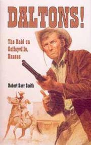

Search results from Open Library.
Recent natural events nearby
- Wildfire BISON, Osage, OklahomaWildfires · 2026-08-21 · 39 mi
- Wildfire B.B, Osage, OklahomaWildfires · 2026-08-06 · 46 mi
- Wildfire WRIGHT, Hughes, OklahomaWildfires · 2026-08-29 · 128 mi
- Wildfire Buck Creek, Pushmataha, OklahomaWildfires · 2026-08-25 · 175 mi
- Wildfire Alexander Trail Fire, Pushmataha, OklahomaWildfires · 2026-08-30 · 178 mi
- Wildfire Alexander Trail, Pushmataha, OklahomaWildfires · 2026-08-30 · 178 mi
- Wildfire Snake Mountain, Pushmataha, OklahomaWildfires · 2026-08-14 · 178 mi
- Wildfire Atoka Lake, Atoka, OklahomaWildfires · 2026-09-14 · 183 mi
Wildfires, storms and other events from NASA EONET (last 12 months, within 250 mi).
Ground air-quality sensors
Recently spotted species
Nearest stream gauge
Live readings from USGS NWIS · measured 2026-10-05 23:45 UTC.
Events
Gallery
Sources
- • Wikipedia
- • US Census Bureau (ACS 5-year estimates)
- • NOAA National Weather Service
- • Wikidata
- • USGS Earthquake Catalog (global feed)
- • USGS NWIS (water data)
- • NCES via Urban Institute Education Data Portal
- • GBIF (Global Biodiversity Information Facility)
- • CDC PLACES
- • Open-Meteo / sunrise-sunset.org
- • Wikipedia Pageviews API
- • Open Library
- • NASA EONET