Browse / United States / Kentucky / Hodgenville
Hodgenville
Kentuckycity

Hodgenville
Total population
3,389
Median home value
$151,400
Bachelor's+
Median income
$57,739
Founded
1839
Demographic figures from US Census Bureau · ACS 5-year estimates. Overview below cites Wikipedia and may reference a different year.
City facts
Facts from Wikidata (CC0).
Overview
Hodgenville is a home rule-class city in LaRue County, Kentucky, United States. It is the seat of its county. Hodgenville sits along the North Fork of the Nolin River. As of the 2020 census, Hodgenville had a population of 3,235. It is included in the Elizabethtown metropolitan area and is best known for being the birthplace of the 16th United States president Abraham Lincoln.
Read more on WikipediaHistory & geography
History
Robert Hodgen, a Pennsylvania native who moved to Virginia, purchased of land in the vicinity. In 1789, after the Revolutionary War, when settlers started moving west into Kentucky, he built a mill at the site. After his death, the community that developed around it was called "Hodgenville" upon the petition of his widow and children. The United States post office at the site, however, was known as "Hodgensville" from 1826 to 1904. The city was formally incorporated by the state assembly on February 18, 1836. Abraham Lincoln was born in a small cabin on Sinking Spring Farm near Hodgenville on February 12, 1809. About two years later, the family moved to another farm in the Hodgenville area. The Abraham Lincoln Birthplace National Historical Park labels the replica cabin, which was built thirty years after his death, the "Traditional Lincoln Birthplace Cabin". The significance of the two Hodgenville sites (birthplace and boyhood home) are found in the setting. Preservation of these two national sites allows visitors to see the landscape of the earliest period of Abraham Lincoln's life. The Lincoln Museum is opened for visitors downtown, and two bronze Abraham Lincoln statues stand at the town square, one of Lincoln as a child, the other as an adult.
Geography
Hodgenville is in central LaRue County, in the valley of the North Fork of the Nolin River, a west- and south-flowing tributary of the Green River. It is southeast of Elizabethtown via Kentucky Route 61. U.S. Route 31E passes through the center of Hodgenville, leading northeast to Bardstown and south to Glasgow. According to the U.S. Census Bureau, Hodgenville has a total area of , of which , or 0.16%, are water. The climate in this area is characterized by hot, humid summers and generally mild to cool winters. According to the Köppen Climate Classification system, Hodgenville has a humid subtropical climate, abbreviated "Cfa" on climate maps.
Excerpted from the corresponding Wikipedia article (CC BY-SA).
Demographics & economy
Race & ethnicity
Source: US Census Bureau — American Community Survey, 5-year estimates.
Geography
Coordinates & boundaries from the US Census TIGER/Line shapefiles.
Climate
Current forecast
Forecast for Hodgenville, KY from NOAA NWS API.
Air quality
Industrial & pollution facilities
Natural hazard risk
Health (adults)
Walkability
Amenities nearby
Wildlife & biodiversity
Schools
Largest nearby schools
- LaRue County High SchoolHigh · Hodgenville · 744 students · 16.9:1 ratio
- Hodgenville Elementary SchoolElementary · Hodgenville · 539 students · 15:1 ratio
- LaRue County Middle SchoolMiddle · Hodgenville · 533 students · 16.2:1 ratio
- Abraham Lincoln Elementary SchoolElementary · Hodgenville · 451 students · 15.6:1 ratio
- Preschool on College StreetOther · Hodgenville · 91 students · 15.2:1 ratio
- The Life ConnectionOther · Sonora · 35 students · 11.7:1 ratio
Public K–12 schools within ~10 mi from Urban Institute Education Data Portal (NCES Common Core of Data, 2022).
Earthquake history
Photos
Sights & places nearby
Notable people from here


People born within ~10 km, from Wikidata (CC0). Click any name for their Wikipedia article.
Nearby places in Kentucky
- Magnolia7.4 mi away
- Sonora9.3 mi away · pop. 653
- Cecilia13.7 mi away · pop. 503
- Raywick16.1 mi away · pop. 125
- Rineyville17.8 mi away
- Lebanon Junction18.8 mi away
- Loretto19.3 mi away
- Summersville19.6 mi away
- Munfordville21.7 mi away
- Big Clifty23 mi away · pop. 285
- Bardstown23.2 mi away · pop. 13,804
- Campbellsville25.7 mi away · pop. 11,622
Geography & sun
Elevation, sunrise/sunset and daylight from Open-Meteo. Solar climatology from NASA POWER.
Nearby airports
Public attention
Pageview totals from the Wikimedia Pageviews API.
Books about Hodgenville
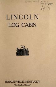

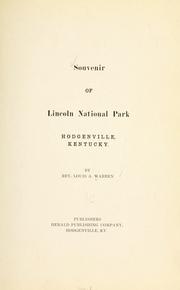

Search results from Open Library.
Recent natural events nearby
Ground air-quality sensors
Recently spotted species
Nearest stream gauge
Events
Gallery
Sources
- • Wikipedia
- • US Census Bureau (ACS 5-year estimates)
- • NOAA National Weather Service
- • Wikidata
- • NCES via Urban Institute Education Data Portal
- • Open-Meteo / sunrise-sunset.org
- • Wikipedia Pageviews API
- • Open Library