Browse / United States / Kentucky / Pineville
Pineville
Kentuckycity

Pineville
Total population
2,064
Median home value
$98,700
Bachelor's+
Median income
$24,547
Founded
1781
Demographic figures from US Census Bureau · ACS 5-year estimates. Overview below cites Wikipedia and may reference a different year.
City facts
Facts from Wikidata (CC0).
Overview
Pineville is a home rule-class city in Bell County, Kentucky, United States. It is the seat of its county. The population was 1,678 as of the 2020 census. It is located on a small strip of land between the Cumberland River and Pine Mountain.
Read more on WikipediaHistory & geography
History
Pineville is one of the oldest settlements in Kentucky, located at the crossing of the Cumberland River by the Wilderness Road. It was established as Cumberland Ford in 1781 and formed part of Governor Isaac Shelby's land tracts. When Bell County was formed in 1867, Cumberland Ford was formally laid off; local landowner J.J. Gibson's 1869 land grant permitted it to be selected as the county seat, but the courthouse was not completed until 1871. The settlement was renamed "Pineville" in 1870 and formally incorporated in 1873. Its riverside location has made it subject to flooding, including a devastating incident on April 4, 1977, in which a floodwall built in 1952 was overwhelmed and 200 houses were destroyed or damaged. The U.S. Army Corps of Engineers upgraded the floodwall in 1988. The economy is dependent on the coal mining industry, local family owned businesses and on tourism. Many enjoy visiting Pine Mountain State Resort Park, where the popular attraction "Chained Rock" is located. Thanks to works done by the community organization Main Street Pineville, the town is working on revitalizing downtown Pineville to its historical roots. Every Memorial Day weekend (from Wednesday to Sunday) the town of Pineville welcomes all to the Kentucky Mountain Laurel Festival, named for the Mountain Laurel flower which grows wild on Pine Mountain. The first Kentucky Mountain Laurel Festival was presented in 1931 at the suggestion of Annie Walker Burns, a descendant of Dr. Thomas Walker, the first European to enter Kentucky and who, along with a party of explorers, visited the present site of Pineville in 1750. Burns was captivated by the history and beauty surrounding Pineville and appealed to Governor Flem D. Sampson of Barbourville to initiate some type of event to honor…
Geography
Pineville is located in northern Bell County at (36.7620301, −83.6949176), along the Cumberland River, directly north of its water gap through Pine Mountain. U.S. Route 25E passes through the city, intersecting Kentucky Route 66 in downtown. U.S. Route 119 has its southern terminus at US 25E near the southern border of the city. By US 25E, it is south to Middlesboro and the north entrance of the Cumberland Gap tunnel, and it is northwest to Corbin and Interstate 75. US 119 leads northeast to Harlan. According to the U.S. Census Bureau, Pineville covers a total land area of , of which is land and , or 5.54%, is water.
Excerpted from the corresponding Wikipedia article (CC BY-SA).
Demographics & economy
Race & ethnicity
Source: US Census Bureau — American Community Survey, 5-year estimates.
Geography
Coordinates & boundaries from the US Census TIGER/Line shapefiles.
Climate
Air quality
Industrial & pollution facilities
Natural hazard risk
Health (adults)
Walkability
Amenities nearby
Wildlife & biodiversity
Schools
Largest nearby schools
- Bell County High SchoolHigh · Pineville · 695 students · 17.4:1 ratio
- Pineville Independent SchoolOther · Pineville · 577 students · 15.2:1 ratio
- Yellow Creek School CenterElementary · Middlesboro · 559 students · 16:1 ratio
- Bell Central School CenterElementary · Pineville · 478 students · 13.7:1 ratio
- Middlesboro Elementary SchoolElementary · Middlesboro · 453 students · 13.7:1 ratio
- Middlesboro High SchoolHigh · Middlesboro · 352 students · 12.6:1 ratio
- Page School CenterElementary · Pineville · 285 students · 13.6:1 ratio
- Middlesboro Middle SchoolMiddle · Middlesboro · 281 students · 10.8:1 ratio
Public K–12 schools within ~10 mi from Urban Institute Education Data Portal (NCES Common Core of Data, 2022).
Earthquake history
Photos
Sights & places nearby
Notable people from here
Nearby places in Kentucky
- Arjay5.4 mi away · pop. 56
- Flat Lick6.7 mi away
- Coldiron15.1 mi away · pop. 193
- Wallins Creek17 mi away · pop. 383
- South Wallins17.5 mi away
- Harlan22.4 mi away · pop. 2,160
- Emlyn24.3 mi away · pop. 488
- Corbin25.2 mi away · pop. 8,246
- Coxton25.3 mi away · pop. 137
- Cawood26.4 mi away · pop. 596
- Ages26.9 mi away · pop. 385
- Evarts29.6 mi away · pop. 648
Geography & sun
Elevation, sunrise/sunset and daylight from Open-Meteo. Solar climatology from NASA POWER.
Nearby airports
Public attention
Pageview totals from the Wikimedia Pageviews API.
Books about Pineville
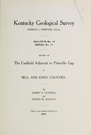
Search results from Open Library.
Recent natural events nearby
Ground air-quality sensors
Recently spotted species
Nearest stream gauge
Events
Gallery
Sources
- • Wikipedia
- • US Census Bureau (ACS 5-year estimates)
- • Wikidata
- • NCES via Urban Institute Education Data Portal
- • Open-Meteo / sunrise-sunset.org
- • Wikipedia Pageviews API
- • Open Library