Browse / United States / Kentucky / Vanceburg
Vanceburg
Kentuckycity

Vanceburg
Total population
1,482
Median home value
$90,600
Bachelor's+
Median income
$30,054
Demographic figures from US Census Bureau · ACS 5-year estimates. Overview below cites Wikipedia and may reference a different year.
City facts
Overview
Vanceburg is a home rule-class city in Lewis County, Kentucky, United States, along the Ohio River. The population was 1,428 at the 2020 census. It is the county seat of Lewis County.
Read more on WikipediaHistory & geography
History
Founded in 1797, Vanceburg is named for a cofounder of the city, William Vance. Joseph Baird and William Vance received land rights and divided the area into parcels for sale. While Baird was the header of the project, the two agreed that a coin toss would settle who the town would be named after. Baird won the toss and the name “Bairdstown” was decided upon. However, the two soon decided that “Bairdstown” too closely resembled the already established city of Bardstown, Kentucky. After reaching this conclusion the pair settled on the name "Vanceburg". The city and surrounding area originally thrived on salt productions and mines located along and in Salt Lick Creek, which flows through the city and inland through much of the heart of the county. Vanceburg was once a thriving production city, with a small train station and a bustling downtown area. In 1937 the city was flooded, as were many cities along the river, which crested at . A crest mark could once be found marked on the old Lock and Dam building west of Vanceburg on KY 8 but is no longer visible. During the flood all of downtown Vanceburg was under water. As a result, 1st Street of Vanceburg was washed into the river. The section of bank on which the homes and businesses once sat slid into the raging stream. Now, one will notice that there is no "1st Street" in the city, only "Front Street". The city streets were renamed according to their order back from Front Street. Front Street now is the nearest street to the river and sits nearly directly on the river bank.
Geography
Vanceburg is located in northern Lewis County on the south bank of the Ohio River. Kentucky Route 9/10, the AA Highway, runs through the southern part of the city, leading west to Tollesboro. To the east KY 10 and the Greenup spur of the AA Highway lead east to the Ohio River at the Jesse Stuart Memorial Bridge near Lloyd, while KY 9 and the Grayson spur of the AA Highway lead southeast to Interstate 64 at Grayson. Kentucky Route 8 also runs through Vanceburg, closer to the center of town. It leads northwest (downstream) along the Ohio River to Concord and east (upstream) to Garrison. According to the United States Census Bureau, Vanceburg has a total area of , of which , or 3.45%, are water. The climate in this area is characterized by hot, humid summers and generally mild to cool winters. According to the Köppen Climate Classification system, Vanceburg has a humid subtropical climate, abbreviated "Cfa" on climate maps.
Excerpted from the corresponding Wikipedia article (CC BY-SA).
Demographics & economy
Race & ethnicity
Source: US Census Bureau — American Community Survey, 5-year estimates.
Geography
Coordinates & boundaries from the US Census TIGER/Line shapefiles.
Climate
Air quality
Industrial & pollution facilities
Natural hazard risk
Health (adults)
Walkability
Amenities nearby
Wildlife & biodiversity
Schools
Largest nearby schools
- Lewis County High SchoolHigh · Vanceburg · 621 students · 19.4:1 ratio
- Lewis County Central Elementary SchoolElementary · Vanceburg · 455 students · 14.7:1 ratio
- Lewis County Middle SchoolMiddle · Vanceburg · 299 students · 13.6:1 ratio
- Garrison Elementary SchoolElementary · Garrison · 286 students · 13:1 ratio
- Foster Meade Career & Technical CenterHigh · Vanceburg
Public K–12 schools within ~10 mi from Urban Institute Education Data Portal (NCES Common Core of Data, 2022).
Earthquake history
Photos
Sights & places nearby
Notable people from here


People born within ~10 km, from Wikidata (CC0). Click any name for their Wikipedia article.
Nearby places in Kentucky
Geography & sun
Elevation, sunrise/sunset and daylight from Open-Meteo. Solar climatology from NASA POWER.
Nearby airports
Public attention
Pageview totals from the Wikimedia Pageviews API.
Books about Vanceburg

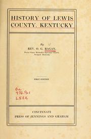
Search results from Open Library.
Recent natural events nearby
Ground air-quality sensors
Recently spotted species
Nearest stream gauge
Events
Gallery
Sources
- • Wikipedia
- • US Census Bureau (ACS 5-year estimates)
- • Wikidata
- • NCES via Urban Institute Education Data Portal
- • Open-Meteo / sunrise-sunset.org
- • Wikipedia Pageviews API
- • Open Library