Browse / Laos / Luang Prabang / Luang Prabang
Luang Prabang
Luang Prabangcity

Luang Prabang
Total population
53,792
Demographic figures from Lao Statistics Bureau. Overview below cites Wikipedia and may reference a different year.
City facts
Facts from Wikidata (CC0).
Overview
Luang Prabang, historically known as Xieng Thong, and alternatively spelled Luang Phabang or Louangphabang, is the capital of Luang Prabang Province in north-central Laos. Its name, meaning “Royal Buddha Image,” derives from the Phra Bang, a statue symbolizing Lao sovereignty. Designated a UNESCO World Heritage Site in 1995, the city is recognized for blending Lao architecture, European colonial buildings, and over 30 Buddhist temples. The protected area encompasses 33 of its 58 villages, where daily rituals like the morning alms-giving ceremony persist.
Read more on WikipediaHistory & geography
History
By the 6th century in the Chao Phraya River Valley, Mon peoples had coalesced to create the Dvaravati kingdoms. In the north, Haripunjaya (Lamphun) emerged as a rival power to the Dvaravati. By the 8th century the Mon had pushed north to create city states in Fa Daet (later is Kalasin, northeastern Thailand); Sri Gotapura (Sikhottabong) near what later is Tha Khek, Laos; Muang Sua (Luang Prabang); and Chantaburi (Vientiane). In the 8th century CE, Sri Gotapura (Sikhottabong) controlled trade throughout the middle Mekong region. The city states introduced Therevada Buddhism from Sri Lankan missionaries throughout the region. Xieng Dong Xieng Thong experienced a period of Khmer suzerainty under Jayavarman VII from 1185 to 1191. In 1238 an internal uprising in the Khmer outpost of Sukhothai expelled the Khmer overlords. Xieng Dong Xieng Thong in 1353 became the capital of the Lan Xang kingdom. In 1359 the Khmer king from Angkor gave the Phra Bang to his son-in-law, the first Lang Xang monarch Fa Ngum (1353–1373); to provide Buddhist legitimacy to Fa Ngum's rule and by extension to the sovereignty of Laos and was used to spread Theravada Buddhism in the kingdom. The capital name was changed to Luangphabang, where it was kept, named after the Buddha image. Luang Prabang was occupied by the Vietnamese forces during Emperor Lê Thánh Tông's 1478–1480 expedition against Lan Xang and Lanna. In 1707, Lan Xang fell apart because of a dynastic struggle and Luang Prabang became the capital of the Kingdom of Luang Phrabang. When France annexed Laos, the French recognised Luang Prabang as the royal residence of Laos. Eventually, the ruler of Luang Prabang became synonymous with the figurehead of Laos. When Laos achieved independence, the king of Luang Prabang, Sisavang Vong, became…
Excerpted from the corresponding Wikipedia article (CC BY-SA).
Geography
Coordinates & boundaries from the US Census TIGER/Line shapefiles.
Climate
10-year averages from ERA5 reanalysis (Open-Meteo).
Air quality
Walkability
Amenities nearby
Wildlife & biodiversity
Most-observed species
- Common TailorbirdOrthotomus sutorius (Pennant, 1769) · Aves245
- Eurasian Tree SparrowPasser montanus (Linnaeus, 1758) · Aves229
- Sooty-headed BulbulPycnonotus aurigaster (Vieillot, 1818) · Aves194
- Asian Palm-SwiftCypsiurus balasiensis (J.E.Gray, 1829) · Aves125
- Yellow-browed WarblerPhylloscopus inornatus (Blyth, 1842) · Aves115
- Common IoraAegithina tiphia (Linnaeus, 1758) · Aves108
- Brown ShrikeLanius cristatus Linnaeus, 1758 · Aves99
- Greater CoucalCentropus sinensis (Stephens, 1815) · Aves91
Citizen-science & research observations from the Global Biodiversity Information Facility (GBIF).
Earthquake history
Most recent
- M 5.5 — 2021-12-1953 km NW of Sainyabuli, Laos
- M 4.6 — 2021-10-3149 km ENE of Chiang Klang, Thailand
- M 4.3 — 2021-10-2952 km NW of Sainyabuli, Laos
- M 4.3 — 2019-12-1233 km WNW of Sainyabuli, Laos
- M 4.4 — 2019-11-2852 km NE of Chiang Klang, Thailand
- M 4.4 — 2019-11-2139 km WNW of Sainyabuli, Laos
Events from the USGS Earthquake Catalog (global) (FDSN Event Web Service).
Photos
Sights & places nearby
Notable people from here


People born within ~10 km, from Wikidata (CC0). Click any name for their Wikipedia article.
Nearby places in Luang Prabang
Geography & sun
Elevation, sunrise/sunset and daylight from Open-Meteo. Solar climatology from NASA POWER.
Nearby airports
Public attention
Pageview totals from the Wikimedia Pageviews API.
Books about Luang Prabang
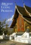
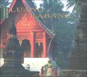

Search results from Open Library.
Recent natural events nearby
Ground air-quality sensors
Recently spotted species
Events
Gallery
Geotagged photos within ~6 miles of Luang Prabang, from Wikimedia Commons contributors.
 0 mi
0 mi 0 mi
0 mi 0.1 mi
.jpg) 0.1 mi
0.1 mi.jpg) 0.1 mi
0.1 mi.jpg) 0.1 mi
0.1 mi.jpg) 0.1 mi
0.1 mi.jpg) 0.1 mi
0.1 mi.jpg) 0.1 mi
0.1 mi.jpg) 0.1 mi
0.1 mi.jpg) 0.1 mi
0.1 mi.jpg) 0.1 mi
0.1 mi 0.1 mi
.jpg) 0.1 mi
0.1 mi.jpg) 0.1 mi
0.1 mi 0.1 mi
 0.1 mi
 0.1 mi
 0.1 mi
 0.1 mi
 0.1 mi
 0.1 mi
 0.1 mi
 0.1 mi
Photos via Wikimedia Commons — see each image page for license & attribution.
Sources
- • Wikipedia
- • Open-Meteo (ERA5 reanalysis)
- • Wikimedia Commons
- • Wikidata
- • USGS Earthquake Catalog (global feed)
- • GBIF (Global Biodiversity Information Facility)
- • Open-Meteo / sunrise-sunset.org
- • Wikipedia Pageviews API
- • Open Library