Browse / United States / Louisiana / Natchitoches
Natchitoches
Louisianacity

Natchitoches
Total population
17,577
Median home value
$193,200
Bachelor's+
Median income
$37,133
Founded
1714
Demographic figures from US Census Bureau · ACS 5-year estimates. Overview below cites Wikipedia and may reference a different year.
- Fire Weather Watch · SevereFire Weather Watch issued October 14 at 11:36PM CDT until October 17 at 1:00AM CDT by NWS Shreveport LA
Source: NOAA National Weather Service.
City facts
Sister cities
Facts from Wikidata (CC0).
Overview
Natchitoches is a city in and the parish seat of Natchitoches Parish, Louisiana, United States. The population was 18,039 at the 2020 census. Established in 1714 by Louis Juchereau de St. Denis as part of French Louisiana, the community was named after the indigenous Natchitoches people. The city was incorporated on February 5, 1819, and is the oldest permanent settlement in the land acquired by the Louisiana Purchase. Natchitoches is home to Northwestern State University of Louisiana. Its sister city is Nacogdoches, Texas.
Read more on WikipediaHistory & geography
History
Natchitoches was established in 1714 by Canadien explorer Louis Juchereau de St. Denis. It is the oldest permanent European settlement within the borders of the 1803 Louisiana Purchase. Natchitoches was founded as a French outpost on the Red River for trade with Spanish-controlled Mexico; French traders settled there as early as 1699. The post was established near a village of Natchitoches Indians, after whom the city was named. Early settlers were French Catholic immigrants and creoles (originally meaning those ethnic French born in the colony). French creoles acquired lands that were developed in the antebellum years as cotton-producing Magnolia Plantation and Oakland Plantation. Each has been preserved and is designated as a National Historic Landmark. After the United States' Louisiana Purchase of 1803, migration into the territory increased from the US. Natchitoches grew along with the population in the parish. Initially, the Americans were primarily of English and Scots-Irish ancestry and of Protestant faith. They developed several cotton plantations along the Red River. Numerous enslaved African Americans were brought to the area through the domestic slave trade to work the cotton, and provide all other skills on these plantations, generating the revenues for the wealthy planters before the Civil War. The United States Government established a federal fur trade factory here in 1805. It was removed to Sulphur Fork, Arkansas in 1818. In the 1820s and early 1830s, Natchitoches also served as a freight transfer point for cotton shipped from parts of east Texas. Cotton shippers used a land route crossing the Sabine River to Natchitoches, where the freight was transferred to boats, and floated down the Red River to New Orleans. When the course of the Red River…
Geography
According to the United States Census Bureau, the city has a total area of , of which are land and (14.21%) are covered by water. A lake was formed from a portion of the Red River when it changed course. It is now known as Cane River Lake. The municipal water supply comes from nearby Sibley Lake, a formerly drained wetland dammed in 1962, which also offers fishing and boating. Soils in this area are a combination of leaf mold and red clays, sand, and sediments. The area is part of the Chestnut Salt Dome. Though Natchitoches has few multistorey buildings, it has retained much of its historic European-style architecture listed on the National Register of Historic Places as the Natchitoches Historic District. The city is a mesh of wrought iron, stucco, and red brick. The city still has one of the original brick streets (Front Street), which the historical society protects from alterations. The city of Natchitoches recently completed a restoration project to repair the century-old brick street. During this process, workers removed each brick one by one, numbered it, cleaned it, and then replaced it after utilities, drainage, and the foundation were repaired beneath. Natchitoches lies in a boundary region that separates the plains of Texas from the consistently humid Gulf Coast. Summers are hot and humid. Winters in Natchitoches are relatively mild, with measurable snowfall once every 5–10 years. Natchitoches averages of rain per year. The city is in an area that frequently experiences severe thunderstorms, hail, damaging winds, and tornadoes.
Excerpted from the corresponding Wikipedia article (CC BY-SA).
Demographics & economy
Race & ethnicity
Source: US Census Bureau — American Community Survey, 5-year estimates.
Geography
Coordinates & boundaries from the US Census TIGER/Line shapefiles.
Climate
Current forecast
Forecast for Natchitoches, LA from NOAA NWS API.
Air quality
Industrial & pollution facilities
Natural hazard risk
Health (adults)
Walkability
Amenities nearby
Wildlife & biodiversity
Schools
Earthquake history
Photos
Sights & places nearby
Notable people from here


People born within ~10 km, from Wikidata (CC0). Click any name for their Wikipedia article.
Nearby places in Louisiana
Geography & sun
Elevation, sunrise/sunset and daylight from Open-Meteo. Solar climatology from NASA POWER.
Nearby airports
Public attention
Pageview totals from the Wikimedia Pageviews API.
Books about Natchitoches
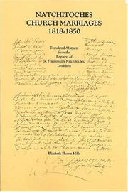

Search results from Open Library.
Recent natural events nearby
Ground air-quality sensors
Recently spotted species
Nearest stream gauge
Events
Gallery
Sources
- • Wikipedia
- • US Census Bureau (ACS 5-year estimates)
- • NOAA National Weather Service
- • Wikidata
- • Open-Meteo / sunrise-sunset.org
- • Wikipedia Pageviews API
- • Open Library