Browse / United States / Louisiana / New Roads
New Roads
Louisianacity

New Roads
Total population
4,404
Median home value
$168,200
Bachelor's+
Median income
$51,328
Demographic figures from US Census Bureau · ACS 5-year estimates. Overview below cites Wikipedia and may reference a different year.
City facts
Facts from Wikidata (CC0).
Overview
New Roads is a city in and the parish seat of Pointe Coupee Parish, Louisiana, United States. The center of population of Louisiana was located in New Roads in 2000. The population was 4,831 at the 2010 census, down from 4,966 in 2000. In the 2020 census the population was 4,549, while at the beginning year of 2023 the census showed a population of 4,205 and expects to be under 4,000 by the years end. The city's ZIP code is 70760. It is part of the Baton Rouge Metropolitan Statistical Area.
Read more on WikipediaHistory & geography
History
Le Poste de Pointe Coupée ("the Pointe Coupée Post" or Cut Point Post) is one of the oldest communities in the Mississippi River Valley established by European colonists. The trading post was founded in 1719 by settlers from France. It was located upstream from the point crossed by explorers, immediately above but not circled by False River. The name referred to the area along the Mississippi River northeast of what is now New Roads. The post was initially settled by native French, as well as French-speaking Creoles born in the colony. Additional ethnically French settlers migrated down the Mississippi River from Fort de Chartres, Upper Louisiana. The colonists imported numerous African slaves from the French West Indies (Guadeloupe, Martinique, Saint-Domingue), and many directly from Africa, as workers for the plantations. Historian Gwendolyn Midlo Hall discovered extensive French and Spanish documentation of the early slave trade, which provided more information than is usually available as to the ethnicity and names of individual slaves, all in the court house at New Roads. Using this and other research, she has produced "The Louisiana Slave Database and the Louisiana Free Database: 1719–1820," which is searchable online. *1729: Chevalier Henri du Loubois *1731: Jean Baptiste François Tisserand de Moncharvaux *1734–38: Claude Joseph de Favrot *1738–1742: Jean Louis Richard de la Houssaye *1742–1744: Claude Joseph de Favrot *1744–1753: Jean Joseph Delfau de Pontalba, Lt. Col.; father-in-law and attempted murderer of Micaela Almonester, Baroness de Pontalba, New Orleans native who built the Pontalba Buildings and redesigned Jackson Square. *1753: Chevalier Morlière *1753–1756: Francois Artaud *1756–1759: Pierre Benoist, Sieur Payen de Noyan de Chavoy *1759–1762:…
Excerpted from the corresponding Wikipedia article (CC BY-SA).
Demographics & economy
Race & ethnicity
Source: US Census Bureau — American Community Survey, 5-year estimates.
Geography
Coordinates & boundaries from the US Census TIGER/Line shapefiles.
Climate
Air quality
Industrial & pollution facilities
Natural hazard risk
Health (adults)
Age-adjusted prevalence estimates from CDC PLACES (latest release).
Walkability
Amenities nearby
Wildlife & biodiversity
Schools
Largest nearby schools
- Rougon Elementary SchoolElementary · Rougon · 516 students · 19.1:1 ratio
- Rosenwald Elementary SchoolElementary · New Roads · 389 students · 12.5:1 ratio
Public K–12 schools within ~10 mi from Urban Institute Education Data Portal (NCES Common Core of Data, 2022).
Earthquake history
Photos
Sights & places nearby
Notable people from here


People born within ~10 km, from Wikidata (CC0). Click any name for their Wikipedia article.
Nearby places in Louisiana
Geography & sun
Elevation, sunrise/sunset and daylight from Open-Meteo. Solar climatology from NASA POWER.
Nearby airports
Public attention
Pageview totals from the Wikimedia Pageviews API.
Books about New Roads
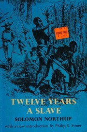



Search results from Open Library.
Recent natural events nearby
Ground air-quality sensors
Recently spotted species
Nearest stream gauge
Events
Gallery
Sources
- • Wikipedia
- • US Census Bureau (ACS 5-year estimates)
- • Wikidata
- • NCES via Urban Institute Education Data Portal
- • CDC PLACES
- • Open-Meteo / sunrise-sunset.org
- • Wikipedia Pageviews API
- • Open Library