Browse / Sri Lanka / North Central / Anuradhapura
Anuradhapura
North Centralcity

Anuradhapura
Total population
63,200
Demographic figures from Department of Census and Statistics, Sri Lanka. Overview below cites Wikipedia and may reference a different year.
City facts
Facts from Wikidata (CC0).
Overview
Anuradhapura is a major city located in the north central plain of Sri Lanka. It is the capital city of North Central Province and the capital of Anuradhapura District. The city lies 205 kilometres (127 mi) north of the current capital of Colombo in the North Central Province, on the banks of the historic Malwathu Oya. The city is now a World Heritage Site famous for its well-preserved ruins of the ancient Sinhalese civilisation.
Read more on WikipediaHistory & geography
History
Anuradhapura is the best representation of the beginnings of pre-modern urbanisation in Sri Lanka. The development of the initial settlement at the site of the city can be attributed to the second global cycle of historical evolution with the generalised diffusion of iron technology in the Old World through the first millennium BCE, culminating in the emergence of many historical civilisations. The history of Anuradhapura then extends from its traditional founding in the recorded history in the fourth century BCE and its subsequent laying-out by Devanampiya Tissa (250–210 BCE) to its abandonment by the last of the Anuradhapura kings at the end of the tenth century CE, its brief reoccupation in the eleventh century and the restoration of some of its major monuments, in the late 13th century CE by Vijayabahu IV (1267–1270 CE). Even though, historical chronicle Mahāvaṃsa (5th century CE) place founding of the city in the 5th century BC, the archaeological data from the excavation of the citadel area of the old city puts the date of the human settlement as far back as the 10th century BC. According to these excavations, protohistoric Iron Age of the city spans from 900 - 600 BCE, with the appearance of iron technology, pottery, the horse, domestic cattle and paddy cultivation. In the time period 700-600 BCE, the settlement in Anuradhapura had grown over an area of at least 50 ha. Irrigable and fertile land surround the city, strategically situated with major ports northwest and northeast of the island. The city also benefited from dense jungle surroundings, providing a natural defence from invaders. Excavation at Anuradhapura has unearthed Plain Grey Ware (in North India associated with Painted Grey Ware (PGW) pottery during vedic period) from the 'Basal early historic'…
Excerpted from the corresponding Wikipedia article (CC BY-SA).
Geography
Coordinates & boundaries from the US Census TIGER/Line shapefiles.
Climate
Air quality
Walkability
Amenities nearby
Wildlife & biodiversity
Earthquake history
Photos
Sights & places nearby
Notable people from here


People born within ~10 km, from Wikidata (CC0). Click any name for their Wikipedia article.
Nearby places in North Central
- Dewanampiyatissapura2.4 mi away
- Pothanegama3 mi away
- Kurukundalama3.3 mi away
- Sravasthipura3.5 mi away · pop. 5,000
- Kannattiya4.8 mi away
- Viharapalugama4.8 mi away
- Asokapura5.3 mi away · pop. 5,000
- Kaluwila5.8 mi away
- Mihintale7.1 mi away · pop. 15,000
- Puwarasankulama7.2 mi away
- Galkulama7.4 mi away · pop. 10,000
- Thuruwila7.4 mi away
Geography & sun
Elevation, sunrise/sunset and daylight from Open-Meteo. Solar climatology from NASA POWER.
Nearby airports
Public attention
Pageview totals from the Wikimedia Pageviews API.
Books about Anuradhapura
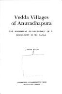

Search results from Open Library.
Recent natural events nearby
Ground air-quality sensors
Recently spotted species
Events
Gallery
Sources
- • Wikipedia
- • Wikidata
- • Open-Meteo / sunrise-sunset.org
- • Wikipedia Pageviews API
- • Open Library