Browse / Liberia / Liberia / Harper
Harper
Liberiatown

Harper
Demographic figures from LISGIS Liberia. Overview below cites Wikipedia and may reference a different year.
City facts
Facts from Wikidata (CC0).
Overview
Harper, situated on Cape Palmas, is the capital of Maryland County in Liberia. It is a coastal town situated between the Atlantic Ocean and the Hoffman River. Harper is Liberia's 11th largest town, with a population of 17,837.
Read more on WikipediaHistory & geography
History
Harper was the capital of the Republic of Maryland, an independent country (1834–1857), the last component of modern Liberia. Cape Palmas, the region of which Harper is the center, is one of the traditional hometowns of the Americo-Liberians, descendants of free people of color and freed slaves from the United States who settled in Liberia and declared it an independent country in 1847. John Brown Russwurm, an African-American abolitionist and governor of Monrovia, was buried in Harper after his death. There is a statue to commemorate his gravesite. Harper as it existed prior to the Civil Wars was based on the plantation architecture of the southern United States, where many of the Americo-Liberians came from. Before the First Liberian Civil War, Harper was an important administrative centre. During the 1970s, Harper was terrorized by Maryland ritual killings. The crimes have been regarded as "Liberia's most notorious ritual killing case" due to the number of murders, the involvement of high ranking government officials, and their subsequent public executions. Tubman University, one of only two public universities in Liberia, is located in Harper. Harper is also home to the Roman Catholic Diocese of Cape Palmas, one of three dioceses of the Catholic Church in Liberia.
Geography
A warm ocean temperature is present year round. Fish are found in abundance, as well as whales, dolphins, and large oysters. Fanti canoes sail from Harper to Monrovia via Greenville. This trip can take from 3 to 6 days depending on the wind and weather. A UNMIL ship, the MV Catarina, sails fortnightly between Harper and Monrovia. From the Ivory Coast, Harper is accessible from Tabou. Local landmarks are the old, ruined mansion of William Tubman, President of Liberia, and the shell of the Morning Star Masonic Lodge, also built by Tubman.
Excerpted from the corresponding Wikipedia article (CC BY-SA).
Geography
Coordinates & boundaries from the US Census TIGER/Line shapefiles.
Climate
Air quality
Walkability
Amenities nearby
Wildlife & biodiversity
Most-observed species
- Snouted Grassland FrogPtychadena longirostris (Peters, 1870) · Amphibia4
- Madagascar periwinkle, Rose periwinkle, Rosy periwinkle, Cape periwinkle, Old-maid, Pink periwinkleCatharanthus roseus (L.) G.Don · Magnoliopsida3
- Pied CrowCorvus albus Statius Muller, 1776 · Aves2
- Common BulbulPycnonotus barbatus (Desfontaines, 1789) · Aves2
- Swamp ArumLasimorpha senegalensis Schott · Liliopsida2
- Bitter gourd, Bitter melon, Bitter balsam apple, Balsam apple, Wild balsam-apple, Bitter apple, Bitter squash, Bitter cucumber, Bitter gourd, Carilla gourd, Carilla bush, Balsam Pear, Jumbee pumpkin, Maiden appleMomordica charantia L. · Magnoliopsida2
- Black KiteMilvus migrans (Boddaert, 1783) · Aves2
- Black-legged NephilaTrichonephila fenestrata (Thorell, 1859) · Arachnida1
Citizen-science & research observations from the Global Biodiversity Information Facility (GBIF).
Earthquake history
Events from the USGS Earthquake Catalog (global) (FDSN Event Web Service).
Photos
Sights & places nearby
Notable people from here


People born within ~10 km, from Wikidata (CC0). Click any name for their Wikipedia article.
Nearby places in Liberia
Geography & sun
Elevation, sunrise/sunset and daylight from Open-Meteo. Solar climatology from NASA POWER.
Nearby airports
Public attention
Pageview totals from the Wikimedia Pageviews API.
Books about Harper


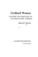
Search results from Open Library.
Recent natural events nearby
Ground air-quality sensors
Recently spotted species
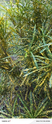
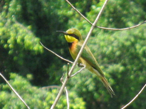
Research-grade observations from iNaturalist (within ~15 mi).
Events
Gallery
Sources
- • Wikipedia
- • Wikidata
- • USGS Earthquake Catalog (global feed)
- • GBIF (Global Biodiversity Information Facility)
- • iNaturalist
- • Open-Meteo / sunrise-sunset.org
- • Wikipedia Pageviews API
- • Open Library
- • Wikidata SPARQL (CC0) — population, area, elevation, inception, head of government, Commons image