Browse / Liberia / Liberia / Nanlah
Nanlah
Liberiavillage
Air quality index
Demographic figures from LISGIS Liberia. Overview below cites Wikipedia and may reference a different year.
City facts
Overview
Situated in Liberia, Nanlah is a village. Geographically it lies in the northern hemisphere at a equatorial latitude (7.005°, -8.424°). No reliable population estimate is published for this entry in the open data we rely on. Open solar datasets indicate about 1,737 kWh/m² of solar irradiance per year, combined with sunshine for roughly 68% of daylight hours. Based on its equatorial position, residents likely encounter hot and humid year-round with little seasonal temperature variation. Continue scrolling for population, climate, environmental and points-of-interest data drawn from public sources.
Summary composed automatically from structured open data on this page. See our Terms for details.
History & geography
Geography
Coordinates & boundaries from the US Census TIGER/Line shapefiles.
Climate
Air quality
Current readings from Open-Meteo Air Quality API (Copernicus CAMS European reanalysis).
Walkability
Amenities nearby
Wildlife & biodiversity
Most-observed species
- Lizard BuzzardKaupifalco monogrammicus (Temminck, 1824) · Aves1
- Shining DrongoDicrurus atripennis Swainson, 1837 · Aves1
- common kusimanseCrossarchus obscurus F.G.Cuvier, 1825 · Mammalia1
- Woodland KingfisherHalcyon senegalensis (Linnaeus, 1766) · Aves1
- Lesser HoneyguideIndicator minor Stephens, 1815 · Aves1
- African Pied HornbillLophoceros fasciatus (Shaw, 1812) · Aves1
Citizen-science & research observations from the Global Biodiversity Information Facility (GBIF).
Earthquake history
Events from the USGS Earthquake Catalog (global) (FDSN Event Web Service).
Photos
Sights & places nearby
Notable people from here
Nearby places in Liberia
Geography & sun
Elevation, sunrise/sunset and daylight from Open-Meteo. Solar climatology from NASA POWER.
Nearby airports
Public attention
Books about this place
Recent natural events nearby
Ground air-quality sensors
Recently spotted species
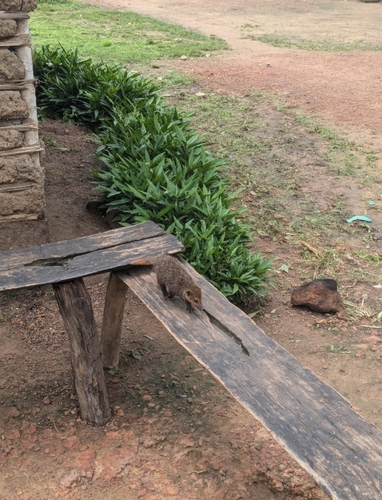
Research-grade observations from iNaturalist (within ~15 mi).
Events
Gallery
Geotagged photos within ~6 miles of Nanlah, from Wikimedia Commons contributors.


Photos via Wikimedia Commons — see each image page for license & attribution.
Sources
- • Wikimedia Commons
- • Wikidata
- • Open-Meteo Air Quality (CAMS)
- • USGS Earthquake Catalog (global feed)
- • GBIF (Global Biodiversity Information Facility)
- • iNaturalist
- • Open-Meteo / sunrise-sunset.org