Browse / United States / Massachusetts / Danvers
Danvers
MassachusettsCDP

Danvers
Total population
28,098
Median home value
$644,200
Bachelor's+
Median income
$125,395
Founded
1636
Demographic figures from US Census Bureau · ACS 5-year estimates. Overview below cites Wikipedia and may reference a different year.
- Coastal Flood Watch · ModerateCoastal Flood Watch issued September 24 at 1:11PM EDT until September 27 at 8:00PM EDT by NWS Boston/Norton MA
- High Surf Advisory · MinorHigh Surf Advisory issued September 24 at 1:11PM EDT until September 27 at 8:00PM EDT by NWS Boston/Norton MA
- High Wind Warning · SevereHigh Wind Warning issued September 24 at 12:38PM EDT until September 27 at 2:00AM EDT by NWS Boston/Norton MA
Source: NOAA National Weather Service.
City facts
Facts from Wikidata (CC0).
Overview
Danvers is a town in Essex County, Massachusetts, United States, located on the Danvers River near the northeastern coast of Massachusetts. The suburb is a fairly short ride from Boston and is also in close proximity to the beaches of Gloucester, Ipswich and Revere. Originally known as Salem Village, the village was most widely known for its association with the 1692 Salem witch trials. It was also the site of Danvers State Hospital, one of the state's 19th-century psychiatric hospitals. Danvers is a local center of commerce, hosting many car dealerships and the Liberty Tree Mall. As of the 2020 United States Census, the town's population was 28,087.
Read more on WikipediaHistory & geography
History
The area was long settled by indigenous cultures of Native Americans. In the historic period, the Massachusett, a tribe of the Algonquian language family, dominated the area. The land that is now Danvers was once owned by the Naumkeag branch of the Massachusett tribe. Around 1630, English colonists improved an existing Naumkeag trail as the Old Spanish Road, creating a connection to the main cities of Salem and Boston. Danvers was permanently settled in 1636 as Salem Village. The historical event for which Danvers is best-known is the Salem witch trials of 1692, which began in the home of Rev. Samuel Parris, and spread throughout the region. Resident Rebecca Nurse was convicted in a trial for witchcraft and executed, along with 19 other innocent victims. The Rebecca Nurse Homestead is still standing in Danvers, and can be visited as a historical landmark. The residents of Salem Village petitioned the Massachusetts General Court several times over the following decades to become a town separate from Salem beginning as early as 1733. In 1752, the General Court finally separated Danvers from Salem, but established Danvers as an independent self-governing "district" instead of incorporating it as a town, because of a royal prohibition against creating new towns in Massachusetts. A district had all the rights and powers of a town except the ability to send representatives to the legislature. Following the refusal to admit Danvers to township, 5 out of the 18 Essex County, Massachusetts towns didn't send any representatives and some larger towns like Wenham and Middleton sent only 1 out of their 2 representatives during the 1751-52 meetings of Massachusetts General Court. Danvers was likely named for Danvers Osborn, and 1752 is the date locally commemorated on major…
Geography
According to the United States Census Bureau, Danvers has a total area of , of which is land and , or 5.75%, is water. The tidal Danvers River begins near the southeast corner of town, and is formed by the confluence of the Porter River, Crane River and Waters River. These rivers, in turn, are fed by several brooks. The Ipswich River also flows along the town's western border. The Putnamville Reservoir lies in the north end of the town, which supplies drinking water to the towns of Salem and Beverly. Though being at sea level in the Danversport area, the town has numerous hills reaching around 130 to 180 feet in elevation, including Dales Hill (located at St. John's Preparatory School), Ferncroft Hill, Folly Hill, Hathorne Hill, Lindall Hill, Nichols Hill, Putnam Hill, Rocky Hill and Whipple Hill (part of Endicott Park). Danvers has numerous villages dating back to the late 1800s, when the town had a bustling railroad. These include Burley's Corner, Danvers Center, Danversport, Downtown, Ferncroft, Hathorne (which still has its own post office and ZIP code of 01937), Putnamville and Tapleyville.
Excerpted from the corresponding Wikipedia article (CC BY-SA).
Demographics & economy
Race & ethnicity
Source: US Census Bureau — American Community Survey, 5-year estimates.
Geography
Coordinates & boundaries from the US Census TIGER/Line shapefiles.
Climate
Current forecast
Forecast for Danvers, MA from NOAA NWS API.
Air quality
Industrial & pollution facilities
Natural hazard risk
Health (adults)
Walkability
Amenities nearby
Wildlife & biodiversity
Most-observed species
- Black-capped ChickadeePoecile atricapillus (Linnaeus, 1766) · Aves67,744
- Blue JayCyanocitta cristata (Linnaeus, 1758) · Aves65,059
- Northern CardinalCardinalis cardinalis (Linnaeus, 1758) · Aves64,118
- American RobinTurdus migratorius Linnaeus, 1766 · Aves62,036
- Downy WoodpeckerDryobates pubescens (Linnaeus, 1766) · Aves54,135
- Song SparrowMelospiza melodia (A.Wilson, 1810) · Aves53,455
- Mourning DoveZenaida macroura (Linnaeus, 1758) · Aves53,132
- Tufted TitmouseBaeolophus bicolor (Linnaeus, 1766) · Aves52,096
Citizen-science & research observations from the Global Biodiversity Information Facility (GBIF).
Schools
Earthquake history
Most recent
- M 3.8 — 2025-01-279 km SE of York Harbor, Maine
- M 2.7 — 2023-12-235 km SW of Chichester, New Hampshire
- M 2.7 — 2018-02-150 km SE of East Kingston, New Hampshire
- M 2.61 — 2013-10-11New Hampshire
- M 3.15 — 2010-09-262 km SW of Canterbury, New Hampshire
- M 2.9 — 2010-06-0729 km SE of York Beach, Maine
Events from the USGS Earthquake Catalog (global) (FDSN Event Web Service).
Photos
Sights & places nearby
Notable people from here


People born within ~10 km, from Wikidata (CC0). Click any name for their Wikipedia article.
Nearby places in Massachusetts
- Peabody2.9 mi away · pop. 54,695
- Boxford6.4 mi away · pop. 2,284
- Methuen Town16.4 mi away
- Amesbury Town19.1 mi away
- West Concord24.6 mi away · pop. 6,320
- Cochituate26.6 mi away
- Cordaville35.9 mi away
- Duxbury39.1 mi away · pop. 1,994
- Spencer57.7 mi away · pop. 11,992
- Ocean Grove59.9 mi away · pop. 3,453
- Bourne60.7 mi away · pop. 1,806
- Forestdale65.5 mi away
Geography & sun
Elevation, sunrise/sunset and daylight from Open-Meteo. Solar climatology from NASA POWER.
Nearby airports
Public attention
Pageview totals from the Wikimedia Pageviews API.
Books about Danvers


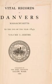


Search results from Open Library.
Recent natural events nearby
Ground air-quality sensors
Recently spotted species
Nearest stream gauge
Events
Gallery
Sources
- • Wikipedia
- • US Census Bureau (ACS 5-year estimates)
- • NOAA National Weather Service
- • Wikidata
- • USGS Earthquake Catalog (global feed)
- • GBIF (Global Biodiversity Information Facility)
- • Open-Meteo / sunrise-sunset.org
- • Wikipedia Pageviews API
- • Open Library