Browse / United States / Massachusetts / Foxborough
Foxborough
MassachusettsCDP

Foxborough
Total population
6,251
Median home value
$538,500
Bachelor's+
Median income
$86,871
Founded
1704
Demographic figures from US Census Bureau · ACS 5-year estimates. Overview below cites Wikipedia and may reference a different year.
- Wind Advisory · ModerateWind Advisory issued September 24 at 12:38PM EDT until September 27 at 2:00AM EDT by NWS Boston/Norton MA
Source: NOAA National Weather Service.
City facts
Facts from Wikidata (CC0).
Overview
Foxborough is a town in Norfolk County, Massachusetts, United States. Located within the Boston metropolitan area, it sits approximately 22 miles southwest of the city in Massachusetts' MetroWest region. As of the 2020 census, the population was 18,618.
Read more on WikipediaHistory & geography
History
Settled in 1704 and incorporated in 1778, the town of Foxborough was named for Charles James Fox, a Whig member of Parliament and a staunch supporter of the Colonies in the years leading up to the American Revolution. The town was once home to the world's largest straw hat factory, erected in 1886. The building became the Bay State Boot and Shoe Company which closed in 1891. In 1894, the building became the Inman and Kimball hat factory. It burned to the ground during a spectacular mid-day fire in 1936. The Foxborough Post Office now stands on the site. Foxborough was composed of small neighborhood communities until the early 1900s. These included Foxvale/Paineburgh, which remained semi-independent until the early twentieth century; Quaker Hill in South Foxborough; and Lakeview/Donkeyville in West Foxborough. Schaefer Stadium (later known as Sullivan Stadium, then Foxboro Stadium) opened in 1971 as the home of the New England Patriots, after the football team spent its first eleven seasons playing at various stadiums in Boston. The family of Billy Sullivan owned both the Patriots and the stadium until they sold the team in 1988. The stadium, however, lapsed into bankruptcy and was then bought by paper magnate Robert Kraft. With Kraft in control of Foxboro Stadium, he prevented the Patriots from relocating to St. Louis in 1994 by refusing to let the team break their lease, then bought the Patriots outright. Kraft then founded the New England Revolution, one of the charter clubs of Major League Soccer, in 1996. Gillette Stadium opened in 2002 as a replacement for Foxboro Stadium. The Patriot Place shopping plaza, built on land surrounding the stadium bought by Kraft, completed construction in 2009. The plaza includes a variety of restaurants, clothing stores, and…
Geography
According to the United States Census Bureau, the town has a total area of , of which is land and (3.88%) is water. For the purposes of the United States Census Bureau, the built-up central area of Foxborough known as the Foxborough Census Designated Place (CDP) has a total area of , of which is land and (1.69%) is water. Foxborough's climate is humid continental (Köppen: Dfa) with four distinct seasons, which is the predominant climate for Massachusetts and New England. Summers are typically warm to hot, rainy, and humid, while winters are cold, windy, and snowy. Spring and fall are usually mild, but conditions are widely varied, depending on wind direction and jet stream positioning. The warmest month is July, with an average high temperature of 83 °F and an average low temperature of 62 °F. The coldest month is January, with an average high temperature of 36 °F and an average low temperature of 18 °F. Periods exceeding 90 °F in summer and below 10 °F in winter are not uncommon but rarely extended, with about 14 days per year seeing the former extreme. Because of the town's relatively short distance from the Atlantic Ocean, temperatures tend to remain warmer than locations further inland. Like the rest of the northeastern seaboard, precipitation is distributed fairly evenly throughout the entire year, with the winter months receiving slightly more precipitation than the summer months. Powerful storm systems known as Nor'easters can produce heavy amounts of rain and snow at any time of the year, but these storms most often strike during the winter months, causing significant snowfall amounts and blizzard conditions. Thunderstorms occur somewhat frequently in the summer, occasionally bringing heavy downpours, damaging winds, and…
Excerpted from the corresponding Wikipedia article (CC BY-SA).
Demographics & economy
Race & ethnicity
Source: US Census Bureau — American Community Survey, 5-year estimates.
Geography
Coordinates & boundaries from the US Census TIGER/Line shapefiles.
Climate
Current forecast
Forecast for Foxborough, MA from NOAA NWS API.
Air quality
Industrial & pollution facilities
Natural hazard risk
Health (adults)
Age-adjusted prevalence estimates from CDC PLACES (latest release).
Walkability
Amenities nearby
Wildlife & biodiversity
Schools
Largest nearby schools
- TEC Connections Academy Commonwealth Virtual SchoolOther · East Walpole · 2,940 students · 24.7:1 ratio
- Franklin HighHigh · Franklin · 1,630 students · 13.8:1 ratio
- Foxborough Regional Charter SchoolOther · Foxborough · 1,569 students
- Sharon HighHigh · Sharon · 1,143 students · 11.4:1 ratio
- King Philip Regional HighHigh · Wrentham · 1,142 students · 13.4:1 ratio
- Stoughton HighHigh · Stoughton · 1,073 students · 10.5:1 ratio
- Walpole HighHigh · Walpole · 987 students · 11.1:1 ratio
- Tri-County Regional Vocational TechnicalHigh · Franklin · 957 students · 11.5:1 ratio
Public K–12 schools within ~10 mi from Urban Institute Education Data Portal (NCES Common Core of Data, 2022).
Earthquake history
Photos
Sights & places nearby
Notable people from here


People born within ~10 km, from Wikidata (CC0). Click any name for their Wikipedia article.
Nearby places in Massachusetts
- Cochituate19 mi away
- Cordaville20.1 mi away
- Ocean Grove23.2 mi away · pop. 3,453
- West Concord27.9 mi away · pop. 6,320
- Duxbury29.2 mi away · pop. 1,994
- Peabody35.5 mi away · pop. 54,695
- Bourne39.8 mi away · pop. 1,806
- Spencer40.2 mi away · pop. 11,992
- Boxford43.6 mi away · pop. 2,284
- Forestdale46.2 mi away
- Methuen Town47 mi away
- Mashpee Neck50.9 mi away · pop. 1,076
Geography & sun
Elevation, sunrise/sunset and daylight from Open-Meteo. Solar climatology from NASA POWER.
Nearby airports
Public attention
Pageview totals from the Wikimedia Pageviews API.
Books about Foxborough
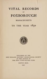

Search results from Open Library.
Recent natural events nearby
Ground air-quality sensors
Recently spotted species
Nearest stream gauge
Events
Gallery
Sources
- • Wikipedia
- • US Census Bureau (ACS 5-year estimates)
- • NOAA National Weather Service
- • Wikidata
- • NCES via Urban Institute Education Data Portal
- • CDC PLACES
- • Open-Meteo / sunrise-sunset.org
- • Wikipedia Pageviews API
- • Open Library
- • Wikidata SPARQL (CC0) — population, area, elevation, inception, head of government, Commons image