Browse / United States / Massachusetts / Ipswich
Ipswich
MassachusettsCDP

Ipswich
Total population
4,924
Median home value
$598,400
Bachelor's+
Median income
$104,102
Founded
1633
Air quality index
Demographic figures from US Census Bureau · ACS 5-year estimates. Overview below cites Wikipedia and may reference a different year.
- Coastal Flood Watch · ModerateCoastal Flood Watch issued September 24 at 1:11PM EDT until September 27 at 8:00PM EDT by NWS Boston/Norton MA
- High Surf Advisory · MinorHigh Surf Advisory issued September 24 at 1:11PM EDT until September 27 at 8:00PM EDT by NWS Boston/Norton MA
- High Wind Warning · SevereHigh Wind Warning issued September 24 at 12:38PM EDT until September 27 at 2:00AM EDT by NWS Boston/Norton MA
Source: NOAA National Weather Service.
City facts
Facts from Wikidata (CC0).
Overview
Ipswich is a coastal town in Essex County, Massachusetts, United States. The population was 13,785 at the 2020 census. It contains the census-designated place of the same name. Home to Willowdale State Forest and Sandy Point State Reservation, Ipswich includes the southern part of Plum Island. A residential community with a vibrant tourism industry, the town is famous for its clams, celebrated annually at the Ipswich Chowderfest, and for Crane Beach, a barrier beach near the Crane estate. Ipswich was incorporated as a town in 1634.
Read more on WikipediaHistory & geography
History
Ipswich was inhabited for thousands of years prior to European colonization of the Americas. The Bull Brook archaeological site in Ipswich provided among the oldest signs of human habitation in New England, dated to between 9000 and 11,000 years before present. Later stone tools and shell mounds found in Ipswich attest to continued human occupation in Ipswich in the intervening 10,000 years. The English settlement of Ipswich was founded by John Winthrop the Younger, son of John Winthrop, one of the founders of the Massachusetts Bay Colony in 1630 and its first governor, elected in England in 1629. Several hundred colonists sailed from England in 1630 in a fleet of 11 ships, including Winthrop's flagship, the Arbella. Investigating the region of Salem and Cape Ann, they entertained aboard the Arbella for a day, June 12, 1630, a native chief of the lands to the north, Chief Masconomet. The event was recorded in Winthrop's journal on the 13th, but Winthrop did not say how they overcame the language barrier. The name they heard from Masconomet concerning the country over which he ruled has been reconstructed as Wonnesquamsauke, which the English rendered as "Agawam". The colonists, however, sailed to the south where some buildings had already been prepared for them at a place newly named Charlestown. That winter they lost a few hundred colonists to malnutrition and disease. They also experienced their first nor'easter, which cost them some fingers and toes, as well as houses destroyed by the fires they kept burning day and night. Just as Winthrop was handing out the last handful of grain, the supply ship Lyon entered Boston Harbor. John sent for his family in England, but his then wife, Margaret, her children, and his eldest son, John, whose mother was the elder John's…
Geography
Ipswich is drained by the Ipswich River and Plum Island Sound, which join at their mouths and empty through a narrow but navigable channel at the foot of Castle Hill around Sandy Point into Ipswich Bay adjoining the Atlantic Ocean. The crane estate has a long lawn that overlooks the bay and often has castle hill concerts. The southern part of Plum Island falls within the area allotted to the town, making up the town's ocean shore along with Castle Neck, south of the Sound. The northeastern part of town is marshy, where the Rowley River, Roger Island River, and Eagle Hill River drain into Plum Island Sound. South of Castle Neck, the Castle Neck River separates the town from neighboring Essex. Much of the western end of town is dominated by Willowdale State Forest, and other parts of the town are also protected land, including Crane Wildlife Refuge on Castle Neck, the Parker River National Wildlife Refuge and Sandy Point State Reservation on Plum Island, Hamlin Reservation, Heartbreak Hill Reservation, Bull Brook Reservoir, Greenwood Farm, and part of Appleton Farms Sanctuary, which extends into Hamilton. Ipswich is in central Essex County and is south of Newburyport, northwest of Gloucester, north of Salem, east of Lawrence, and northeast of Boston. It is bordered by Rowley to the north, Boxford to the west, and Topsfield, Hamilton, Essex and Gloucester to the south. (The border with Gloucester lies across Essex Bay, and as such there is no land connection between the two.)
Excerpted from the corresponding Wikipedia article (CC BY-SA).
Demographics & economy
Race & ethnicity
Source: US Census Bureau — American Community Survey, 5-year estimates.
Geography
Coordinates & boundaries from the US Census TIGER/Line shapefiles.
Climate
10-year averages from ERA5 reanalysis (Open-Meteo).
Current forecast
Forecast for Ipswich, MA from NOAA NWS API.
Air quality
Current readings from Open-Meteo Air Quality API (Copernicus CAMS European reanalysis).
Industrial & pollution facilities
Natural hazard risk
Health (adults)
Age-adjusted prevalence estimates from CDC PLACES (latest release).
Walkability
Amenities nearby
Wildlife & biodiversity
Most-observed species
- Song SparrowMelospiza melodia (A.Wilson, 1810) · Aves56,440
- American herring gull, Smithsonian GullLarus smithsonianus Coues, 1862 · Aves56,246
- American RobinTurdus migratorius Linnaeus, 1766 · Aves52,966
- Black-capped ChickadeePoecile atricapillus (Linnaeus, 1766) · Aves51,383
- Blue JayCyanocitta cristata (Linnaeus, 1758) · Aves49,737
- Northern CardinalCardinalis cardinalis (Linnaeus, 1758) · Aves48,657
- Canada Goose (canadensis Group)Branta canadensis (Linnaeus, 1758) · Aves47,029
- MallardAnas platyrhynchos Linnaeus, 1758 · Aves45,484
Citizen-science & research observations from the Global Biodiversity Information Facility (GBIF).
Schools
Largest nearby schools
- Essex North Shore Agricultural and Technical SchoolHigh · Hathorne · 1,694 students · 11.2:1 ratio
- Beverly Middle SchoolMiddle · Beverly · 1,367 students · 12.4:1 ratio
- Beverly HighHigh · Beverly · 1,286 students · 12.5:1 ratio
- Masconomet Regional High SchoolHigh · Boxford · 990 students · 12.1:1 ratio
- Gloucester HighHigh · Gloucester · 804 students · 10.3:1 ratio
- Danvers HighHigh · Danvers · 777 students · 10.5:1 ratio
- Holten Richmond Middle SchoolMiddle · Danvers · 772 students · 11.5:1 ratio
- Penn BrookElementary · Georgetown · 703 students · 16.3:1 ratio
Public K–12 schools within ~10 mi from Urban Institute Education Data Portal (NCES Common Core of Data, 2022).
Earthquake history
Most recent
- M 3.8 — 2025-01-279 km SE of York Harbor, Maine
- M 2.7 — 2023-12-235 km SW of Chichester, New Hampshire
- M 2.6 — 2021-12-0738 km SE of Old Orchard Beach, Maine
- M 2.7 — 2018-02-150 km SE of East Kingston, New Hampshire
- M 2.61 — 2013-10-11New Hampshire
- M 3.15 — 2010-09-262 km SW of Canterbury, New Hampshire
Events from the USGS Earthquake Catalog (global) (FDSN Event Web Service).
Photos
Sights & places nearby
Notable people from here


People born within ~10 km, from Wikidata (CC0). Click any name for their Wikipedia article.
Nearby places in Massachusetts
- Boxford8.3 mi away · pop. 2,284
- Peabody12.3 mi away · pop. 54,695
- Amesbury Town13.9 mi away
- Methuen Town18.7 mi away
- West Concord33.4 mi away · pop. 6,320
- Cochituate36.2 mi away
- Duxbury44.2 mi away · pop. 1,994
- Cordaville45.3 mi away
- Bourne66.1 mi away · pop. 1,806
- Spencer66.6 mi away · pop. 11,992
- Ocean Grove68.4 mi away · pop. 3,453
- Forestdale70.4 mi away
Geography & sun
Elevation, sunrise/sunset and daylight from Open-Meteo. Solar climatology from NASA POWER.
Nearby airports
Public attention
Pageview totals from the Wikimedia Pageviews API.
Books about Ipswich


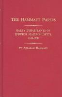

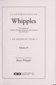
Search results from Open Library.
Recent natural events nearby
Ground air-quality sensors
Recently spotted species
Nearest stream gauge
Events
Gallery
Sources
- • Wikipedia
- • US Census Bureau (ACS 5-year estimates)
- • Open-Meteo (ERA5 reanalysis)
- • NOAA National Weather Service
- • Wikidata
- • Open-Meteo Air Quality (CAMS)
- • USGS Earthquake Catalog (global feed)
- • NCES via Urban Institute Education Data Portal
- • GBIF (Global Biodiversity Information Facility)
- • CDC PLACES
- • Open-Elevation
- • Open-Meteo / sunrise-sunset.org
- • Wikipedia Pageviews API
- • Open Library
- • Wikidata SPARQL (CC0) — population, area, elevation, inception, head of government, Commons image