Browse / United States / Massachusetts / Milford
Milford
MassachusettsCDP

Milford
Total population
27,731
Median home value
$464,700
Bachelor's+
Median income
$93,310
Founded
1662
Air quality index
Demographic figures from US Census Bureau · ACS 5-year estimates. Overview below cites Wikipedia and may reference a different year.
- Wind Advisory · ModerateWind Advisory issued September 25 at 12:30PM EDT until September 27 at 8:00AM EDT by NWS Boston/Norton MA
Source: NOAA National Weather Service.
City facts
Facts from Wikidata (CC0).
Overview
Milford is a town in Worcester County, Massachusetts, United States. The population was 30,379 according to the 2020 census. It contains the census-designated place of the same name. First settled in 1662 and incorporated in 1780, Milford became a booming industrial and quarrying community in the 19th century due to its unique location which includes the nearby source of the Charles River, the Mill River, the Blackstone River watershed, and large quantities of Milford pink granite.
Read more on WikipediaHistory & geography
History
Milford was first settled in 1662 as a part of Mendon after Native Americans, including the Sachem, Quashaamit, granted land to the early settlers. King Philip's War destroyed the town in 1676, but settlers returned in 1680. The Mill River flows through Milford and had several conspicuous fords that were familiar to the Native Americans, and used by the early white settlers. These "mill (river) fords" are said to have given Milford its name. Milford was incorporated April 11, 1780, and the first town hall built in 1819; a brick structure later named the Town House School. The current town hall was built in 1854 by architect Thomas Silloway. Milford quarries fueled the local economy until about 1940. The granite has been used for local buildings such as Memorial Hall; the Bancroft Memorial Library in Hopedale; Worcester City Hall; and the Boston Public Library. Other notable buildings include the original Pennsylvania Station in New York City; the main post office in New York City; and more recently the Singapore Changi Airport in 2002. The center is affiliated with UMass Medical Center as a teaching hospital. In 2015 the hospital completed a $54-million expansion project that created a new emergency department and updated the intensive care unit, as well as patient rooms.
Geography
According to the United States Census Bureau, the town has a total area of , of which is land, and , or 1.82%, is water. Milford is drained by the Charles River. The town is crossed by Interstate 495 and state routes 16, 85, 109, and 140.
Excerpted from the corresponding Wikipedia article (CC BY-SA).
Demographics & economy
Race & ethnicity
Source: US Census Bureau — American Community Survey, 5-year estimates.
Geography
Coordinates & boundaries from the US Census TIGER/Line shapefiles.
Climate
Current forecast
Forecast for Milford, MA from NOAA NWS API.
Air quality
Current readings from Open-Meteo Air Quality API (Copernicus CAMS European reanalysis).
Industrial & pollution facilities
Natural hazard risk
Health (adults)
Age-adjusted prevalence estimates from CDC PLACES (latest release).
Walkability
Amenities nearby
Wildlife & biodiversity
Most-observed species
- Black-capped ChickadeePoecile atricapillus (Linnaeus, 1766) · Aves26,906
- Blue JayCyanocitta cristata (Linnaeus, 1758) · Aves25,442
- Tufted TitmouseBaeolophus bicolor (Linnaeus, 1766) · Aves24,852
- Northern CardinalCardinalis cardinalis (Linnaeus, 1758) · Aves23,645
- American RobinTurdus migratorius Linnaeus, 1766 · Aves23,589
- Downy WoodpeckerDryobates pubescens (Linnaeus, 1766) · Aves19,773
- White-breasted NuthatchSitta carolinensis Latham, 1790 · Aves19,641
- Song SparrowMelospiza melodia (A.Wilson, 1810) · Aves19,632
Citizen-science & research observations from the Global Biodiversity Information Facility (GBIF).
Schools
Largest nearby schools
- Milford HighHigh · Milford · 1,324 students · 12.1:1 ratio
- Blackstone ValleyHigh · Upton · 1,230 students · 11.5:1 ratio
- Westborough HighHigh · Westborough · 1,178 students · 13.1:1 ratio
- Stacy MiddleMiddle · Milford · 1,030 students · 11.6:1 ratio
- Northbridge Elementary SchoolElementary · Whitinsville · 953 students · 11.9:1 ratio
- WoodlandElementary · Milford · 943 students · 11.1:1 ratio
- Grafton High SchoolHigh · Grafton · 875 students · 12.3:1 ratio
- Mill Pond SchoolMiddle · Westborough · 865 students · 12:1 ratio
Public K–12 schools within ~10 mi from Urban Institute Education Data Portal (NCES Common Core of Data, 2022).
Earthquake history
Most recent
- M 3.6 — 2020-11-0810 km S of Bliss Corner, Massachusetts
- M 2.7 — 2018-02-150 km SE of East Kingston, New Hampshire
- M 2.6 — 2015-01-132 km E of Wauregan, Connecticut
- M 3.3 — 2015-01-120 km NE of Wauregan, Connecticut
- M 2.5 — 2007-10-192 km WSW of Littleton Common, Massachusetts
- M 2.5 — 2005-11-174 km S of Plymouth, Massachusetts
Events from the USGS Earthquake Catalog (global) (FDSN Event Web Service).
Photos
Sights & places nearby
Notable people from here


People born within ~10 km, from Wikidata (CC0). Click any name for their Wikipedia article.
Nearby places in Massachusetts
- Cochituate14.9 mi away
- Ocean Grove33.2 mi away · pop. 3,453
- Peabody38.6 mi away · pop. 54,695
- Duxbury43.6 mi away · pop. 1,994
- Methuen Town44.4 mi away
- Boxford44.7 mi away · pop. 2,284
- Chicopee53.9 mi away · pop. 55,295
- Bourne54.6 mi away · pop. 1,806
- Amesbury Town56.2 mi away
- Deerfield61.8 mi away · pop. 458
- Yarmouth Port73.4 mi away · pop. 5,403
- South Dennis76.8 mi away · pop. 3,899
Geography & sun
Elevation, sunrise/sunset and daylight from Open-Meteo. Solar climatology from NASA POWER.
Nearby airports
Public attention
Pageview totals from the Wikimedia Pageviews API.
Books about Milford
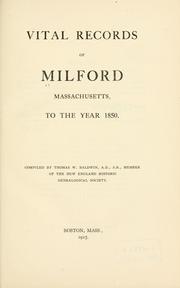

Search results from Open Library.
Recent natural events nearby
Ground air-quality sensors
Recently spotted species

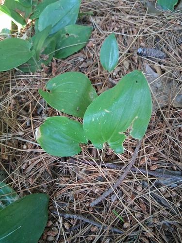



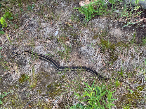



Research-grade observations from iNaturalist (within ~15 mi).
Nearest stream gauge
Live readings from USGS NWIS · measured 2026-06-27 20:30 UTC.
Events
Gallery
Geotagged photos within ~6 miles of Milford, from Wikimedia Commons contributors.
 0.4 mi
 0.5 mi
 0.5 mi
 0.6 mi
 0.6 mi
 0.6 mi
 0.7 mi
.jpg) 0.7 mi
0.7 mi 0.8 mi
 0.8 mi
 0.8 mi
 0.8 mi
 0.8 mi
 0.8 mi
 0.8 mi
 0.8 mi
.jpg) 0.8 mi
0.8 mi.jpg) 0.8 mi
0.8 mi 0.9 mi
 1.1 mi
 1.1 mi
 1.2 mi
 1.2 mi
 1.2 mi
Photos via Wikimedia Commons — see each image page for license & attribution.
Sources
- • Wikipedia
- • US Census Bureau (ACS 5-year estimates)
- • NOAA National Weather Service
- • Wikimedia Commons
- • Wikidata
- • Open-Meteo Air Quality (CAMS)
- • USGS Earthquake Catalog (global feed)
- • USGS NWIS (water data)
- • NCES via Urban Institute Education Data Portal
- • GBIF (Global Biodiversity Information Facility)
- • iNaturalist
- • CDC PLACES
- • Open-Elevation
- • Open-Meteo / sunrise-sunset.org
- • Wikipedia Pageviews API
- • Open Library
- • Wikidata SPARQL (CC0) — population, area, elevation, inception, head of government, Commons image