Browse / United States / Massachusetts / Saugus
Saugus
MassachusettsCDP

Saugus
Total population
28,773
Median home value
$603,400
Bachelor's+
Median income
$101,539
Founded
1629
Demographic figures from US Census Bureau · ACS 5-year estimates. Overview below cites Wikipedia and may reference a different year.
City facts
Facts from Wikidata (CC0).
Overview
Saugus is a town in Essex County, Massachusetts, United States, in the Greater Boston area. The population was 28,619 at the 2020 census. Saugus is known as the site of the first integrated iron works in North America.
Read more on WikipediaHistory & geography
History
Native Americans inhabited the area around Saugus for thousands of years before the arrival of European settlers in the 1620s. At the time of European arrival, the Naumkeag, also known as Pawtucket, under the leadership of Montowampate were based near present-day Saugus and controlled land extending from what is now Boston to the Merrimack River. English settlers took the name Sagus or Saugus from the Pawtucket word for "outlet", and used the term to refer to the Saugus River and the region that includes the present day cities and towns of Swampscott, Nahant, Lynn, Lynnfield, Reading, North Reading and Wakefield) which were later renamed Lin or Lynn in 1637, after King's Lynn in Norfolk, England. In 1646, the Saugus Iron Works, then called Hammersmith, began operations. It was the first integrated iron works in North America as well as one of the most technologically advanced in the world. The Iron Works produced over one ton of iron a day but was not financially successful. It closed around 1670. In September 1687, Major Samuel Appleton was said to have given a speech from a rocky cliff near the Iron Works denouncing the tyranny of Colonial Governor Sir Edmund Andros. The place where he is said to have delivered the speech became known as Appleton's Pulpit. Nearly 100 men from Saugus fought in the American Revolutionary War. Saugus' preacher, Parson Joseph Roby, worked to strengthen the spirit of independence in Saugus and was instrumental in seeing that Saugus sent a large contingent to fight in the war. The nineteenth century ice industry began in Saugus when in 1804 Frederic Tudor cut ice from a pond on the family farm and shipped it to Martinique. In 1805 the Newburyport Turnpike (now U.S. 1) was built. About four miles of this road were built in Saugus. At…
Excerpted from the corresponding Wikipedia article (CC BY-SA).
Demographics & economy
Race & ethnicity
Source: US Census Bureau — American Community Survey, 5-year estimates.
Geography
Coordinates & boundaries from the US Census TIGER/Line shapefiles.
Climate
Air quality
Industrial & pollution facilities
Natural hazard risk
Health (adults)
Age-adjusted prevalence estimates from CDC PLACES (latest release).
Walkability
Amenities nearby
Wildlife & biodiversity
Most-observed species
- American RobinTurdus migratorius Linnaeus, 1766 · Aves124,407
- Blue JayCyanocitta cristata (Linnaeus, 1758) · Aves115,092
- Northern CardinalCardinalis cardinalis (Linnaeus, 1758) · Aves106,231
- House SparrowPasser domesticus (Linnaeus, 1758) · Aves104,739
- Mourning DoveZenaida macroura (Linnaeus, 1758) · Aves99,015
- Black-capped ChickadeePoecile atricapillus (Linnaeus, 1766) · Aves96,362
- Song SparrowMelospiza melodia (A.Wilson, 1810) · Aves88,803
- MallardAnas platyrhynchos Linnaeus, 1758 · Aves88,244
Citizen-science & research observations from the Global Biodiversity Information Facility (GBIF).
Schools
Largest nearby schools
- Lynn English HighHigh · Lynn · 2,176 students · 15.9:1 ratio
- Classical HighHigh · Lynn · 1,818 students · 15.4:1 ratio
- Essex North Shore Agricultural and Technical SchoolHigh · Hathorne · 1,694 students · 11.2:1 ratio
- KIPP Academy Lynn Charter SchoolOther · Lynn · 1,612 students · 13.9:1 ratio
- Lynn Vocational Technical InstituteOther · Lynn · 1,523 students · 12.5:1 ratio
- Peabody Veterans Memorial HighHigh · Peabody · 1,476 students · 12.3:1 ratio
- Beverly Middle SchoolMiddle · Beverly · 1,367 students · 12.4:1 ratio
- J Henry Higgins MiddleMiddle · Peabody · 1,346 students · 13.2:1 ratio
Public K–12 schools within ~10 mi from Urban Institute Education Data Portal (NCES Common Core of Data, 2022).
Earthquake history
Most recent
- M 3.8 — 2025-01-279 km SE of York Harbor, Maine
- M 2.7 — 2023-12-235 km SW of Chichester, New Hampshire
- M 2.7 — 2018-02-150 km SE of East Kingston, New Hampshire
- M 2.9 — 2010-06-0729 km SE of York Beach, Maine
- M 2.8 — 2008-03-0925 km SE of York Beach, Maine
- M 2.5 — 2007-10-192 km WSW of Littleton Common, Massachusetts
Events from the USGS Earthquake Catalog (global) (FDSN Event Web Service).
Photos
Sights & places nearby
Notable people from here
Geography & sun
Elevation, sunrise/sunset and daylight from Open-Meteo. Solar climatology from NASA POWER.
Nearby airports
Public attention
Pageview totals from the Wikimedia Pageviews API.
Books about Saugus
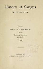

Search results from Open Library.
Recent natural events nearby
Ground air-quality sensors
Recently spotted species
Nearest stream gauge
Events
Gallery
Sources
- • Wikipedia
- • US Census Bureau (ACS 5-year estimates)
- • Wikidata
- • USGS Earthquake Catalog (global feed)
- • NCES via Urban Institute Education Data Portal
- • GBIF (Global Biodiversity Information Facility)
- • CDC PLACES
- • Open-Meteo / sunrise-sunset.org
- • Wikipedia Pageviews API
- • Open Library
- • Wikidata SPARQL (CC0) — population, area, elevation, inception, head of government, Commons image