Browse / United States / Maryland / Cambridge
Cambridge
Marylandcity

Cambridge
Total population
13,152
Median home value
$257,900
Bachelor's+
Median income
$47,323
Founded
1793
Demographic figures from US Census Bureau · ACS 5-year estimates. Overview below cites Wikipedia and may reference a different year.
- Coastal Flood Warning · SevereCoastal Flood Warning issued September 24 at 6:19AM EDT until September 25 at 4:00AM EDT by NWS Wakefield VA
Source: NOAA National Weather Service.
City facts
Facts from Wikidata (CC0).
Overview
Cambridge is a city in Dorchester County, Maryland, United States. The population was 13,096 at the 2020 census. It is the county seat of Dorchester County and the county's largest municipality. Cambridge is the fourth most populous city in Maryland's Eastern Shore region, after Salisbury, Elkton and Easton.
Read more on WikipediaHistory & geography
History
Settled by English colonists in 1684, Cambridge is one of the oldest colonial cities in Maryland. During the time of English colonization, the Algonquian-speaking Choptank Indians resided along the river bearing their name. Throughout the colonial years, English colonists developed farming on the Eastern Shore, with the largest plantations initially focusing on tobacco, before shifting to mixed farming. Cambridge served as a regional trading center, with its town pier being a major hub. Its history is extensively documented by historical markers scattered throughout the town center. Cambridge was officially incorporated in 1793, taking over part of the former Choptank Indian Reservation. The town received its name from a city and county in England. Cambridge also became a stop on the Underground Railroad, which provided a network of safe houses for enslaved people escaping to the north. In the late 19th century, Cambridge developed food processing industries, specializing in the canning of oysters, tomatoes, and sweet potatoes. The town's industrial growth was led by the Phillips Packing Company, which eventually became the region's largest employer. Winning contracts from the Department of Defense during the First and Second World Wars greatly aided the company's growth. At its height, the company employed as many as 10,000 workers. From 1962 to 1967, Cambridge was a center of protests during the Civil Rights Movement, with local Black residents advocating for equal employment and housing opportunities, as well as the eradication of racial segregation in schools and other public facilities. Riots broke out in Cambridge in 1963 and 1967, prompting the deployment of the Maryland National Guard to the city to help maintain peace. The movement's leader was Gloria…
Geography
Cambridge is located at . According to the United States Census Bureau, the city has a total area of , of which, is land and is water. Cambridge is on the southern bank of the Choptank River. The climate in this area is characterized by hot, humid summers and generally mild to cool winters. According to the Köppen climate classification system, Cambridge has a humid subtropical climate, abbreviated "Cfa" on climate maps. A 4.3 MW solar farm in Cambridge supplies about 40% of the power for the National Aquarium, and saves about 1,300 metric tons of carbon dioxide during the summer.
Excerpted from the corresponding Wikipedia article (CC BY-SA).
Demographics & economy
Race & ethnicity
Source: US Census Bureau — American Community Survey, 5-year estimates.
Geography
Coordinates & boundaries from the US Census TIGER/Line shapefiles.
Climate
Current forecast
Forecast for Cambridge, MD from NOAA NWS API.
Air quality
Industrial & pollution facilities
Natural hazard risk
Health (adults)
Age-adjusted prevalence estimates from CDC PLACES (latest release).
Walkability
Amenities nearby
Wildlife & biodiversity
Schools
Largest nearby schools
- Cambridge-South Dorchester High SchoolHigh · Cambridge · 784 students · 17:1 ratio
- Mace's Lane Middle SchoolMiddle · Cambridge · 481 students · 12.3:1 ratio
- Maple Elementary SchoolElementary · Cambridge · 392 students · 11.9:1 ratio
- Choptank Elementary SchoolElementary · Cambridge · 375 students · 17:1 ratio
- Sandy Hill ElementaryElementary · Cambridge · 374 students · 12.1:1 ratio
- Warwick Elementary SchoolElementary · Secretary · 347 students · 15.8:1 ratio
- Judith P. Hoyer Early Childhood CenterOther · Cambridge
- Dorchester County Career and Technology CenterOther · Cambridge
Public K–12 schools within ~10 mi from Urban Institute Education Data Portal (NCES Common Core of Data, 2022).
Earthquake history
Photos
Sights & places nearby
Notable people from here


People born within ~10 km, from Wikidata (CC0). Click any name for their Wikipedia article.
Nearby places in Maryland
Geography & sun
Elevation, sunrise/sunset and daylight from Open-Meteo. Solar climatology from NASA POWER.
Nearby airports
Public attention
Pageview totals from the Wikimedia Pageviews API.
Books about Cambridge
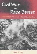

Search results from Open Library.
Recent natural events nearby
Ground air-quality sensors
Recently spotted species
Nearest stream gauge
Events
Gallery
Sources
- • Wikipedia
- • US Census Bureau (ACS 5-year estimates)
- • NOAA National Weather Service
- • Wikidata
- • NCES via Urban Institute Education Data Portal
- • CDC PLACES
- • Open-Meteo / sunrise-sunset.org
- • Wikipedia Pageviews API
- • Open Library