Browse / United States / Maryland / College Park
College Park
Marylandcity

College Park
Total population
34,540
Median home value
$437,900
Bachelor's+
Median income
$69,721
Founded
1856
Demographic figures from US Census Bureau · ACS 5-year estimates. Overview below cites Wikipedia and may reference a different year.
City facts
Facts from Wikidata (CC0).
Overview
College Park is a city in Prince George's County, Maryland, United States, located approximately four miles (6.4 km) from the northeast border of Washington, D.C. Its population was 34,740 at the 2020 United States census. It is the home of the University of Maryland, College Park.
Read more on WikipediaHistory & geography
History
The earliest evidence of human activity in the College Park area was found at an archeological site just south of Archives II. Projectile points of Clagett and Vernon styles dating from 3000 to 2600 BC were recovered, a notable find given their location away from a river. This finding together with other similar ones indicate that the native American population became more sedentary in the Late Archaic period as the availability of local food supply increased, and social complexity grew. By the time Europeans first arrived and colonized the region in the early 17th century, the various native American groups had aligned themselves into a chiefdom under the Piscataway people. Throughout the 17th and 18th centuries, the European settlers lived on large plantations, some holding the original grants under Lord Baltimore. In College Park, there are records for Toaping Castle, a land grant to Col. Isaac Walker from in the area between Branchville, Greenbelt, and Berwyn Heights, and for the Calvert family's Riversdale, which included parts of South College Park. One of the oldest buildings in the city, the Old Parish House dating from 1817 was initially a farm building in the latter estate. The area remained undeveloped and was re-platted in 1889 by John O. Johnson and Samuel Curriden, Washington real estate developers. The original tract was divided into a grid-street pattern with long, narrow building lots, with a standard lot size of . College Park originally included single-family residences constructed in the Shingle, Queen Anne, and Stick styles, as well as modest vernacular dwellings. By the turn of the century, College Park was being developed rapidly by catering to those who were seeking to escape the crowded Washington, D.C., as well as to a rapidly…
Geography
College Park is located in Prince George's County, Maryland. The city is also part of the Washington metropolitan area, with all of its neighborhoods except for Camden and Sunnyside lying inside the Capital Beltway. It is bordered to the North by Beltsville, to the East by Greenbelt and Berwyn Heights, to the South by Riverdale Park and University Park, and to the West by Hyattsville and Adelphi. The city straddles two small streams, Paint Branch and Indian Creek. The confluence of these two streams is located on the South-East corner of the city, next to the College Park Airport, and results in the Northeast branch Anacostia river. This river is a tributary of the Anacostia river, which itself is a tributary of the Potomac river that flows into the Chesapeake Bay. College Park has a total area of , of which is land and is water. The neighborhoods that were part of the initial incorporation of the city in 1945 (Calvert Hills, Old Town, Lakeland, Berwyn, Branchville, Oak Springs, Daniel's Park, and Hollywood) plus Sunnyside lie in between the Washington-Baltimore CSX railway tracks and Route 1/Baltimore Avenue. West of Baltimore Avenue lie Lord Calvert Manor, College Park Woods, Crystal Springs, Acerdale (University View), Autoville, Cherry Hill, and Camden. East of the CSX tracks lie College Park Estates and Yarrow. These neighborhoods are primarily residential. They exhibit a variety of architectural styles including Queen Anne and Colonial Revival, and, in later constructions, American Foursquare, Cape Cod, and bungalow. Commercial activity is concentrated along Baltimore Avenue, Greenbelt Road, and Berwyn Road. Starting in 2017 commercial development also started expanding along Knox Road, Hartwick Road, and Calvert Road. File:Trolley trail Calvert Hills…
Excerpted from the corresponding Wikipedia article (CC BY-SA).
Demographics & economy
Race & ethnicity
Source: US Census Bureau — American Community Survey, 5-year estimates.
Geography
Coordinates & boundaries from the US Census TIGER/Line shapefiles.
Climate
Current forecast
Forecast for College Park, MD from NOAA NWS API.
Air quality
Industrial & pollution facilities
Natural hazard risk
Health (adults)
Age-adjusted prevalence estimates from CDC PLACES (latest release).
Walkability
Amenities nearby
Wildlife & biodiversity
Most-observed species
- Northern CardinalCardinalis cardinalis (Linnaeus, 1758) · Aves161,144
- American RobinTurdus migratorius Linnaeus, 1766 · Aves145,095
- Carolina WrenThryothorus ludovicianus (Latham, 1790) · Aves125,973
- Blue JayCyanocitta cristata (Linnaeus, 1758) · Aves123,681
- Mourning DoveZenaida macroura (Linnaeus, 1758) · Aves117,884
- European StarlingSturnus vulgaris Linnaeus, 1758 · Aves110,006
- House SparrowPasser domesticus (Linnaeus, 1758) · Aves104,423
- American CrowCorvus brachyrhynchos C.L.Brehm, 1822 · Aves104,051
Citizen-science & research observations from the Global Biodiversity Information Facility (GBIF).
Schools
Largest nearby schools
- High Point HighHigh · Beltsville · 3,003 students · 18.4:1 ratio
- Charles Herbert Flowers HighHigh · Springdale · 2,569 students · 21.1:1 ratio
- Parkdale HighHigh · Riverdale · 2,561 students · 16.3:1 ratio
- Eleanor Roosevelt HighHigh · Greenbelt · 2,526 students · 20.7:1 ratio
- Duval HighHigh · Lanham · 2,503 students · 19.7:1 ratio
- Northwestern HighHigh · Hyattsville · 2,346 students · 16.5:1 ratio
- Bladensburg HighHigh · Bladensburg · 2,164 students · 16.5:1 ratio
- Laurel HighHigh · Laurel · 2,134 students · 17.8:1 ratio
Public K–12 schools within ~10 mi from Urban Institute Education Data Portal (NCES Common Core of Data, 2022).
Earthquake history
Most recent
- M 2.5 — 2025-10-274 km E of Riverside, Maryland
- M 2.6 — 2021-06-252 km SE of Woodlawn, Maryland
- M 3.03 — 2016-01-173 km NE of Ranson, West Virginia
- M 3.6 — 2010-07-165 km NNW of Barnesville, Maryland
- M 2.5 — 2001-06-258 km S of Remington, Virginia
Events from the USGS Earthquake Catalog (global) (FDSN Event Web Service).
Photos
Sights & places nearby
Notable people from here


People born within ~10 km, from Wikidata (CC0). Click any name for their Wikipedia article.
Nearby places in Maryland
- Berwyn Heights1.2 mi away · pop. 3,318
- Adelphi1.7 mi away · pop. 17,395
- Riverdale Park2.1 mi away · pop. 7,270
- Langley Park2.5 mi away · pop. 21,508
- Hyattsville2.6 mi away · pop. 20,966
- East Riverdale2.8 mi away · pop. 18,336
- Hillandale3 mi away · pop. 5,060
- Chillum3.1 mi away · pop. 34,871
- North Brentwood3.6 mi away · pop. 624
- Woodlawn3.7 mi away · pop. 7,750
- New Carrollton3.8 mi away · pop. 13,564
- Mount Rainier4 mi away · pop. 8,245
Geography & sun
Elevation, sunrise/sunset and daylight from Open-Meteo. Solar climatology from NASA POWER.
Nearby airports
Public attention
Pageview totals from the Wikimedia Pageviews API.
Books about College Park
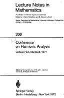
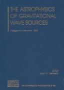

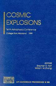
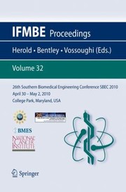
Search results from Open Library.
Recent natural events nearby
Ground air-quality sensors
Recently spotted species
Nearest stream gauge
Events
Notable, recurring, and historical events associated with College Park, sourced from Wikidata.
- Katherine Anne Porter at one hundredMay 9, 1991planned event
a conference and exhibition celebration of the hundredth birthday of Katherine Anne Porter
Source: Wikidata (CC0).
Gallery
Sources
- • Wikipedia
- • US Census Bureau (ACS 5-year estimates)
- • NOAA National Weather Service
- • Wikidata
- • USGS Earthquake Catalog (global feed)
- • NCES via Urban Institute Education Data Portal
- • GBIF (Global Biodiversity Information Facility)
- • CDC PLACES
- • Open-Meteo / sunrise-sunset.org
- • Wikipedia Pageviews API
- • Open Library
- • Wikidata SPARQL (CC0) — population, area, elevation, inception, head of government, Commons image