Browse / United States / Maryland / Essex
Essex
MarylandCDP

Essex
Total population
40,580
Median home value
$258,900
Bachelor's+
Median income
$67,168
Air quality index
Demographic figures from US Census Bureau · ACS 5-year estimates. Overview below cites Wikipedia and may reference a different year.
City facts
Facts from Wikidata (CC0).
Overview
Essex is an unincorporated community and census-designated place in Baltimore County, Maryland, United States. Essex history dates back to 1909. The population was 40,505 in the 2020 census, up from 39,262 in the 2010 census.
Read more on WikipediaHistory & geography
History
Essex is located on a peninsula bodied by the Middle River to the east and the Back River to the west. Essex was originally ten blocks, running from Mace Avenue to Marlyn Avenue. It began in 1909 by the Taylor Land Company for the residents in Baltimore who wanted a place outside the city limits to perhaps grow a garden or to pursue some other rural activity. Land was cheap, and sales were enhanced by a promotional pamphlet. Henry Guttenberger built the first general store in Essex in 1910 on the corner of Eastern Boulevard and Mace Avenue. Between 1911 and 1912, the Taylor Land Company donated the lots for Essex Methodist and St. John's Lutheran churches. They also donated the land where the volunteer fire department built their station. The permanent fire station opened in 1921. With the ever-growing population came the need to build schools. The elementary school opened in 1925 with 400 students. Essex Community College, now CCBC-Essex, was founded in 1957. Classes were first held at Kenwood High School, with fifty part-time and nine full-time students. In 1961, the college moved to Dorsey Avenue, and in 1968 moved to its present location, in Rossville. This site was owned by the Mace family, and the family burial plot is maintained and protected by the college. A fire in August 1957 destroyed an entire block of businesses on Eastern Boulevard, and the town's business district never fully recovered from that catastrophe. The ten-alarm blaze caused a half million dollars in damages, in the time it took to repair the buildings new shopping centers were built changing the buying habits of consumers. The Glenn L. Martin Company was the single biggest reason for the rapid growth of the area. Employment at the company peaked at more than 53,000 workers during World…
Geography
Essex is located at (39.307737, −76.451710). According to the United States Census Bureau, the CDP has a total area of , of which is land and , or 22.16%, is water. The town is on mostly flat to gently rolling terrain, transitioning to marshland at the tip of the peninsula close to the Chesapeake Bay. Essex has a small island on the Chesapeake Bay named Hart Miller Island. The island is only accessible by boat, and the closest boat launch is located in Rocky Point. The island boasts an observation tower, beaches, and hiking trails. A made landfill linking two Chesapeake islands consisting of Hart and Miller island.
Excerpted from the corresponding Wikipedia article (CC BY-SA).
Demographics & economy
Race & ethnicity
Source: US Census Bureau — American Community Survey, 5-year estimates.
Geography
Coordinates & boundaries from the US Census TIGER/Line shapefiles.
Climate
Current forecast
Forecast for Essex, MD from NOAA NWS API.
Air quality
Current readings from Open-Meteo Air Quality API (Copernicus CAMS European reanalysis).
Industrial & pollution facilities
Natural hazard risk
Health (adults)
Age-adjusted prevalence estimates from CDC PLACES (latest release).
Walkability
Amenities nearby
Wildlife & biodiversity
Most-observed species
- Northern CardinalCardinalis cardinalis (Linnaeus, 1758) · Aves46,448
- American RobinTurdus migratorius Linnaeus, 1766 · Aves39,010
- Mourning DoveZenaida macroura (Linnaeus, 1758) · Aves37,440
- Carolina WrenThryothorus ludovicianus (Latham, 1790) · Aves36,793
- European StarlingSturnus vulgaris Linnaeus, 1758 · Aves33,639
- American CrowCorvus brachyrhynchos C.L.Brehm, 1822 · Aves29,347
- Blue JayCyanocitta cristata (Linnaeus, 1758) · Aves29,001
- Carolina ChickadeePoecile carolinensis (Audubon, 1834) · Aves27,746
Citizen-science & research observations from the Global Biodiversity Information Facility (GBIF).
Schools
Largest nearby schools
- Parkville HighHigh · Baltimore · 2,200 students · 14.5:1 ratio
- Dundalk HighHigh · Baltimore · 2,193 students · 16.2:1 ratio
- Perry Hall HighHigh · Baltimore · 2,029 students · 16.8:1 ratio
- Kenwood HighHigh · Baltimore · 1,908 students · 16.6:1 ratio
- Perry Hall MiddleMiddle · Baltimore · 1,754 students · 16.5:1 ratio
- Overlea HighHigh · Baltimore · 1,365 students · 15.9:1 ratio
- Patapsco High and Center for ArtsHigh · Baltimore · 1,312 students · 14.7:1 ratio
- Eastern Technical High SchoolHigh · Baltimore · 1,262 students · 18.6:1 ratio
Public K–12 schools within ~10 mi from Urban Institute Education Data Portal (NCES Common Core of Data, 2022).
Earthquake history
Most recent
- M 2.5 — 2025-10-274 km E of Riverside, Maryland
- M 2.6 — 2021-06-252 km SE of Woodlawn, Maryland
- M 2.81 — 2019-09-155 km ESE of East Berlin, Pennsylvania
- M 4.1 — 2017-11-303 km NNE of Little Creek, Delaware
- M 3.6 — 2010-07-165 km NNW of Barnesville, Maryland
- M 3.05 — 2010-06-034 km ENE of Franklintown, Pennsylvania
Events from the USGS Earthquake Catalog (global) (FDSN Event Web Service).
Photos
Sights & places nearby
Notable people from here
Geography & sun
Elevation, sunrise/sunset and daylight from Open-Meteo. Solar climatology from NASA POWER.
Nearby airports
Public attention
Pageview totals from the Wikimedia Pageviews API.
Books about Essex

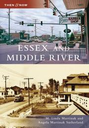
Search results from Open Library.
Recent natural events nearby
- Little Schloss RX Prescribed Fire, Shenandoah, VirginiaWildfires · 2026-06-10 · 120 mi
Wildfires, storms and other events from NASA EONET (last 12 months, within 250 mi).
Ground air-quality sensors
Recently spotted species
Nearest stream gauge
Live readings from USGS NWIS · measured 2026-04-02 12:34 UTC.
Events
Gallery
Geotagged photos within ~6 miles of Essex, from Wikimedia Commons contributors.
_from_the_pedestrian_overpass_just_south_of_Mansfield_Road_in_Essex,_Baltimore_County,_Maryland.jpg) 0.3 mi
0.3 mi_from_the_pedestrian_overpass_just_south_of_Mansfield_Road_in_Essex,_Baltimore_County,_Maryland.jpg) 0.3 mi
0.3 mi_at_Homberg_Avenue_in_Essex,_Baltimore_County,_Maryland.jpg) 0.8 mi
0.8 mi_at_Back_River_Neck_Road_in_Essex,_Baltimore_County,_Maryland.jpg) 1 mi
1 mi.jpeg) 1 mi
1 mi_at_Back_River_Neck_Road_in_Essex,_Baltimore_County,_Maryland.jpg) 1 mi
1 mi.jpeg) 1.2 mi
1.2 mi 1.3 mi
 1.4 mi
_at_the_exit_for_Maryland_State_Route_150_EAST-Eastern_Avenue_(Chase)_in_Essex,_Baltimore_County,_Maryland.jpg) 1.4 mi
1.4 mi_at_the_exit_for_Maryland_State_Route_702_NORTH_(TO_Interstate_695-Beltway)_in_Essex,_Baltimore_County,_Maryland.jpg) 1.4 mi
1.4 mi_from_the_overpass_for_Maryland_State_Route_702_(Southeast_Boulevard-Southeast_Freeway)_in_Essex,_Baltimore_County,_Maryland.jpg) 1.4 mi
1.4 mi_from_the_overpass_for_Maryland_State_Route_702_(Southeast_Boulevard-Southeast_Freeway)_in_Essex,_Baltimore_County,_Maryland.jpg) 1.4 mi
1.4 mi_at_the_exit_for_Maryland_State_Route_702_NORTH_(TO_Interstate_695)_in_Essex,_Baltimore_County,_Maryland.jpg) 1.4 mi
1.4 mi_at_the_exit_for_Maryland_State_Route_150_WEST-Eastern_Boulevard_(Essex)_in_Essex,_Baltimore_County,_Maryland.jpg) 1.7 mi
1.7 mi_from_the_overpass_for_North_Marlyn_Avenue_in_Essex,_Baltimore_County,_Maryland.jpg) 1.7 mi
1.7 mi_from_the_overpass_for_North_Marlyn_Avenue_in_Essex,_Baltimore_County,_Maryland.jpg) 1.7 mi
1.7 mi 1.7 mi
 1.9 mi
_at_Dogwood_Drive_in_Middle_River,_Baltimore_County,_Maryland.jpg) 1.9 mi
1.9 mi_at_Dogwood_Drive_in_Middle_River,_Baltimore_County,_Maryland.jpg) 1.9 mi
1.9 mi_at_the_exit_for_Interstate_695_SOUTH_(Sparrows_Point)_in_Essex,_Baltimore_County,_Maryland.jpg) 2 mi
2 mi_at_the_exit_for_Maryland_State_Route_700_NORTH_(Martin_Boulevard,_TO_U.S._Route_40)_in_Middle_River,_Baltimore_County,_Maryland.jpg) 2.1 mi
2.1 mi_at_the_exit_for_Maryland_State_Route_150_WEST_(Eastern_Avenue)_in_Middle_River,_Baltimore_County,_Maryland.jpg) 2.1 mi
2.1 miPhotos via Wikimedia Commons — see each image page for license & attribution.
Sources
- • Wikipedia
- • US Census Bureau (ACS 5-year estimates)
- • NOAA National Weather Service
- • Wikimedia Commons
- • Wikidata
- • Open-Meteo Air Quality (CAMS)
- • USGS Earthquake Catalog (global feed)
- • USGS NWIS (water data)
- • NCES via Urban Institute Education Data Portal
- • GBIF (Global Biodiversity Information Facility)
- • CDC PLACES
- • Open-Meteo / sunrise-sunset.org
- • Wikipedia Pageviews API
- • Open Library
- • NASA EONET