Browse / United States / Maryland / Funkstown
Funkstown
Marylandtown

Funkstown
Total population
1,076
Median home value
$277,800
Bachelor's+
Median income
$61,392
Founded
1767
Demographic figures from US Census Bureau · ACS 5-year estimates. Overview below cites Wikipedia and may reference a different year.
City facts
Facts from Wikidata (CC0).
Overview
Funkstown is a town in Washington County, Maryland, United States. As of the 2020 census, Funkstown had a population of 852.
Read more on WikipediaHistory & geography
History
Originally were sold to Henry Funk by Frederick Calvert, 6th Baron Baltimore in 1754 and settled as Jerusalem. The Civil War Battle of Funkstown took place July 10, 1863, during the Gettysburg campaign as Robert E. Lee's Army of Northern Virginia retreated toward Virginia in the week following the Battle of Gettysburg. Union forces of the Army of the Potomac attacked the rear guard of the Confederate Army of Northern Virginia during its retreat from Pennsylvania following the Battle of Gettysburg. A strong Confederate presence at Funkstown threatened any Union advance against Gen. Robert E. Lee's position near Williamsport and the Potomac River as he retreated to Virginia after the Battle of Gettysburg. Maj. Gen. J.E.B. Stuart's cavalry, posted at Funkstown, posed a serious risk to the Federal right and rear if the Union army lunged west from Boonsboro. Stuart, meanwhile, determined to wage a spirited defense to ensure Lee time to complete fortifications protecting his army and his avenue of retreat. As Brig. Gen. John Buford's Federal cavalry division cautiously approached Funkstown via the National Road on Friday morning July 10, 1863, it encountered Stuart's crescent-shaped, three-mile-long battle line. It was Stuart's first defensive battle since reentering Maryland. The high ground constituted Stuart's extreme right, held by Preston Chew's horse artillery. A nearby stone barn and barnyard wall proved a superb defensive position for the 34th Virginia Battalion's dismounted cavalry. Col. Thomas C. Devin's dismounted Union cavalry brigade attacked about 8:00 a.m. By mid-afternoon, with Buford's cavalrymen running low on ammunition and gaining little ground, Col. Lewis A. Grant's First Vermont Brigade of infantry arrived and jabbed at the Confederate center…
Geography
Funkstown is located on Antietam Creek, south of Hagerstown. According to the United States Census Bureau, the town has a total area of , all land. Antietam Creek flows to the south within the city limits. The climate in this area is characterized by hot, humid summers and generally mild to cool winters. According to the Köppen Climate Classification system, Funkstown has a humid subtropical climate, abbreviated "Cfa" on climate maps.
Excerpted from the corresponding Wikipedia article (CC BY-SA).
Demographics & economy
Race & ethnicity
Source: US Census Bureau — American Community Survey, 5-year estimates.
Geography
Coordinates & boundaries from the US Census TIGER/Line shapefiles.
Climate
Current forecast
Forecast for Funkstown, MD from NOAA NWS API.
Air quality
Industrial & pollution facilities
Natural hazard risk
Health (adults)
Age-adjusted prevalence estimates from CDC PLACES (latest release).
Walkability
Amenities nearby
Wildlife & biodiversity
Most-observed species
- Northern CardinalCardinalis cardinalis (Linnaeus, 1758) · Aves13,402
- Carolina WrenThryothorus ludovicianus (Latham, 1790) · Aves10,401
- Blue JayCyanocitta cristata (Linnaeus, 1758) · Aves9,293
- Carolina ChickadeePoecile carolinensis (Audubon, 1834) · Aves9,160
- Red-bellied WoodpeckerMelanerpes carolinus (Linnaeus, 1758) · Aves9,080
- American RobinTurdus migratorius Linnaeus, 1766 · Aves9,074
- Tufted TitmouseBaeolophus bicolor (Linnaeus, 1766) · Aves9,040
- American CrowCorvus brachyrhynchos C.L.Brehm, 1822 · Aves8,412
Citizen-science & research observations from the Global Biodiversity Information Facility (GBIF).
Schools
Largest nearby schools
- South Hagerstown HighHigh · Hagerstown · 1,487 students · 17.1:1 ratio
- North Hagerstown HighHigh · Hagerstown · 1,438 students · 19.4:1 ratio
- Williamsport HighHigh · Williamsport · 959 students · 16.8:1 ratio
- Western Heights MiddleMiddle · Hagerstown · 903 students · 15.6:1 ratio
- Northern MiddleMiddle · Hagerstown · 848 students · 16.3:1 ratio
- E. Russell Hicks MiddleMiddle · Hagerstown · 824 students · 16.5:1 ratio
- Springfield MiddleMiddle · Williamsport · 748 students · 15.3:1 ratio
- Boonsboro HighHigh · Boonsboro · 747 students · 14.4:1 ratio
Public K–12 schools within ~10 mi from Urban Institute Education Data Portal (NCES Common Core of Data, 2022).
Earthquake history
Most recent
- M 2.5 — 2025-10-274 km E of Riverside, Maryland
- M 2.6 — 2021-06-252 km SE of Woodlawn, Maryland
- M 2.81 — 2019-09-155 km ESE of East Berlin, Pennsylvania
- M 3.44 — 2019-06-139 km N of Blain, Pennsylvania
- M 3.03 — 2016-01-173 km NE of Ranson, West Virginia
- M 3.6 — 2010-07-165 km NNW of Barnesville, Maryland
Events from the USGS Earthquake Catalog (global) (FDSN Event Web Service).
Photos
Sights & places nearby
Notable people from here


People born within ~10 km, from Wikidata (CC0). Click any name for their Wikipedia article.
Nearby places in Maryland
Geography & sun
Elevation, sunrise/sunset and daylight from Open-Meteo. Solar climatology from NASA POWER.
Nearby airports
Public attention
Pageview totals from the Wikimedia Pageviews API.
Books about Funkstown
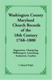
Search results from Open Library.
Recent natural events nearby
Ground air-quality sensors
Recently spotted species
Nearest stream gauge
Events
Gallery
Sources
- • Wikipedia
- • US Census Bureau (ACS 5-year estimates)
- • NOAA National Weather Service
- • Wikidata
- • USGS Earthquake Catalog (global feed)
- • NCES via Urban Institute Education Data Portal
- • GBIF (Global Biodiversity Information Facility)
- • CDC PLACES
- • Open-Meteo / sunrise-sunset.org
- • Wikipedia Pageviews API
- • Open Library