Browse / Madagascar / Madagascar / Belalona
Belalona
Madagascarvillage
Demographic figures from INSTAT Madagascar. Overview below cites Wikipedia and may reference a different year.
City facts
Overview
Found in Madagascar, Belalona is classified as a village in public datasets. Belalona maps to -14.871°, 49.355° — squarely within the tropical belt. Detailed population figures are not currently catalogued in the open data sources we track. Open solar datasets indicate about 1,821 kWh/m² of solar irradiance per year, combined with sunshine for roughly 71% of daylight hours. The latitude suggests warm temperatures throughout the year with pronounced wet and dry seasons. Open-data panels below dive into population trends, climate normals, environmental indicators and nearby places.
Summary composed automatically from structured open data on this page. See our Terms for details.
History & geography
Geography
Coordinates & boundaries from the US Census TIGER/Line shapefiles.
Climate
Air quality
Walkability
Amenities nearby
Wildlife & biodiversity
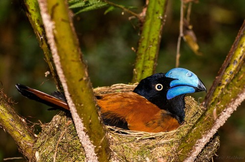
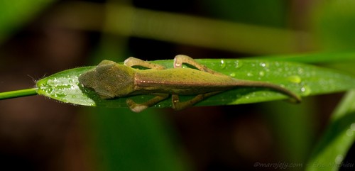
Most-observed species
- White-throated RailDryolimnas cuvieri (Pucheran, 1845) · Aves1
- Short-legged Ground-RollerBrachypteracias leptosomus (R.Lesson, 1833) · Aves1
- Madagascar Magpie-RobinCopsychus albospecularis (Eydoux & Gervais, 1836) · Aves1
- Red-fronted CouaCoua reynaudii Pucheran, 1845 · Aves1
- Red-breasted CouaCoua serriana Pucheran, 1845 · Aves1
- Malagasy KingfisherCorythornis vintsioides (Eydoux & Gervais, 1836) · Aves1
Citizen-science & research observations from the Global Biodiversity Information Facility (GBIF).
Earthquake history
Most recent
- M 4.4 — 2022-04-1012 km WNW of Antakotako, Madagascar
- M 4.8 — 2015-10-3025 km W of Antalaha, Madagascar
- M 4.1 — 2006-06-1119 km S of Maroantsetra, Madagascar
Events from the USGS Earthquake Catalog (global) (FDSN Event Web Service).
Photos
Sights & places nearby
Notable people from here
Nearby places in Madagascar
- Andasibe Kobahina27.8 mi away
- Bemahogo60.9 mi away
- Mramani مرماني368 mi away
- Hamouchako هاموشاكو368.1 mi away
- Salapouani سالابواني368.4 mi away
- Dziani دزياني368.7 mi away
- Nyamboiro نيامبويرو368.8 mi away
- Kiyo كيو369 mi away
- Mirondroni ميروندروني369.2 mi away
- Comoni كوموني369.3 mi away
- Chaouéni شاويني369.5 mi away
- Nounga نونجا369.7 mi away
Geography & sun
Elevation, sunrise/sunset and daylight from Open-Meteo. Solar climatology from NASA POWER.
Nearby airports
Public attention
Books about this place
Recent natural events nearby
Ground air-quality sensors
Recently spotted species
Research-grade observations from iNaturalist (within ~15 mi).
Events
Gallery
Geotagged photos within ~6 miles of Belalona, from Wikimedia Commons contributors.


Photos via Wikimedia Commons — see each image page for license & attribution.
Sources
- • Wikimedia Commons
- • Wikidata
- • USGS Earthquake Catalog (global feed)
- • GBIF (Global Biodiversity Information Facility)
- • iNaturalist
- • Open-Meteo / sunrise-sunset.org