Browse / United States / Michigan / Leland
Leland
MichiganCDP

Leland
Total population
400
Median home value
$637,300
Bachelor's+
Median income
$120,781
Founded
1853
Air quality index
Demographic figures from US Census Bureau · ACS 5-year estimates. Overview below cites Wikipedia and may reference a different year.
City facts
Facts from Wikidata (CC0).
Overview
Leland is an unincorporated community and census-designated place (CDP) in the U.S. state of Michigan. It is located in Leelanau County, part of the northwestern Lower Peninsula of the state. As of the 2020 census it had a population of 410. From 1883 to 2004, Leland was the county seat of Leelanau County, which has since moved to Suttons Bay Township.
Read more on WikipediaHistory & geography
History
Leland is built on the site of one of the oldest and largest Ottawa villages on the Leelanau Peninsula. Where the Leland (Carp) River flows into Lake Michigan, there was a natural fish ladder (which was a traditional Native American fishing grounds). The settlement was called Mishi-me-go-bing, meaning "the place where canoes run up into the river to land, because they have no harbor", or alternatively Che-ma-go-bing or Chi-mak-a-ping. White settlers, who began arriving in the 1830s, also took advantage of the location as a fishing settlement. White settlement increased after Antoine Manseau, with his son Antoine Jr., and John Miller, built a dam and sawmill on the river in 1854. Construction of the dam raised the water level , and what had been three natural lakes in the river all became a single lake now known as Lake Leelanau (and is navigable all the way to the community of Cedar, about inland). The settlers built wooden docks, which allowed steamers and schooners to transport new settlers and supplies. From 1870 to 1884, the Leland Lake Superior Iron Co. operated an iron smelter north of the river mouth, supplied with ore from the Upper Peninsula and charcoal made from local maple and beech timber; the charcoal was produced in fourteen beehive kilns near the smelting furnace, which produced up to 40 tons of iron per day. In 1884, the plant was sold to the Leland Lumber Co., which operated a sawmill on the site. Other sawmills and shingle mills operated in Leland during the years 1885–1900. As early as 1880, commercial fishermen sailed out of the harbor to catch trout and whitefish, building wooden shacks where they processed their catch and serviced their fleet. Up to eight powered tugs once sailed out of "Fishtown", as the buildings came to be known. Today,…
Geography
Leland is in northern Leelanau County, on the west side of the Leelanau Peninsula. It is bordered to the west by Lake Michigan and to the east by the northern section of Lake Leelanau. The Leland River runs through the center of the community, connecting the two lakes. According to the U.S. Census Bureau, the Leland CDP has a total area of , of which are land and , or 2.22%, are water. Leland lies just north of the 45th parallel. A sign on M-22 south of Leland reads "45th Parallel Halfway Between Equator & North Pole".
Excerpted from the corresponding Wikipedia article (CC BY-SA).
Demographics & economy
Race & ethnicity
Source: US Census Bureau — American Community Survey, 5-year estimates.
Geography
Coordinates & boundaries from the US Census TIGER/Line shapefiles.
Climate
Current forecast
Forecast for Leland, MI from NOAA NWS API.
Air quality
Current readings from Open-Meteo Air Quality API (Copernicus CAMS European reanalysis).
Industrial & pollution facilities
Natural hazard risk
Health (adults)
Age-adjusted prevalence estimates from CDC PLACES (latest release).
Walkability
Amenities nearby
Wildlife & biodiversity
Most-observed species
- Black-capped ChickadeePoecile atricapillus (Linnaeus, 1766) · Aves5,833
- American CrowCorvus brachyrhynchos C.L.Brehm, 1822 · Aves5,783
- Blue JayCyanocitta cristata (Linnaeus, 1758) · Aves5,401
- American RobinTurdus migratorius Linnaeus, 1766 · Aves4,728
- American GoldfinchSpinus tristis (Linnaeus, 1758) · Aves3,743
- Song SparrowMelospiza melodia (A.Wilson, 1810) · Aves3,429
- Northern CardinalCardinalis cardinalis (Linnaeus, 1758) · Aves3,232
- Red-winged BlackbirdAgelaius phoeniceus (Linnaeus, 1766) · Aves3,172
Citizen-science & research observations from the Global Biodiversity Information Facility (GBIF).
Schools
Largest nearby schools
- Leland Public SchoolOther · LELAND · 450 students · 14.1:1 ratio
- Suttons Bay Elementary Middle SchoolElementary · SUTTONS BAY · 236 students · 12.4:1 ratio
- Suttons Bay Virtual SchoolOther · Suttons Bay · 181 students · 30.2:1 ratio
- Suttons Bay Senior High SchoolHigh · SUTTONS BAY · 161 students · 20.1:1 ratio
- Leelanau Montessori Public School AcademyElementary · Lake Leelanau · 74 students · 12.3:1 ratio
Public K–12 schools within ~10 mi from Urban Institute Education Data Portal (NCES Common Core of Data, 2022).
Earthquake history
Events from the USGS Earthquake Catalog (global) (FDSN Event Web Service).
Photos
Sights & places nearby
Notable people from here


People born within ~10 km, from Wikidata (CC0). Click any name for their Wikipedia article.
Nearby places in Michigan
- Lake Leelanau3.4 mi away
- Suttons Bay5.9 mi away
- Northport10.1 mi away · pop. 465
- Cedar12.2 mi away · pop. 23
- Greilickville15.8 mi away
- Empire20.7 mi away · pop. 341
- Eastport20.8 mi away · pop. 311
- Central Lake24.3 mi away · pop. 1,051
- Grawn25.1 mi away · pop. 800
- Interlochen25.7 mi away
- Rapid City26.1 mi away · pop. 1,328
- Ellsworth27 mi away
Geography & sun
Elevation, sunrise/sunset and daylight from Open-Meteo. Solar climatology from NASA POWER.
Nearby airports
Public attention
Pageview totals from the Wikimedia Pageviews API.
Books about Leland

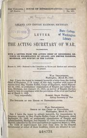
Search results from Open Library.
Recent natural events nearby
- Wildfire Craig Lake 1, Baraga, MichiganWildfires · 2026-10-08 · 161 mi
Wildfires, storms and other events from NASA EONET (last 12 months, within 250 mi).
Ground air-quality sensors
Recently spotted species
Nearest stream gauge
Events
Gallery
Sources
- • Wikipedia
- • US Census Bureau (ACS 5-year estimates)
- • NOAA National Weather Service
- • Wikidata
- • Open-Meteo Air Quality (CAMS)
- • USGS Earthquake Catalog (global feed)
- • NCES via Urban Institute Education Data Portal
- • GBIF (Global Biodiversity Information Facility)
- • CDC PLACES
- • Open-Meteo / sunrise-sunset.org
- • Wikipedia Pageviews API
- • Open Library
- • NASA EONET