Browse / United States / Michigan / Rochester Hills
Rochester Hills
Michigancity

Rochester Hills
Total population
77,089
Median home value
$409,800
Bachelor's+
Median income
$120,694
Demographic figures from US Census Bureau · ACS 5-year estimates. Overview below cites Wikipedia and may reference a different year.
City facts
Facts from Wikidata (CC0).
Overview
Rochester Hills is a city in Oakland County, Michigan, United States. A northern suburb of Detroit, Rochester Hills is located about 25 miles (40 km) north of downtown Detroit. As of the 2020 census, the city had a population of 76,300. The area was first settled by European Americans in 1817 and organized as Avon Township in 1835. The city of Rochester was incorporated in 1967, while the remaining area of Avon Township was incorporated and renamed the city of Rochester Hills in 1984.
Read more on WikipediaHistory & geography
History
Prior to European settlement, the area now known as Rochester Hills was inhabited by Native Americans, namely the Potawatomi. The Potawatomi depended on the area's abundant water sources, such as the Clinton River and Paint Creek, to grow crops, fish, and travel. They resided here until the 1807 Treaty of Detroit caused them, along with the Odawa, Wyandot, and Ojibwe peoples, to cede their land in Southeast Michigan. The first European settler was James Graham who arrived in 1817. Graham and his family reached the area by following trails created by the Sauk Native Americans. Avon Township was organized in 1835. Rochester incorporated as a village within the township in 1869. The township adopted a charter in 1948 under the Home Rule Act. Also in 1948 a post office was established under the name of Brooklands for the area between Auburn Road and Hamlin Road just to the west of Dequindre Road. In 1966, village residents voted to become the City of Rochester, effective in February 1967. As a result, Rochester residents no longer had to pay property taxes to the township, as it was now a separate municipality. In 1967, Avon Township filed a petition to become a city. In January 1968, township voters approved the petition to move forward with seeking city status. Three proposed city charters were voted down by residents, the first in March 1969, the second in May 1970, and the third in September 1971. The city of Rochester then sought to annex all of the township, which was unanimously denied by the Michigan Boundary Commission. In 1972, petitions were filed to consolidate Avon Township and Rochester. In April 1974, the consolidation petition lost by 350 votes in the township, while passing by four votes in Rochester. In May 1974, Rochester's petition to annex of Avon…
Geography
According to the United States Census Bureau, the city has a total area of , of which is land and (0.27%) is water. Rochester Hills is bordered to the north by Oakland Charter Township along Dutton Road, to the south by the city of Troy along South Boulevard, to the east by Shelby Township in Macomb County along Dequindre Road, and to the west by the city of Auburn Hills along part of Adams Road. Rochester Hills is also partially bordered by the city of Rochester to the east. Elevations in the city range from above sea level in the southeastern portion of the city to in the northwestern section. *Stony Creek is a neighborhood on the northeast end of the city on the border with Rochester at . *Yates is on the boundary with Rochester and Shelby Township, Oakland County ( ; Elevation: 669 ft./204 m.).
Excerpted from the corresponding Wikipedia article (CC BY-SA).
Demographics & economy
Race & ethnicity
Source: US Census Bureau — American Community Survey, 5-year estimates.
Geography
Coordinates & boundaries from the US Census TIGER/Line shapefiles.
Climate
Current forecast
Forecast for Rochester Hills, MI from NOAA NWS API.
Air quality
Industrial & pollution facilities
Natural hazard risk
Health (adults)
Age-adjusted prevalence estimates from CDC PLACES (latest release).
Walkability
Amenities nearby
Wildlife & biodiversity
Most-observed species
- American RobinTurdus migratorius Linnaeus, 1766 · Aves28,473
- Northern CardinalCardinalis cardinalis (Linnaeus, 1758) · Aves28,107
- Blue JayCyanocitta cristata (Linnaeus, 1758) · Aves27,397
- House SparrowPasser domesticus (Linnaeus, 1758) · Aves24,634
- Mourning DoveZenaida macroura (Linnaeus, 1758) · Aves23,536
- Black-capped ChickadeePoecile atricapillus (Linnaeus, 1766) · Aves23,356
- Downy WoodpeckerDryobates pubescens (Linnaeus, 1766) · Aves19,208
- American GoldfinchSpinus tristis (Linnaeus, 1758) · Aves18,914
Citizen-science & research observations from the Global Biodiversity Information Facility (GBIF).
Schools
Largest nearby schools
- Lighthouse Connections AcademyOther · TROY · 2,454 students · 30.7:1 ratio
- Lake Orion Community High SchoolHigh · LAKE ORION · 2,174 students · 17.3:1 ratio
- Troy High SchoolHigh · Troy · 2,094 students · 18.7:1 ratio
- Rochester High SchoolHigh · ROCHESTER HILLS · 1,690 students · 22.8:1 ratio
- Bloomfield Hills High SchoolHigh · Bloomfield Hills · 1,598 students · 15.5:1 ratio
- Athens High SchoolHigh · Troy · 1,545 students · 17.8:1 ratio
- Rochester Adams High SchoolHigh · ROCHESTER HILLS · 1,534 students · 23.6:1 ratio
- Stoney Creek High SchoolHigh · ROCHESTER HILLS · 1,524 students · 24.2:1 ratio
Public K–12 schools within ~10 mi from Urban Institute Education Data Portal (NCES Common Core of Data, 2022).
Earthquake history
Most recent
- M 2.7 — 2026-05-048 km N of Maybee, Michigan
- M 3 — 2026-04-267 km SSE of Amherstburg, Canada
- M 2.5 — 2022-05-232 km NNW of Corunna, Canada
- M 3.2 — 2020-08-212 km SSE of Detroit Beach, Michigan
- M 3.4 — 2018-04-20Michigan
- M 2.6 — 2017-05-1418 km ENE of Leamington, Canada
Events from the USGS Earthquake Catalog (global) (FDSN Event Web Service).
Photos
Sights & places nearby
Notable people from here


People born within ~10 km, from Wikidata (CC0). Click any name for their Wikipedia article.
Nearby places in Michigan
- Troy5.5 mi away · pop. 89,205
- Utica7.3 mi away · pop. 5,180
- Lake Angelus8.7 mi away · pop. 238
- Clawson8.8 mi away · pop. 11,374
- Lathrup Village12.3 mi away · pop. 4,059
- Franklin12.4 mi away · pop. 2,554
- Fraser13.9 mi away · pop. 14,583
- Ferndale14.2 mi away · pop. 19,190
- Mount Clemens14.8 mi away · pop. 15,511
- Farmington Hills16.5 mi away · pop. 84,160
- Eastpointe17.4 mi away · pop. 33,982
- St. Clair Shores18 mi away · pop. 58,140
Geography & sun
Elevation, sunrise/sunset and daylight from Open-Meteo. Solar climatology from NASA POWER.
Nearby airports
Public attention
Pageview totals from the Wikimedia Pageviews API.
Books about Rochester Hills

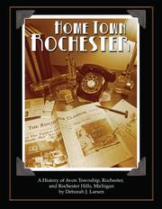

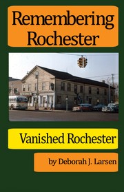

Search results from Open Library.
Recent natural events nearby
Ground air-quality sensors
Recently spotted species
Nearest stream gauge
Events
Gallery
Sources
- • Wikipedia
- • US Census Bureau (ACS 5-year estimates)
- • NOAA National Weather Service
- • Wikidata
- • USGS Earthquake Catalog (global feed)
- • NCES via Urban Institute Education Data Portal
- • GBIF (Global Biodiversity Information Facility)
- • CDC PLACES
- • Open-Elevation
- • Open-Meteo / sunrise-sunset.org
- • Wikipedia Pageviews API
- • Open Library