Kidal
Malicity

Kidal
Total population
25,000
Demographic figures from INSTAT Mali. Overview below cites Wikipedia and may reference a different year.
City facts
Facts from Wikidata (CC0).
Overview
Kidal is a town and commune in the desert region of northern Mali. The town lies 285 km (177 mi) northeast of Gao and is the capital of the Kidal Cercle and the Kidal Region. The commune has an area of about 9,910 km2 (3,830 sq mi) and includes the town of Kidal and 31 other settlements.
Read more on WikipediaHistory & geography
History
The Kidal region has been inhabited by the Tuareg for centuries. The modern town grew up around a French military post established in the early 20th century. On 30 March 2012, Kidal and its military base were captured by the National Movement for the Liberation of Azawad as part of the Tuareg rebellion for the independence of Azawad. A spokesman for the Malian military junta said "To preserve the life of the people of Kidal, the military command decided not to prolong the battle". Gao and Timbuktu were captured within the next 48 hours, and on 6 April, the National Movement for the Liberation of Azawad declared the independence of Azawad from Mali. In the course of the conflict the MNLA lost their control to Islamist militias. On 30 January 2013 French and Malian forces moved into the town to bring it back under government control. On 14 December 2013, a car bombing in Kidal killed two United Nations peacekeepers. On 21 May 2014, MNLA forced government troops in Kidal to retreat after heavy fighting, capturing the military base. On 13 February 2020, Mali government forces were sent to Kidal for the first time in six years. In late 2023, the ruling junta carried out an offensive along with Wagner Group fighters. They managed to bring the city back under government control in the Battle of Kidal in November 2023. In April 2026, the Azawad Liberation Front launched an assault on the city as part of a coordinated offensive across the country. The rebels later reported that they had captured the city and posted a video of rebels in the governor's residence.
Excerpted from the corresponding Wikipedia article (CC BY-SA).
Geography
Coordinates & boundaries from the US Census TIGER/Line shapefiles.
Climate
Air quality
Walkability
Amenities nearby
Wildlife & biodiversity
Earthquake history
Photos
Sights & places nearby
Notable people from here


People born within ~10 km, from Wikidata (CC0). Click any name for their Wikipedia article.
Nearby places in Mali
- Tazeh Shahr2929.9 mi away · pop. 8,629
- Bazargan2937.4 mi away · pop. 9,000
- Vara2969.4 mi away
- Saqqez2982.8 mi away · pop. 140,000
- Bonab-e-Jadid2998.2 mi away · pop. 4,430
- Bostan3030.8 mi away · pop. 8,476
- Hoveyzeh3034.2 mi away · pop. 19,481
- Minooshahr3035.6 mi away
- Bostanabad3037.3 mi away · pop. 16,592
- Shush3049.7 mi away · pop. 77,148
- Arwandkenar3051.2 mi away · pop. 11,173
- Hamidieh3055.4 mi away · pop. 22,057
Geography & sun
Elevation, sunrise/sunset and daylight from Open-Meteo. Solar climatology from NASA POWER.
Nearby airports
Public attention
Pageview totals from the Wikimedia Pageviews API.
Books about Kidal
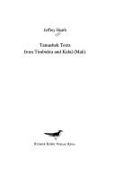
Search results from Open Library.
Recent natural events nearby
Ground air-quality sensors
Recently spotted species
Events
Gallery
Sources
- • Wikipedia
- • Wikidata
- • Open-Meteo / sunrise-sunset.org
- • Wikipedia Pageviews API
- • Open Library
- • Wikidata SPARQL (CC0) — population, area, elevation, inception, head of government, Commons image