Browse / United States / Minnesota / Champlin
Champlin
Minnesotacity

Champlin
Total population
23,294
Median home value
$358,700
Bachelor's+
Median income
$116,102
Founded
1852
Demographic figures from US Census Bureau · ACS 5-year estimates. Overview below cites Wikipedia and may reference a different year.
City facts
Facts from Wikidata (CC0).
Overview
Champlin is a city in Hennepin County, Minnesota, United States. The population was 23,919 at the 2020 census. Champlin is a northern suburb of Minneapolis.
Read more on WikipediaHistory & geography
History
The Champlin area was first settled when Father Louis Hennepin, a Franciscan priest from whom Hennepin County gets its name, Michael Accult, and Peter Dulay were captured by Lakota Indians. An Indian trading post was later established in the area. Charles Miles created the first permanent settlement in what came to be named Marshall Township. In 1859, it was split into two towns, Champlin and Dayton. Champlin's name came from U.S. Navy Commodore Stephen Champlin. He was active in the war against England and Canada in 1812 and in the establishment of the Canadian–United States boundary. He died in 1870 in Buffalo, New York. On August 30, 1853, Stephen Champlin's daughter, Eliza Ellen Champlin, married John B. Cook, a partner of Minnesota's Alexander Ramsey. Cook never resided in Champlin, but he was involved in real estate transactions there and in its incorporation. In 1947, part of the former Champlin Township was incorporated to form the village of Champlin, and on January 2, 1971, as the result of a petitioned order from the Minnesota Municipal Commission, Champlin Township and the village of Champlin consolidated to form the city of Champlin.
Geography
Champlin lies along the Mississippi River, surrounded by the cities of Anoka, Dayton, Brooklyn Park, Maple Grove and Coon Rapids, northwest of Minneapolis. According to the United States Census Bureau, the city has an area of , of which is land and is water. The average elevation is above sea level, and the Mississippi River is approximately one-eighth of a mile wide throughout Champlin.
Excerpted from the corresponding Wikipedia article (CC BY-SA).
Demographics & economy
Race & ethnicity
Source: US Census Bureau — American Community Survey, 5-year estimates.
Geography
Coordinates & boundaries from the US Census TIGER/Line shapefiles.
Climate
Current forecast
Forecast for Champlin, MN from NOAA NWS API.
Air quality
Industrial & pollution facilities
Natural hazard risk
Health (adults)
Age-adjusted prevalence estimates from CDC PLACES (latest release).
Walkability
Amenities nearby
Wildlife & biodiversity
Most-observed species
- Black-capped ChickadeePoecile atricapillus (Linnaeus, 1766) · Aves28,579
- Northern CardinalCardinalis cardinalis (Linnaeus, 1758) · Aves24,712
- Blue JayCyanocitta cristata (Linnaeus, 1758) · Aves22,213
- American RobinTurdus migratorius Linnaeus, 1766 · Aves21,809
- American CrowCorvus brachyrhynchos C.L.Brehm, 1822 · Aves21,468
- American GoldfinchSpinus tristis (Linnaeus, 1758) · Aves21,312
- MallardAnas platyrhynchos Linnaeus, 1758 · Aves20,188
- Downy WoodpeckerDryobates pubescens (Linnaeus, 1766) · Aves19,703
Citizen-science & research observations from the Global Biodiversity Information Facility (GBIF).
Schools
Largest nearby schools
- Champlin Park High SchoolHigh · CHAMPLIN · 2,983 students · 20.7:1 ratio
- MAPLE GROVE SENIOR HIGHHigh · MAPLE GROVE · 2,324 students · 23.5:1 ratio
- OSSEO SENIOR HIGHHigh · OSSEO · 2,280 students · 21.9:1 ratio
- JACKSON MIDDLEMiddle · CHAMPLIN · 1,981 students · 17.5:1 ratio
- PARK CENTER IB WORLD SCHOOLHigh · BROOKLYN PARK · 1,908 students · 17.2:1 ratio
- ROGERS SENIOR HIGHHigh · ROGERS · 1,740 students · 37:1 ratio
- ROBBINSDALE COOPER SENIOR HIGHHigh · NEW HOPE · 1,630 students · 28.1:1 ratio
- Maple Grove Middle SchoolMiddle · MAPLE GROVE · 1,598 students · 21.6:1 ratio
Public K–12 schools within ~10 mi from Urban Institute Education Data Portal (NCES Common Core of Data, 2022).
Earthquake history
Events from the USGS Earthquake Catalog (global) (FDSN Event Web Service).
Photos
Sights & places nearby
Notable people from here


People born within ~10 km, from Wikidata (CC0). Click any name for their Wikipedia article.
Geography & sun
Elevation, sunrise/sunset and daylight from Open-Meteo. Solar climatology from NASA POWER.
Nearby airports
Public attention
Pageview totals from the Wikimedia Pageviews API.
Books about Champlin
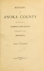


Search results from Open Library.
Recent natural events nearby
Ground air-quality sensors
Recently spotted species
Nearest stream gauge
Events
Gallery
Sources
- • Wikipedia
- • US Census Bureau (ACS 5-year estimates)
- • NOAA National Weather Service
- • Wikidata
- • USGS Earthquake Catalog (global feed)
- • NCES via Urban Institute Education Data Portal
- • GBIF (Global Biodiversity Information Facility)
- • CDC PLACES
- • Open-Meteo / sunrise-sunset.org
- • Wikipedia Pageviews API
- • Open Library