Browse / United States / Minnesota / Duluth
Duluth
Minnesotacity

Duluth
Total population
87,990
Median home value
$268,700
Bachelor's+
Median income
$69,255
Founded
1679
Air quality index
Demographic figures from US Census Bureau · ACS 5-year estimates. Overview below cites Wikipedia and may reference a different year.
- Beach Hazards Statement · ModerateBeach Hazards Statement issued June 27 at 3:52AM CDT until June 27 at 9:00PM CDT by NWS Duluth MN
Source: NOAA National Weather Service.
City facts
Sister cities
Facts from Wikidata (CC0).
Overview
Duluth is a port city in the U.S. state of Minnesota and the county seat of St. Louis County. Located on Lake Superior in Minnesota's Arrowhead Region, the city is a hub for cargo shipping. The population was 86,697 at the 2020 census, making it Minnesota's fifth-largest city. Duluth forms a metropolitan area with neighboring Superior, Wisconsin, called the Twin Ports. Duluth is south of the Iron Range and the Boundary Waters Canoe Area Wilderness. It is named after Daniel Greysolon, Sieur du Lhut, the area's first known European explorer.
Read more on WikipediaHistory & geography
History
For both the Ojibwe and the Dakota, interaction with Europeans during the contact period revolved around the fur trade and related activities. According to Ojibwe oral history, Spirit Island, near the Spirit Valley neighborhood, was the "Sixth Stopping Place" where the northern and southern branches of the Ojibwe Nation came together and proceeded to their "Seventh Stopping Place" near the present city of La Pointe, Wisconsin. The "Stopping Places" were places the Native Americans occupied during their westward migration because of their war with the Iroquois and as Europeans overran their territory. Several factors brought fur traders to the Great Lakes in the early 17th century. The fashion for beaver hats in Europe generated demand for pelts. The French trade for beavers in the lower St. Lawrence River led to the depletion of the animals in the region by the late 1630s, after which the French searched farther west for new resources and new routes, making alliances with the Native Americans along the way to trap and deliver furs. Étienne Brûlé is credited with the European discovery of Lake Superior before 1620. Pierre-Esprit Radisson and Médard des Groseilliers explored the Duluth area, Fond du Lac (Bottom of the Lake), in 1654 and again in 1660. The French soon established fur posts near Duluth and in the far north where Grand Portage became a major trading center. The French explorer Daniel Greysolon, Sieur du Lhut, whose name is sometimes anglicized as "DuLuth", explored the St. Louis River in 1679. After 1792 and the independence of the United States, the North West Company established several posts on Minnesota rivers and lakes, as well as in areas to the west and northwest, for trading with the Ojibwe, the Dakota, and other native tribes. The first post…
Geography
According to the United States Census Bureau, the city has an area of , of which is land and is water. Minnesota Point is about long and, when included with adjacent Wisconsin Point, which extends from the city of Superior, Wisconsin, is the largest freshwater baymouth bar in the world at a total of . Duluth's topography is dominated by a steep hillside that climbs from Lake Superior to high inland elevations. Duluth has been called "the San Francisco of the Midwest", alluding to San Francisco's similar water-to-hilltop topography. This similarity was most evident before World War II, when Duluth had a network of streetcars and an inclined railroad, the 7th Avenue West Incline Railway, that, like San Francisco's cable cars, climbed a steep hill. The change in elevation is illustrated by Duluth's two airports. The weather station at the lakeside Sky Harbor Airport on Minnesota Point has an elevation of , while Duluth International Airport, atop the hill, is higher at . Even as the city has grown, its populace has tended to hug Lake Superior's shoreline, making Duluth a primarily southwest–northeast city. The considerable development on the hill has given Duluth many steep streets. Some neighborhoods, such as Piedmont Heights and Bayview Heights, are atop the hill with scenic views of the city. Skyline Parkway is a scenic roadway that extends from Becks Road above the Gary–New Duluth neighborhood near the western end of the city to the Lester Park neighborhood on the east side. It crosses nearly Duluth's entire length and affords views of Lake Superior, the Aerial Lift Bridge, Canal Park, and the many industries that inhabit the largest inland port. A developing part of the city is the Miller Hill Mall area, as well as the adjacent big-box retailer shopping…
Excerpted from the corresponding Wikipedia article (CC BY-SA).
Demographics & economy
Race & ethnicity
Source: US Census Bureau — American Community Survey, 5-year estimates.
Geography
Coordinates & boundaries from the US Census TIGER/Line shapefiles.
Climate
Current forecast
Forecast for Duluth, MN from NOAA NWS API.
Air quality
Current readings from Open-Meteo Air Quality API (Copernicus CAMS European reanalysis).
Industrial & pollution facilities
Natural hazard risk
Health (adults)
Age-adjusted prevalence estimates from CDC PLACES (latest release).
Walkability
Amenities nearby
Wildlife & biodiversity
Most-observed species
- American CrowCorvus brachyrhynchos C.L.Brehm, 1822 · Aves38,801
- Black-capped ChickadeePoecile atricapillus (Linnaeus, 1766) · Aves28,535
- Rock PigeonColumba livia J.F.Gmelin, 1789 · Aves21,217
- Ring-billed GullLarus delawarensis Ord, 1815 · Aves20,546
- American RobinTurdus migratorius Linnaeus, 1766 · Aves18,816
- Bald EagleHaliaeetus leucocephalus (Linnaeus, 1766) · Aves15,710
- Blue JayCyanocitta cristata (Linnaeus, 1758) · Aves14,552
- American herring gull, Smithsonian GullLarus smithsonianus Coues, 1862 · Aves13,914
Citizen-science & research observations from the Global Biodiversity Information Facility (GBIF).
Schools
Largest nearby schools
- East High SchoolHigh · DULUTH · 1,494 students · 28.2:1 ratio
- ORDEAN EAST MIDDLE SCHOOLMiddle · DULUTH · 989 students · 28.3:1 ratio
- DENFELD HIGH SCHOOLHigh · DULUTH · 940 students · 20:1 ratio
- HERMANTOWN ELEMENTARYElementary · HERMANTOWN · 739 students · 16.4:1 ratio
- NORTH STAR ACADEMYElementary · DULUTH · 716 students · 11.2:1 ratio
- HERMANTOWN MIDDLEMiddle · HERMANTOWN · 680 students · 16.6:1 ratio
- HERMANTOWN SENIOR HIGHHigh · HERMANTOWN · 660 students · 23.6:1 ratio
- BAY VIEW ELEMENTARYElementary · DULUTH · 588 students · 14.7:1 ratio
Public K–12 schools within ~10 mi from Urban Institute Education Data Portal (NCES Common Core of Data, 2022).
Earthquake history
Most recent
- M 2.6 — 2025-08-066 km NW of Mountain Iron, Minnesota
- M 2.7 — 2025-07-024 km NW of Leonidas, Minnesota
- M 2.6 — 2025-03-274 km NNE of Virginia, Minnesota
- M 2.8 — 2025-03-103 km ENE of Virginia, Minnesota
- M 2.5 — 2024-05-313 km NNW of Parkville, Minnesota
- M 2.7 — 2024-03-082 km NNE of Kinney, Minnesota
Events from the USGS Earthquake Catalog (global) (FDSN Event Web Service).
Photos
Sights & places nearby
Notable people from here
People born within ~10 km, from Wikidata (CC0). Click any name for their Wikipedia article.
Geography & sun
Elevation, sunrise/sunset and daylight from Open-Meteo. Solar climatology from NASA POWER.
Nearby airports
Public attention
Pageview totals from the Wikimedia Pageviews API.
Books about Duluth


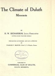
Search results from Open Library.
Recent natural events nearby
Ground air-quality sensors
Recently spotted species
Nearest stream gauge
Events
Gallery
Geotagged photos within ~6 miles of Duluth, from Wikimedia Commons contributors.
.jpg) 0.2 mi
0.2 mi.jpg) 0.3 mi
0.3 mi 0.4 mi
 0.4 mi
 0.4 mi
 0.4 mi
 0.4 mi
.jpg) 0.4 mi
0.4 mi.jpg) 0.5 mi
0.5 mi.jpg) 0.5 mi
0.5 mi 0.5 mi
 0.5 mi
 0.5 mi
 0.5 mi
 0.5 mi
 0.5 mi
.jpg) 0.5 mi
0.5 mi.jpg) 0.5 mi
0.5 mi.jpg) 0.5 mi
0.5 mi.jpg) 0.5 mi
0.5 mi.jpg) 0.5 mi
0.5 mi.jpg) 0.5 mi
0.5 mi.jpg) 0.5 mi
0.5 mi.jpg) 0.5 mi
0.5 miPhotos via Wikimedia Commons — see each image page for license & attribution.
Sources
- • Wikipedia
- • US Census Bureau (ACS 5-year estimates)
- • NOAA National Weather Service
- • Wikimedia Commons
- • Wikidata
- • Open-Meteo Air Quality (CAMS)
- • USGS Earthquake Catalog (global feed)
- • NCES via Urban Institute Education Data Portal
- • GBIF (Global Biodiversity Information Facility)
- • CDC PLACES
- • Open-Meteo / sunrise-sunset.org
- • Wikipedia Pageviews API
- • Open Library