Browse / United States / Minnesota / Frontenac
Frontenac
MinnesotaCDP

Frontenac
Total population
188
Median home value
$266,700
Bachelor's+
Median income
$88,542
Demographic figures from US Census Bureau · ACS 5-year estimates. Overview below cites Wikipedia and may reference a different year.
City facts
Facts from Wikidata (CC0).
Overview
Frontenac is an unincorporated community and census-designated place (CDP) in Florence Township, Goodhue County, Minnesota, United States, on the Mississippi River. As of the 2020 census, its population was 249.
Read more on WikipediaHistory & geography
History
James Wells established a trading post in the location that would become Frontenac before 1850. He dealt mostly with Native Americans until the railroad was built in the early 1870s. In 1854, brothers Israel and Lewis Garrard came upon the area during a hunting trip and bought large tracts of land. By 1857, the community was permanently established with the name of Westervelt in 1855 to honor the then postmaster, Evert V. Westervelt. The name was changed to Frontenac in 1860 by the Garrard brothers after Louis de Buade de Frontenac, the French colonial governor of Canada in 1672–82 and 1689–98. There is no record of him actually traveling to the Mississippi River. The picturesque scenery soon began attracting wealthy residents. It became a community of summer homes with lakeside views. Several hotels were established, including the Lakeside Hotel in 1867. These hotels contributed to Frontenac's reputation as a resort town during the later 19th century. During the 1870s, a Chicago, Milwaukee, St. Paul and Pacific Railroad line to Frontenac was established; however, as the founders would not sell land to the railway company, the line was established some distance away from town. The railway ran from north to south and connected the remote area to larger cities, but it was far enough away from the bluffs not to detract from the vacation destination. A new community sprang up around the railway station, and later the highway, called Frontenac Station; the original townsite was then dubbed Old Frontenac. Both are in Florence Township and are listed as one location in the U.S. Census.
Geography
According to the United States Census Bureau, Frontenac has an area of ; of this is land, and is water.
Excerpted from the corresponding Wikipedia article (CC BY-SA).
Demographics & economy
Race & ethnicity
Source: US Census Bureau — American Community Survey, 5-year estimates.
Geography
Coordinates & boundaries from the US Census TIGER/Line shapefiles.
Climate
Air quality
Industrial & pollution facilities
Natural hazard risk
Health (adults)
Age-adjusted prevalence estimates from CDC PLACES (latest release).
Walkability
Amenities nearby
Wildlife & biodiversity
Schools
Largest nearby schools
- Red Wing Senior HighHigh · RED WING · 866 students · 18.4:1 ratio
- Twin Bluff SchoolMiddle · RED WING · 534 students · 19.1:1 ratio
- SUNNYSIDE ELEMENTARYElementary · RED WING · 339 students · 14.7:1 ratio
- 5RiversOnline SecondaryHigh · RED WING · 122 students · 24.4:1 ratio
- COLVILL FAMILY EDUCATION CENTEROther · RED WING · 74 students · 8.2:1 ratio
- MCF-Red Wing Maginnis High SchoolHigh · RED WING · 54 students
- Reach ProgramsOther · RED WING · 54 students · 6.8:1 ratio
- 5RiversOnline ElementaryElementary · RED WING · 31 students · 3.4:1 ratio
Public K–12 schools within ~10 mi from Urban Institute Education Data Portal (NCES Common Core of Data, 2022).
Earthquake history
Photos
Sights & places nearby
Notable people from here
Nearby places in Minnesota
Geography & sun
Elevation, sunrise/sunset and daylight from Open-Meteo. Solar climatology from NASA POWER.
Nearby airports
Public attention
Pageview totals from the Wikimedia Pageviews API.
Books about Frontenac

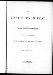

Search results from Open Library.
Recent natural events nearby
Ground air-quality sensors
Recently spotted species
Nearest stream gauge
Events
Gallery
Sources
- • Wikipedia
- • US Census Bureau (ACS 5-year estimates)
- • Wikidata
- • NCES via Urban Institute Education Data Portal
- • CDC PLACES
- • Open-Meteo / sunrise-sunset.org
- • Wikipedia Pageviews API
- • Open Library