Browse / United States / Missouri / Florida
Florida
Missourivillage

Florida
Total population
0
Median home value
$0
Median income
$0
Founded
1831
Demographic figures from US Census Bureau · ACS 5-year estimates. Overview below cites Wikipedia and may reference a different year.
City facts
Facts from Wikidata (CC0).
Overview
Florida is a village in Monroe County, Missouri, United States. It is located at the intersection of Missouri Route 107 and State Route U on the shores of Mark Twain Lake. In 1910 the population was 200, per the census data in the 1911 Cram's World Atlas. As of the 2020 census, Florida had a population of 5. The Mark Twain Birthplace State Historic Site is located in Florida, with Mark Twain State Park nearby.
Read more on WikipediaHistory & geography
History
The village was laid out in the winter of 1831. The community took its name from the state of Florida. The founders were Robert Donaldson, Joseph Grigsby, Hugh A. Hickman, a Doctor Keenan, John Witt, and Major W.N. Penn. Hickman owned and operated a mill approximately one half-mile (800 m) south of Florida, while Penn had a dry goods store near there as well. Penn soon moved his store into Florida proper, becoming the town's first business. Mark Twain was born in Florida in 1835. He said his birthplace was "a nearly invisible village", and "The village contained a hundred people and I increased the population by 1 per cent. It is more than many of the best men in history could have done for a town." In the early years there was some hope of the town becoming a regional point of commerce and shipping. Florida is located at the confluence of the North, South, and Middle forks of the Salt River, upstream from its mouth emptying into the Mississippi River at Louisiana, Missouri. The location was thought to be strategic because it was felt to be a potential "growth center" in the settlement of northeast Missouri. For example, John Clemens, father of Mark Twain, along with other investors, had formed the Salt River Navigation Company in 1836 in hopes of developing this water commerce. Several boatloads of flour were shipped from Hickman's mill to the Mississippi and returned with sugar, coffee, and manufactured goods. However, fickle river levels on the Salt made consistent shipping via barge or riverboat impractical. under Colonel Joseph C. Porter were traveling south through Monroe County after a raid on Memphis, Missouri, and the Battle of Vassar Hill in Scotland County. At Florida, they were surprised by a detachment of Federal cavalry, approximately fifty men,…
Geography
Florida is located in eastern Monroe County, overlooking Mark Twain Lake, a reservoir on the Salt River. The North and Middle forks of the Salt River join within the lake, just east of the bluff on which Florida stands. The Mark Twain Birthplace State Historic Site lies along what is now the eastern edge of the village, while Mark Twain State Park, a public recreation area associated with Mark Twain Lake, borders the village to the south and west. Missouri Route 107 runs along the western boundary of the village, leading north to U.S. Route 24 and south less than to Missouri Route 154. Paris, the Monroe county seat, is to the west via State Highway U and US 24. According to the U.S. Census Bureau, the village has a total area of , all land.
Excerpted from the corresponding Wikipedia article (CC BY-SA).
Demographics & economy
Source: US Census Bureau — American Community Survey, 5-year estimates.
Geography
Coordinates & boundaries from the US Census TIGER/Line shapefiles.
Climate
Air quality
Industrial & pollution facilities
Natural hazard risk
Health (adults)
Walkability
Amenities nearby
Wildlife & biodiversity
Schools
Earthquake history
Photos
Sights & places nearby
Notable people from here


People born within ~10 km, from Wikidata (CC0). Click any name for their Wikipedia article.
Geography & sun
Elevation, sunrise/sunset and daylight from Open-Meteo. Solar climatology from NASA POWER.
Nearby airports
Public attention
Pageview totals from the Wikimedia Pageviews API.
Books about Florida
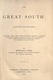


Search results from Open Library.
Recent natural events nearby
Ground air-quality sensors
Recently spotted species
Nearest stream gauge
Events
Gallery
Sources
- • Wikipedia
- • US Census Bureau (ACS 5-year estimates)
- • Wikidata
- • Open-Meteo / sunrise-sunset.org
- • Wikipedia Pageviews API
- • Open Library