Browse / United States / Missouri / Jefferson City
Jefferson City
Missouricity

Jefferson City
Total population
42,488
Median home value
$218,700
Bachelor's+
Median income
$66,371
Founded
1821
Demographic figures from US Census Bureau · ACS 5-year estimates. Overview below cites Wikipedia and may reference a different year.
City facts
Facts from Wikidata (CC0).
Overview
Jefferson City, officially City of Jefferson and informally Jeff City, is the capital of the U.S. state of Missouri. It had a population of 43,228 at the 2020 United States census, ranking as the 16th most populous city in the state, but the 9th least populous U.S. state capital. It is also the county seat of Cole County and the principal city of the Jefferson City Metropolitan Statistical Area, the second-most-populous metropolitan area in Mid-Missouri and the fifth-most populous in the state. It forms part of the nine-county Columbia–Jefferson City–Moberly combined statistical area, which has 415,747 residents. Most of the city is located within Cole County, with a small northern section extending into adjacent Callaway County.
Read more on WikipediaHistory & geography
History
In pre-Columbian times, this region was home of an ancient people known today as the Mound Builders, likely related to the Mississippian societies. They were subsequently replaced by Osage Native Americans. In the late 17th century, frontiersmen began to inhabit the area, including Antoine de la Mothe Cadillac, Louis Jolliet, Jacques Marquette, Robert de LaSalle, and Daniel Boone, with the latter having the greatest influence on the region. Famed Western explorer and settler Daniel Boone's son, Daniel Morgan Boone (1769–1839), would later lay out and plat Jefferson City in the early 19th century. When the Missouri Territory was organized in 1812, St. Louis was Missouri's seat of government for the territorial governor and territorial legislature. Later St. Charles would serve as the next capital town of the old Territory. Jefferson City was chosen as the new state capital in 1821, after Missouri was admitted to the Union as the 24th State. The village on the southern banks of the Missouri River was first called "Lohman's Landing", and when the new state legislature decided to relocate there, they proposed the name "Missouriopolis" before settling on "Jefferson" to honor former President Thomas Jefferson, who would still live at his Virginia home estate of Monticello for the next five years. Over the years, the city was most often referred to as "Jefferson City"; the common name eventually stuck. For years, this village was little more than a trading post located in the wilderness about midway between St. Louis and Kansas City. In 1825, the settlement was formally incorporated, and a year later, the state legislature of the General Assembly of Missouri moved to Jefferson City, where they would continue to meet. Jefferson City was also chosen by the lawmakers as the…
Geography
According to the United States Census Bureau, the city has a total area of , of which is land and is water. Jefferson City has a humid continental climate (Köppen Dfa) with hot, rainy summers and cold winters. The city borders on having a humid subtropical climate but falls just short due to January having a mean temperature of which is below the isotherm. Thunderstorms are common in both the spring and summer. Light snow is common during the winter, although about half of wintertime precipitation falls as rain.
Excerpted from the corresponding Wikipedia article (CC BY-SA).
Demographics & economy
Race & ethnicity
Source: US Census Bureau — American Community Survey, 5-year estimates.
Geography
Coordinates & boundaries from the US Census TIGER/Line shapefiles.
Climate
Current forecast
Forecast for Jefferson City, MO from NOAA NWS API.
Air quality
Industrial & pollution facilities
Natural hazard risk
Health (adults)
Age-adjusted prevalence estimates from CDC PLACES (latest release).
Walkability
Amenities nearby
Wildlife & biodiversity
Most-observed species
- Northern CardinalCardinalis cardinalis (Linnaeus, 1758) · Aves3,411
- Blue JayCyanocitta cristata (Linnaeus, 1758) · Aves2,653
- Tufted TitmouseBaeolophus bicolor (Linnaeus, 1766) · Aves2,593
- Mourning DoveZenaida macroura (Linnaeus, 1758) · Aves2,529
- Red-bellied WoodpeckerMelanerpes carolinus (Linnaeus, 1758) · Aves2,486
- Downy WoodpeckerDryobates pubescens (Linnaeus, 1766) · Aves2,302
- European StarlingSturnus vulgaris Linnaeus, 1758 · Aves2,108
- Eastern BluebirdSialia sialis (Linnaeus, 1758) · Aves2,033
Citizen-science & research observations from the Global Biodiversity Information Facility (GBIF).
Schools
Largest nearby schools
- CAPITAL CITY HIGH SCHOOLHigh · JEFFERSON CITY · 1,404 students · 15.3:1 ratio
- JEFFERSON CITY HIGHHigh · JEFFERSON CITY · 1,296 students · 12.8:1 ratio
- LEWIS AND CLARK MIDDLEMiddle · JEFFERSON CITY · 1,005 students · 12.3:1 ratio
- THOMAS JEFFERSON MIDDLEMiddle · JEFFERSON CITY · 957 students · 12.4:1 ratio
- PIONEER TRAIL ELEMENTARYElementary · JEFFERSON CITY · 477 students · 13.6:1 ratio
- BLAIR OAKS HIGHHigh · JEFFERSON CITY · 457 students · 16.3:1 ratio
- CLARENCE LAWSON ELEM.Elementary · JEFFERSON CITY · 419 students · 11.3:1 ratio
- BELAIR ELEM.Elementary · JEFFERSON CITY · 377 students · 12.6:1 ratio
Public K–12 schools within ~10 mi from Urban Institute Education Data Portal (NCES Common Core of Data, 2022).
Earthquake history
Photos
Sights & places nearby
Notable people from here


People born within ~10 km, from Wikidata (CC0). Click any name for their Wikipedia article.
Nearby places in Missouri
Geography & sun
Elevation, sunrise/sunset and daylight from Open-Meteo. Solar climatology from NASA POWER.
Nearby airports
Public attention
Pageview totals from the Wikimedia Pageviews API.
Books about Jefferson City
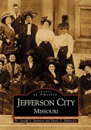
Search results from Open Library.
Recent natural events nearby
Ground air-quality sensors
Recently spotted species
Nearest stream gauge
Live readings from USGS NWIS · measured 2026-09-17 01:45 UTC.
Events
Gallery
Sources
- • Wikipedia
- • US Census Bureau (ACS 5-year estimates)
- • NOAA National Weather Service
- • Wikidata
- • USGS NWIS (water data)
- • NCES via Urban Institute Education Data Portal
- • GBIF (Global Biodiversity Information Facility)
- • CDC PLACES
- • Open-Meteo / sunrise-sunset.org
- • Wikipedia Pageviews API
- • Open Library