Browse / United States / Missouri / Neosho
Neosho
Missouricity

Neosho
Total population
13,224
Median home value
$163,400
Bachelor's+
Median income
$57,891
Founded
1829
Demographic figures from US Census Bureau · ACS 5-year estimates. Overview below cites Wikipedia and may reference a different year.
- Heat Advisory · ModerateHeat Advisory issued September 18 at 1:32PM CDT until September 19 at 8:00PM CDT by NWS Springfield MO
Source: NOAA National Weather Service.
City facts
Facts from Wikidata (CC0).
Overview
Neosho is the most populous city in and the county seat of Newton County, Missouri, United States. With a population of 12,590 as of the 2020 census, the city is a part of the Joplin metropolitan area, a region with an estimated 176,849 residents, as of 2011. Neosho lies on the western edge of the Ozarks, in the far southwest of the state.
Read more on WikipediaHistory & geography
History
Starting in the late 1820s, European-American settlers of English, Scottish, German, Welsh, and Scots-Irish ancestry began moving into the area. The first of these settlers was Lunsford Oliver, who migrated from Tennessee in 1829 and located near Shoal Creek. He was the namesake for Oliver's Prairie. His nearest neighbors were in Springfield, sixty miles to the east. In 1831 he was joined by Nathaniel Turner, John Smith, Joseph Ross, Campbell Pure, Blake Wilson, Levi Lee, Carmac Ratcliffe, and George McInturf. McInturf built a corn mill, the first mill of any kind in the region. Soon afterward came Mathew H. Ritchie, who founded the town of Newtonia near Oliver's Prairie, and John W. McCord, who settled near Walbridge Spring with Levie Lee and founded the town Neosho to the west. In these years, the region was called "Six Bulls", a colloquial reference to "six boils", referring to the large streams that flowed through the area – Shoal Creek, Center Creek, Indian Creek, Spring River, and North Fork. By 1835, at least three schools had been established along Shoal Creek, and a teacher named Billingsley taught near Neosho. The earliest known religious effort dates to 1836, when Methodist Circuit riders visited the area and held meetings in settlers' log cabins. In 1843, Rev. Anthony Bewley was appointed to the Neosho and Granby circuit, establishing the first permanent churches in Six Bulls. Rev. John W. McCord was involved in organizing Neosho Presbytery, a Cumberland Presbyterian congregation at New Salem Campground, on May 15, 1837. These early settlers were sometimes visited by Native Americans from the Southeast United States, who had been relocated from Georgia to the Indian Territory a few miles west of later Kansas under the Indian Removal Act. They…
Geography
Neosho is in south central Newton County approximately 15 miles south-southeast of Joplin. It is at the intersection of US routes 60 and 71. According to the United States Census Bureau, the city has a total area of , of which is land and is water. Neosho is noted for numerous springs including: Also known historically as Clark Spring, Big Spring is Neosho's largest spring and is located near the historic downtown in the city's main park, Big Spring Park. This spring issues at the base of a high bluff of Mississippian limestone from a series of cavernous openings developed along a bedding plane, and flows through the city park. Also known as historically as Walbridge Spring, located east of the Big Spring and a block east of the courthouse square, Bell's Iron Spring played an important role in Neosho's development. Originally rising in the valley and capable of supplying a city of 50,000 people, though hidden from view for many years, this spring is currently the focus of an ongoing restoration project, which includes plans to re-expose the spring and redevelop the surrounding property as a public historic park. Due to the recent discovery of the presence of endangered Ozark cave fish in the spring, the city is working closely with Missouri Department of Conservation and the U.S. Fish and Wildlife Service. Hearrell, McMahon, Bartholic, and Elm Springs supply water to the Neosho National Fish Hatchery. In 1888, Hearrell Spring, named after Lemuel B Hearrell, began supplying water to the newly built hatchery. In 1908, McMahon Spring was added to supply the hatchery's fish rearing ponds, after its condemnation under the governmental power of eminent domain. In 1964, after the closing of nearby Fort Crowder, additional water was supplied by Elm Spring and Bartholic…
Excerpted from the corresponding Wikipedia article (CC BY-SA).
Demographics & economy
Race & ethnicity
Source: US Census Bureau — American Community Survey, 5-year estimates.
Geography
Coordinates & boundaries from the US Census TIGER/Line shapefiles.
Climate
Current forecast
Forecast for Neosho, MO from NOAA NWS API.
Air quality
Industrial & pollution facilities
Natural hazard risk
Health (adults)
Age-adjusted prevalence estimates from CDC PLACES (latest release).
Walkability
Amenities nearby
Wildlife & biodiversity
Schools
Largest nearby schools
- NEOSHO HIGHHigh · NEOSHO · 1,491 students · 18.4:1 ratio
- NEOSHO JR. HIGHMiddle · NEOSHO · 748 students · 16.6:1 ratio
- MIDDLE SCH.Middle · NEOSHO · 720 students · 14.4:1 ratio
- GRANBYElementary · GRANBY · 587 students · 14.3:1 ratio
- GEORGE WASHINGTON CARVER ELEM.Elementary · NEOSHO · 551 students · 16.7:1 ratio
- BENTON ELEM.Elementary · NEOSHO · 505 students · 14:1 ratio
- EAST NEWTON HIGHHigh · GRANBY · 431 students · 13.5:1 ratio
- SOUTH ELEM.Elementary · NEOSHO · 277 students · 13.2:1 ratio
Public K–12 schools within ~10 mi from Urban Institute Education Data Portal (NCES Common Core of Data, 2022).
Earthquake history
Photos
Sights & places nearby
Notable people from here


People born within ~10 km, from Wikidata (CC0). Click any name for their Wikipedia article.
Nearby places in Missouri
Geography & sun
Elevation, sunrise/sunset and daylight from Open-Meteo. Solar climatology from NASA POWER.
Nearby airports
Public attention
Pageview totals from the Wikimedia Pageviews API.
Books about Neosho

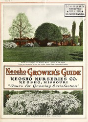

Search results from Open Library.
Recent natural events nearby
Ground air-quality sensors
Recently spotted species
Nearest stream gauge
Events
Gallery
Sources
- • Wikipedia
- • US Census Bureau (ACS 5-year estimates)
- • NOAA National Weather Service
- • Wikidata
- • NCES via Urban Institute Education Data Portal
- • CDC PLACES
- • Open-Meteo / sunrise-sunset.org
- • Wikipedia Pageviews API
- • Open Library