Browse / United States / Missouri / Parnell
Parnell
Missouricity

Parnell
Total population
189
Median home value
$53,800
Bachelor's+
Median income
$41,591
Demographic figures from US Census Bureau · ACS 5-year estimates. Overview below cites Wikipedia and may reference a different year.
City facts
Facts from Wikidata (CC0).
Overview
Parnell is a city in northeast Nodaway County, Missouri, United States, near the Platte River. The population was 135 at the 2020 Census. It was home to the father-son horse trainers Ben and Jimmy Jones, whose horses won eight Kentucky Derbies and two Triple Crowns.
Read more on WikipediaHistory & geography
History
Parnell was platted on July 5, 1887 as a station stop on the Chicago Great Western Railway and it was formally incorporated in 1888. The Chicago Great Western route passing through the community was called the Diagonal Route. It ran at northeast direction from Kansas City to Waterloo, Iowa including passing through the community of Diagonal, Iowa. Among the first businesses was the Diagonal Hotel. Ben Jones father Horace Jones organized the founding of the community and an early proposed names was Jonesville until it was discovered there was another Jonesville in Missouri. The name ultimately chosen was in honor or Irish politician Charles Stewart Parnell who was at the peak of influence in creating Irish homerule when Parnell was incorporated. After he retiring in 1976 Jimmy returned to 1,750 acre ranch in Parnell. He sold the ranch in 1986. He had no children and died in Maryville, Missouri in 2001. He left $7.2 million to St. Francis Hospital there.
Geography
Parnell is located at the junction of routes 46 and NN one-half mile from the Nodaway-Worth county line. The Platte River flows past the west side of the community. Ravenwood is approximately six miles to the south-southwest and Sheridan in northwest Worth County is five miles to the north. According to the United States Census Bureau, the city has a total area of , all land.
Excerpted from the corresponding Wikipedia article (CC BY-SA).
Demographics & economy
Race & ethnicity
Source: US Census Bureau — American Community Survey, 5-year estimates.
Geography
Coordinates & boundaries from the US Census TIGER/Line shapefiles.
Climate
Air quality
Industrial & pollution facilities
Natural hazard risk
Health (adults)
Age-adjusted prevalence estimates from CDC PLACES (latest release).
Walkability
Amenities nearby
Wildlife & biodiversity
Schools
Largest nearby schools
- Northeast Nodaway ElementaryElementary · Ravenwood · 126 students · 11.5:1 ratio
- NORTHEAST NODAWAY HIGHHigh · RAVENWOOD · 94 students · 7.8:1 ratio
Public K–12 schools within ~10 mi from Urban Institute Education Data Portal (NCES Common Core of Data, 2022).
Earthquake history
Photos
Sights & places nearby
Notable people from here

People born within ~10 km, from Wikidata (CC0). Click any name for their Wikipedia article.
Nearby places in Missouri
Geography & sun
Elevation, sunrise/sunset and daylight from Open-Meteo. Solar climatology from NASA POWER.
Nearby airports
Public attention
Pageview totals from the Wikimedia Pageviews API.
Books about Parnell

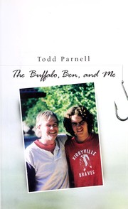
Search results from Open Library.
Recent natural events nearby
Ground air-quality sensors
Recently spotted species
Nearest stream gauge
Events
Gallery
Sources
- • Wikipedia
- • US Census Bureau (ACS 5-year estimates)
- • Wikidata
- • NCES via Urban Institute Education Data Portal
- • CDC PLACES
- • Open-Meteo / sunrise-sunset.org
- • Wikipedia Pageviews API
- • Open Library