Browse / United States / Missouri / St. Joseph
St. Joseph
Missouricity

St. Joseph
Total population
69,221
Median home value
$173,800
Bachelor's+
Median income
$57,010
Founded
1843
Demographic figures from US Census Bureau · ACS 5-year estimates. Overview below cites Wikipedia and may reference a different year.
City facts
Facts from Wikidata (CC0).
Overview
St. Joseph is a city in and the county seat of Buchanan County, Missouri, United States. Located on the Missouri River, it is the principal city of the St. Joseph Metropolitan Statistical Area, which includes Buchanan, Andrew, and DeKalb counties in Missouri and Doniphan County, Kansas. As of the 2020 census, St. Joseph had a population of 72,473, making it the 8th most populous city in the state, and the 3rd most populous in Northwest Missouri. St. Joseph is located roughly 30 miles (48 km) north of the Kansas City, Missouri city limits and approximately 125 miles (201 km) south of Omaha, Nebraska.
Read more on WikipediaHistory & geography
History
St. Joseph was founded on the Missouri River by Joseph Robidoux, a local fur trader of French Canadian descent. It was officially incorporated in 1843. In its early days, it was a bustling outpost and rough frontier town, serving as a last supply point and jumping-off point for travelers on the Missouri River toward the "Wild West". It was the westernmost point in the United States accessible by rail until after the American Civil War, which helped earn it the designation "Gateway to the West." The main east–west downtown streets were named for Robidoux's eight children: Faraon, Jules, Francois (Francis), Felix, Edmond, Charles, Sylvanie, and Messanie. The street between Sylvanie and Messanie was named for his second wife, Angelique. St. Joseph, or "St. Joe", as it was called by many, was a "Jumping-Off Point" for those migrants headed to the Oregon Territory in the mid-1800s. Such cities, including Independence, and St. Joseph, were where pioneers would stay and purchase supplies before they headed out in wagon trains across the Great Plains. The town was a very lively place. Between April 3, 1860, and late October 1861, St. Joseph was one of the two endpoints of the Pony Express, which operated for a short period over the land then inaccessible by rail, to provide fast mail service. Today the Pony Express Museum hosts visitors in the former stables of the company. St. Joseph is identified by the slogan, "Where the Pony Express started and Jesse James ended." The town's main hotel was Patee House. In the post-Civil War years, when the economy was down, the hotel was used for a time by the Patee Female College. It was occupied by the St. Joseph Female College up to 1880. In 1874 the State Lunatic Asylum #2 was opened just East of St. Joseph. The asylum, originally…
Geography
Saint Joseph is located on the Missouri/Kansas border in northwestern Missouri, also close to Nebraska; Iowa is another farther north. The nearest major metropolitan area to St. Joseph is the Kansas City Metropolitan Area, which begins approximately to the south. The nearest major airport is Kansas City International Airport, which is approximately to the south. According to the United States Census Bureau, the city has a total area of , of which is land and is water. Several water bodies and streams are located in St. Joseph besides the Missouri River. Roys Branch sources just northwest of Krug Park and travels southwest and enters the Missouri River next to Remington Nature Center. Whitehead Creek headwaters southeast of St. Joseph and flows northwest into the Missouri River just southwest of downtown. Corby Pond, a public lake in Corby Park, is a popular fishing location. Lake Contrary is located just southwest of St. Joseph and has a beach. Under the Köppen climate classification, St. Joseph has a humid subtropical climate (Cfa) bordering on a humid continental climate (Dfa), although under United States isotherms of the station is firmly continental. The monthly weather averages listed below are taken from National Weather Service 1981–2010 normals recorded at Rosecrans Airport. Because of the airport's location near the Missouri River and at a low elevation, official overnight lows during wintertime especially are often several degrees colder than at other places within the city. Snowfall is not recorded at the St. Joseph weather station although surrounding reporting stations typically receive of snowfall annually.
Excerpted from the corresponding Wikipedia article (CC BY-SA).
Demographics & economy
Race & ethnicity
Source: US Census Bureau — American Community Survey, 5-year estimates.
Geography
Coordinates & boundaries from the US Census TIGER/Line shapefiles.
Climate
Current forecast
Forecast for St. Joseph, MO from NOAA NWS API.
Air quality
Industrial & pollution facilities
Natural hazard risk
Health (adults)
Age-adjusted prevalence estimates from CDC PLACES (latest release).
Walkability
Amenities nearby
Wildlife & biodiversity
Most-observed species
- Northern CardinalCardinalis cardinalis (Linnaeus, 1758) · Aves3,017
- Blue JayCyanocitta cristata (Linnaeus, 1758) · Aves2,317
- Red-bellied WoodpeckerMelanerpes carolinus (Linnaeus, 1758) · Aves2,129
- Black-capped ChickadeePoecile atricapillus (Linnaeus, 1766) · Aves2,117
- American RobinTurdus migratorius Linnaeus, 1766 · Aves2,111
- American CrowCorvus brachyrhynchos C.L.Brehm, 1822 · Aves1,992
- Red-winged BlackbirdAgelaius phoeniceus (Linnaeus, 1766) · Aves1,962
- KilldeerCharadrius vociferus Linnaeus, 1758 · Aves1,774
Citizen-science & research observations from the Global Biodiversity Information Facility (GBIF).
Schools
Largest nearby schools
- CENTRAL HIGHHigh · ST JOSEPH · 1,728 students · 18.6:1 ratio
- OAK GROVE ELEMElementary · St. Joseph · 842 students · 15.6:1 ratio
- LAFAYETTE HIGHHigh · ST JOSEPH · 717 students · 13.8:1 ratio
- BENTON HIGHHigh · ST JOSEPH · 676 students · 15.4:1 ratio
- CARDEN PARK ELEMElementary · St. Joseph · 577 students · 14.8:1 ratio
- BODE MIDDLEMiddle · ST JOSEPH · 486 students · 16.2:1 ratio
- LINDBERGH ELEM.Elementary · ST JOSEPH · 484 students · 15.1:1 ratio
- TRUMAN MIDDLEMiddle · ST JOSEPH · 482 students · 14.6:1 ratio
Public K–12 schools within ~10 mi from Urban Institute Education Data Portal (NCES Common Core of Data, 2022).
Earthquake history
Most recent
- M 3.5 — 2024-03-152 km NE of Ferrelview, Missouri
- M 2.6 — 2018-07-201 km WNW of Saint Joseph, Missouri
- M 3.1 — 2007-03-235 km N of Nortonville, Kansas
Events from the USGS Earthquake Catalog (global) (FDSN Event Web Service).
Photos
Sights & places nearby
Notable people from here


People born within ~10 km, from Wikidata (CC0). Click any name for their Wikipedia article.
Nearby places in Missouri
Geography & sun
Elevation, sunrise/sunset and daylight from Open-Meteo. Solar climatology from NASA POWER.
Nearby airports
Public attention
Pageview totals from the Wikimedia Pageviews API.
Books about St. Joseph
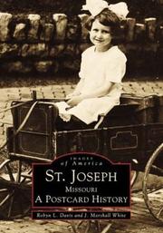
Search results from Open Library.
Recent natural events nearby
- Wildfire BISON, Osage, OklahomaWildfires · 2026-08-21 · 215 mi
- Wildfire B.B, Osage, OklahomaWildfires · 2026-08-06 · 216 mi
Wildfires, storms and other events from NASA EONET (last 12 months, within 250 mi).
Ground air-quality sensors
Recently spotted species
Nearest stream gauge
Live readings from USGS NWIS · measured 2026-10-16 08:35 UTC.
Events
Gallery
Sources
- • Wikipedia
- • US Census Bureau (ACS 5-year estimates)
- • NOAA National Weather Service
- • Wikidata
- • USGS Earthquake Catalog (global feed)
- • USGS NWIS (water data)
- • NCES via Urban Institute Education Data Portal
- • GBIF (Global Biodiversity Information Facility)
- • CDC PLACES
- • Open-Meteo / sunrise-sunset.org
- • Wikipedia Pageviews API
- • Open Library
- • NASA EONET