Browse / United States / Mississippi / Columbus
Columbus
Mississippicity

Columbus
Total population
23,348
Median home value
$125,700
Bachelor's+
Median income
$42,235
Demographic figures from US Census Bureau · ACS 5-year estimates. Overview below cites Wikipedia and may reference a different year.
City facts
Overview
Columbus is a city in and the county seat of Lowndes County, on the eastern border of Mississippi, United States, located primarily east, but also north and northeast of the Tombigbee River, which is also part of the Tennessee-Tombigbee Waterway. It is approximately 146 miles (235 km) northeast of Jackson, 92 miles (148 km) north of Meridian, 63 miles (101 km) south of Tupelo, 60 miles (97 km) northwest of Tuscaloosa, Alabama, and 120 miles (193 km) west of Birmingham, Alabama.
Read more on WikipediaHistory & geography
History
The first record of the site of Columbus in Western history is found in the annals of the explorer Hernando de Soto, who is reputed to have crossed the nearby Tombigbee River on his search for El Dorado. However, the site does not enter the main continuity of United States history until December 1810, when John Pitchlynn, the U.S. Indian agent and interpreter for the Choctaw Nation, moved to Plymouth Bluff, where he built a home, established a farm, and transacted Choctaw Agency business. After the Battle of New Orleans, Andrew Jackson recognized the urgent need for roads to connect New Orleans to the rest of the country. In 1817 Jackson ordered a road be built to provide a direct route from Nashville to New Orleans. His surveyor, Captain Hugh Young, chose a place on the Tombigbee River where high ground approached the river on both sides as the location for a ferry to be used for crossing the river when high water prevented fording the river. A military bridge was constructed where the present-day Tombigbee Bridge was later developed in Columbus, Mississippi. Jackson's Military Road opened the way for development in the area. Columbus was founded in 1819, and, as it was believed to be in Alabama, it was first officially recognized by an Alabama Legislative act as the Town of Columbus on December 6, 1819. Before its incorporation, the town site was referred to informally as Possum Town, a name which was given by the local Native Americans, who were primarily Choctaw and Chickasaw. The name Possum Town remains the town's nickname among locals. The town was settled where Jackson's Military Road crossed the Tombigbee River 4 miles south of John Pitchlynn's residence at Plymouth Bluff. In 1820 the post office that had been at Pitchlynn's relocated in Columbus.…
Geography
The city is located approximately west of the Mississippi-Alabama state line along U.S. Route 82, U.S. Route 45, and numerous state highways. US 82 leads southeast to Reform, Alabama and west to Starkville. US 45 leads south to Macon and north to Aberdeen. According to the United States Census Bureau, the city has a total area of , of which is land and is water. Large lakes and rivers are nearby, such as the Buttahatchee River in northern Lowndes County that defines the border between Lowndes and Monroe counties; in the middle of the City of Columbus and Lowndes County lies the Luxapallila Creek, and the Tombigbee River with the John C. Stennis Lock and Dam impounding Columbus Lake. Columbus is a relatively flat place in the northern part of Lowndes County, as the land rises for a short period of time into hills and bluffs, in the southern/eastern part of the county, the land has rolling hills that quickly turn into flatland floodplains that dominate this county. This county lies in the Black Prairie Geographic Region, and the Northeastern Hills Region of the state/area. Prairies, forests and floodplain forests lie here. The soil quality is poor in the eastern part of the county, otherwise the soil is relatively fertile. Columbus and the surrounding areas are listed as an Arbor Day Hardiness Zone 8a (); note that temperatures in 2010 reached , but the USDA Hardiness Zones list the area as zone 7b (). Columbus has a humid subtropical climate (Köppen Cfa) with long, hot summers and short, mild winters.
Excerpted from the corresponding Wikipedia article (CC BY-SA).
Demographics & economy
Race & ethnicity
Source: US Census Bureau — American Community Survey, 5-year estimates.
Geography
Coordinates & boundaries from the US Census TIGER/Line shapefiles.
Climate
Air quality
Industrial & pollution facilities
Natural hazard risk
Health (adults)
Walkability
Amenities nearby
Wildlife & biodiversity
Schools
Largest nearby schools
- NEW HOPE ELEMENTARY SCHOOLElementary · COLUMBUS · 1,151 students · 12.4:1 ratio
- COLUMBUS HIGH SCHOOLHigh · COLUMBUS · 898 students · 14.3:1 ratio
- NEW HOPE HIGH SCHOOLHigh · COLUMBUS · 807 students · 14.9:1 ratio
- COLUMBUS MIDDLE SCHOOLMiddle · Columbus · 667 students · 13.6:1 ratio
- NEW HOPE MIDDLE SCHOOLMiddle · COLUMBUS · 613 students · 13.3:1 ratio
- COOK ELEMENTARY SCHOOLElementary · COLUMBUS · 388 students · 11.8:1 ratio
- STOKES BEARD ELEMENTARY SCHOOLElementary · COLUMBUS · 365 students · 13:1 ratio
- SALE ELEMENTARY SCHOOLElementary · COLUMBUS · 275 students · 13.8:1 ratio
Public K–12 schools within ~10 mi from Urban Institute Education Data Portal (NCES Common Core of Data, 2022).
Earthquake history
Photos
Sights & places nearby
Notable people from here


People born within ~10 km, from Wikidata (CC0). Click any name for their Wikipedia article.
Nearby places in Mississippi
Geography & sun
Elevation, sunrise/sunset and daylight from Open-Meteo. Solar climatology from NASA POWER.
Nearby airports
Public attention
Pageview totals from the Wikimedia Pageviews API.
Books about Columbus
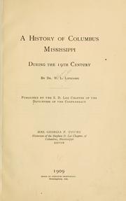

Search results from Open Library.
Recent natural events nearby
- Wildfire RAY COAKER, Washington, AlabamaWildfires · 2026-09-09 · 148 mi
- Wildfire Jackson - Hwy 90, Jackson, MississippiWildfires · 2026-08-16 · 214 mi
- Wildfire Pine Tree Rd, Union, ArkansasWildfires · 2026-08-20 · 237 mi
- Wildfire Bunker Fire, Calhoun, ArkansasWildfires · 2026-09-15 · 241 mi
- Wildfire Bunker Fire, Calhoun, ArkansasWildfires · 2026-09-14 · 241 mi
Wildfires, storms and other events from NASA EONET (last 12 months, within 250 mi).
Ground air-quality sensors
Recently spotted species
Nearest stream gauge
Events
Gallery
Sources
- • Wikipedia
- • US Census Bureau (ACS 5-year estimates)
- • Wikidata
- • NCES via Urban Institute Education Data Portal
- • Open-Meteo / sunrise-sunset.org
- • Wikipedia Pageviews API
- • Open Library
- • NASA EONET