Browse / United States / Mississippi / Picayune
Picayune
Mississippicity

Picayune
Total population
11,900
Median home value
$157,100
Bachelor's+
Median income
$41,213
Demographic figures from US Census Bureau · ACS 5-year estimates. Overview below cites Wikipedia and may reference a different year.
City facts
Facts from Wikidata (CC0).
Overview
Picayune is the largest city in Pearl River County, Mississippi, United States. The population was 11,885 at the 2020 census. The city is located approximately 45 miles (72 km) from New Orleans, Hattiesburg, and Gulfport–Biloxi. The Stennis Space Center is 10 miles (16 km) away. Picayune is part of the New Orleans–Metairie–Hammond combined statistical area.
Read more on WikipediaHistory & geography
History
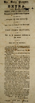
The word "picayune" was the name of a Spanish coin, worth half a real or 1/16 of a Spanish dollar (6.25 cents). Its name derives from the French "picaillon", which is itself from the Provençal "picaioun", the name of an unrelated small copper coin from Savoy. By extension, picayune can mean "trivial" or "of little value". Picayune was incorporated in 1904, and was named by Eliza Jane Poitevent Nicholson in late 1883 or early 1884. She was the owner and publisher of 'The Daily Picayune', a newspaper named for the coin. The local post office contained a mural, subsequently covered over, Lumber Region of Mississippi, painted by Donald H. Robertson in 1940. Federally commissioned murals were produced from 1934 to 1943 in the United States through the Section of Painting and Sculpture, later called the Section of Fine Arts, of the Treasury Department. While Picayune received extensive damage from Hurricane Katrina, it was not as severe as in other nearby cities. This caused Picayune to become the temporary home for many who relocated from the New Orleans area and from the Mississippi Gulf Coast who were seeking a safer home site with easy commuting to those areas. The bulk of the Katrina damage in Picayune was caused by high winds, as the eye wall passed over the city. This resulted in widespread roof, window, and fence damage. The wind also caused hundreds, if not thousands, of downed trees and power outages of up to a few weeks.
Geography
According to the United States Census Bureau, the city has a total area of , of which is land and (7.34%) is water. Picayune is a part of the New Orleans–Metairie–Hammond combined statistical area.
Excerpted from the corresponding Wikipedia article (CC BY-SA).
Demographics & economy
Race & ethnicity
Source: US Census Bureau — American Community Survey, 5-year estimates.
Geography
Coordinates & boundaries from the US Census TIGER/Line shapefiles.
Climate
Current forecast
Forecast for Picayune, MS from NOAA NWS API.
Air quality
Industrial & pollution facilities
Natural hazard risk
Health (adults)
Age-adjusted prevalence estimates from CDC PLACES (latest release).
Walkability
Amenities nearby
Wildlife & biodiversity
Schools
Earthquake history
Photos
Sights & places nearby
Notable people from here
Geography & sun
Elevation, sunrise/sunset and daylight from Open-Meteo. Solar climatology from NASA POWER.
Nearby airports
Public attention
Pageview totals from the Wikimedia Pageviews API.
Books about Picayune


Search results from Open Library.
Recent natural events nearby
Ground air-quality sensors
Recently spotted species
Nearest stream gauge
Events
Gallery
Sources
- • Wikipedia
- • US Census Bureau (ACS 5-year estimates)
- • NOAA National Weather Service
- • Wikidata
- • CDC PLACES
- • Open-Meteo / sunrise-sunset.org
- • Wikipedia Pageviews API
- • Open Library