Browse / United States / Mississippi / Winona
Winona
Mississippicity

Winona
Total population
4,183
Median home value
$123,000
Bachelor's+
Median income
$31,932
Founded
1861
Demographic figures from US Census Bureau · ACS 5-year estimates. Overview below cites Wikipedia and may reference a different year.
City facts
Facts from Wikidata (CC0).
Overview
Winona is a city in and the county seat of Montgomery County, Mississippi, United States. The population was 4,505 at the 2020 census, down from 5,043 in 2010. Winona is known in the local area as "The Crossroads"; the intersection of U.S. Interstate 55 and U.S. Highway 51 and 82 run through here.
Read more on WikipediaHistory & geography
History
Middleton was a town that developed in the 19th century two miles west of Winona's present location. Some locals consider it the predecessor to Winona. After the railroad was built to the east of Middleton, development shifted to what became Winona, bypassing Middleton. The first European-American settler in the area, which was originally part of Carroll County, was Colonel O.J. Moore, who arrived from Virginia in 1848. He agreed to the railroad being constructed through his property, and a station was built in 1860 near his plantation home. As a result of the railroad line and station being built here rather than Middleton, Winona was founded and began to grow. The railroad attracted business, which developed around the station as Moore sold off some property. Winona was incorporated as a town on May 2, 1861. Settlers were attracted because of the railroad access, and Winona became a busy trading town. Captain William Witty, an early settler from North Carolina, was for years a leading Winona merchant and established the first bank in the county. Other names of early settlers were Curtis, Burton, Palmer, Spivey, Townsend, Hart, Turner and Campbell. The early businesses were mainly grocery stores. In 1871, the Reconstruction-era state legislature organized Montgomery County from portions of Carroll and other counties, and Winona was designated as its county seat. A yellow fever epidemic struck the area in 1878 and resulted in the deaths of many residents. Some people left the town in an effort to outrun the epidemic, which spread with river passengers throughout the waterways of the Mississippi Delta and nearby counties. In April 1888, a great fire destroyed almost the entire business section of the town. Forty of the 50 businesses burned. In 1890 the state passed…
Geography
Winona is in western Montgomery County, north of Jackson, the state capital, and south of Grenada via I-55. U.S. Route 51 passes through the west side of the city, while U.S. Route 82 runs through the north side of the city on a four-lane bypass. US 51 leads north to Duck Hill and south the same distance to Vaiden, while US 82 leads east to Starkville and west to Greenwood. I-55 passes through the westernmost part of the city, with access from Exit 185 (US 82). According to the U.S. Census Bureau, Winona has a total area of , of which , or 0.24%, are water.
Excerpted from the corresponding Wikipedia article (CC BY-SA).
Demographics & economy
Race & ethnicity
Source: US Census Bureau — American Community Survey, 5-year estimates.
Geography
Coordinates & boundaries from the US Census TIGER/Line shapefiles.
Climate
Air quality
Industrial & pollution facilities
Natural hazard risk
Health (adults)
Age-adjusted prevalence estimates from CDC PLACES (latest release).
Walkability
Amenities nearby
Wildlife & biodiversity
Schools
Largest nearby schools
- WINONA ELEMENTARY SCHOOLElementary · Winona · 627 students · 13.9:1 ratio
- WINONA SECONDARY SCHOOLHigh · Winona · 517 students · 13.3:1 ratio
- WINONA VOC COMPLEXHigh · Winona
Public K–12 schools within ~10 mi from Urban Institute Education Data Portal (NCES Common Core of Data, 2022).
Earthquake history
Photos
Sights & places nearby
Notable people from here


People born within ~10 km, from Wikidata (CC0). Click any name for their Wikipedia article.
Nearby places in Mississippi
- North Carrollton11.1 mi away
- West20.4 mi away · pop. 175
- French Camp23.4 mi away
- Ethel29.7 mi away · pop. 206
- Kosciusko30.9 mi away · pop. 6,933
- Lexington31.7 mi away · pop. 1,350
- Mathiston34.9 mi away · pop. 775
- Mississippi Valley State University35.5 mi away · pop. 741
- Tchula35.5 mi away
- Longview46.3 mi away · pop. 211
- Louisville46.5 mi away · pop. 5,983
- Sunflower46.7 mi away
Geography & sun
Elevation, sunrise/sunset and daylight from Open-Meteo. Solar climatology from NASA POWER.
Nearby airports
Public attention
Pageview totals from the Wikimedia Pageviews API.
Books about Winona
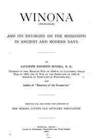
Search results from Open Library.
Recent natural events nearby
Ground air-quality sensors
Recently spotted species
Nearest stream gauge
Events
Gallery
Sources
- • Wikipedia
- • US Census Bureau (ACS 5-year estimates)
- • Wikidata
- • NCES via Urban Institute Education Data Portal
- • CDC PLACES
- • Open-Meteo / sunrise-sunset.org
- • Wikipedia Pageviews API
- • Open Library