Browse / United States / Montana / Antelope
Antelope
MontanaCDP

Antelope
Total population
0
Median home value
$0
Median income
$0
Demographic figures from US Census Bureau · ACS 5-year estimates. Overview below cites Wikipedia and may reference a different year.
City facts
Facts from Wikidata (CC0).
Overview
Antelope is a census-designated place (CDP) in Sheridan County, Montana, United States. As of the 2020 census, Antelope had a population of 74.
Read more on WikipediaHistory & geography
History
Named for the nearby creek, Antelope began as a tiny community along the Great Northern Railway's Bainville to Scobey branch line in 1910. That year, John and Richard Grayson built a hardware store next to the Antelope Creek Lutheran Church. A post office, bank, lumberyard, and saloon soon followed. The town was incorporated in 1913. The community thrived during its first decade, adding general mercantiles, a butcher shop, a concrete plant, restaurants, and other businesses to serve the region's growing homesteader population. Over the years, however, better roads to the south siphoned off business, and the “Biggest Little City in Eastern Montana” sank into decline. In 1967 a U.S. Navy gunboat was named the "Antelope". To mark the occasion crew members came to the town of Antelope and some of the town's citizens went to Tacoma, Washington.
Geography
According to the United States Census Bureau, the CDP has a total area of , all land.
Excerpted from the corresponding Wikipedia article (CC BY-SA).
Demographics & economy
Source: US Census Bureau — American Community Survey, 5-year estimates.
Geography
Coordinates & boundaries from the US Census TIGER/Line shapefiles.
Climate
Current forecast
Forecast for Antelope, MT from NOAA NWS API.
Air quality
Industrial & pollution facilities
Natural hazard risk
Health (adults)
Age-adjusted prevalence estimates from CDC PLACES (latest release).
Walkability
Amenities nearby
Wildlife & biodiversity
Most-observed species
- Mourning DoveZenaida macroura (Linnaeus, 1758) · Aves391
- Yellow WarblerSetophaga petechia (Linnaeus, 1766) · Aves322
- American RobinTurdus migratorius Linnaeus, 1766 · Aves308
- Common GrackleQuiscalus quiscula (Linnaeus, 1758) · Aves293
- American GoldfinchSpinus tristis (Linnaeus, 1758) · Aves275
- Ring-necked PheasantPhasianus colchicus Linnaeus, 1758 · Aves273
- House SparrowPasser domesticus (Linnaeus, 1758) · Aves219
- Purple MartinProgne subis (Linnaeus, 1758) · Aves185
Citizen-science & research observations from the Global Biodiversity Information Facility (GBIF).
Schools
Largest nearby schools
- Plentywood SchoolElementary · Plentywood · 207 students · 13.8:1 ratio
- Plentywood High SchoolHigh · Plentywood · 114 students · 12.7:1 ratio
- Plentywood 7-8Middle · Plentywood · 50 students · 12.5:1 ratio
Public K–12 schools within ~10 mi from Urban Institute Education Data Portal (NCES Common Core of Data, 2022).
Earthquake history
Most recent
- M 2.8 — 2019-11-1232 km NNW of Flaxville, Montana
- M 3.8 — 2014-02-2523 km N of Brockton, Montana
Events from the USGS Earthquake Catalog (global) (FDSN Event Web Service).
Photos
Sights & places nearby
Notable people from here
Nearby places in Montana
Geography & sun
Elevation, sunrise/sunset and daylight from Open-Meteo. Solar climatology from NASA POWER.
Nearby airports
Public attention
Pageview totals from the Wikimedia Pageviews API.
Books about Antelope


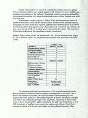


Search results from Open Library.
Recent natural events nearby
Ground air-quality sensors
Recently spotted species
Nearest stream gauge
Events
Gallery
Sources
- • Wikipedia
- • US Census Bureau (ACS 5-year estimates)
- • NOAA National Weather Service
- • Wikidata
- • USGS Earthquake Catalog (global feed)
- • NCES via Urban Institute Education Data Portal
- • GBIF (Global Biodiversity Information Facility)
- • CDC PLACES
- • Open-Meteo / sunrise-sunset.org
- • Wikipedia Pageviews API
- • Open Library