Browse / United States / Montana / Bigfork
Bigfork
MontanaCDP

Bigfork
Total population
5,565
Median home value
$674,600
Bachelor's+
Median income
$85,307
Demographic figures from US Census Bureau · ACS 5-year estimates. Overview below cites Wikipedia and may reference a different year.
City facts
Facts from Wikidata (CC0).
Overview
Bigfork is a census-designated place (CDP) in Flathead County, Montana, United States. It is within Montana's Rocky Mountains. The population was 5,118 at the 2020 census, up from 4,270 in 2010.
Read more on WikipediaHistory & geography
History
Some say the name "Bigfork" is derived from the Salish name for the area. However, Bigfork is a fork where two rivers, the Flathead River and the Swan River, flow in to the Flathead Lake. There are reports of a homestead and orchard immediately north of Bigfork as early as 1885. Everit L. Sliter set out 500 apple, cherry, plum, and pear trees in 1892 on Flathead Lake's east shore. He became the first postmaster in 1901. In 1902, he platted the Bigfork townsite at the mouth of the Swan River. The east shore has since become a major cherry-growing area. Wayfarers State Park lies just south of the community.
Geography
Bigfork is located in south-central Flathead County at the north end of Flathead Lake. The western edge of the CDP is the Flathead River, the primary inflow of the lake. The Swan River flows into Flathead Lake from the east, entering the lake at the center of town. The CDP extends south to the Lake County line; east to Mud Lake, Mud Creek, and the north–south part of the Swan River; and northwards to the roads north of Echo Lake. Kalispell is to the northwest, via Montana Highway 35, Montana Highway 82, and U.S. Route 93. Highway 35 runs through the center of Bigfork and proceeds south along the eastern shore of Flathead Lake, rejoining US 93 at Polson. According to the United States Census Bureau, the Bigfork CDP has a total area of , of which is land and , or 16.25%, is water.
Excerpted from the corresponding Wikipedia article (CC BY-SA).
Demographics & economy
Race & ethnicity
Source: US Census Bureau — American Community Survey, 5-year estimates.
Geography
Coordinates & boundaries from the US Census TIGER/Line shapefiles.
Climate
Current forecast
Forecast for Bigfork, MT from NOAA NWS API.
Air quality
Industrial & pollution facilities
Natural hazard risk
Health (adults)
Age-adjusted prevalence estimates from CDC PLACES (latest release).
Walkability
Amenities nearby
Wildlife & biodiversity
Most-observed species
- Black-capped ChickadeePoecile atricapillus (Linnaeus, 1766) · Aves4,797
- Northern FlickerColaptes auratus (Linnaeus, 1758) · Aves4,723
- Canada Goose (canadensis Group)Branta canadensis (Linnaeus, 1758) · Aves4,395
- MallardAnas platyrhynchos Linnaeus, 1758 · Aves3,865
- American RobinTurdus migratorius Linnaeus, 1766 · Aves3,687
- Red-winged BlackbirdAgelaius phoeniceus (Linnaeus, 1766) · Aves3,556
- House FinchHaemorhous mexicanus (P.L.Statius Müller, 1776) · Aves3,302
- Black-billed MagpiePica hudsonia (Sabine, 1823) · Aves3,095
Citizen-science & research observations from the Global Biodiversity Information Facility (GBIF).
Schools
Largest nearby schools
- Bigfork ElementaryElementary · Bigfork · 461 students · 15.9:1 ratio
- Bigfork High SchoolHigh · Bigfork · 354 students · 16.1:1 ratio
- Lakeside Elementary SchoolElementary · Lakeside · 302 students · 13.7:1 ratio
- Somers Middle SchoolMiddle · Somers · 253 students · 14.1:1 ratio
- Bigfork 7-8Middle · Bigfork · 149 students · 18.6:1 ratio
- Creston SchoolElementary · Kalispell · 121 students · 12.1:1 ratio
- Swan River SchoolElementary · Bigfork · 112 students · 12.4:1 ratio
- Swan River 6-8Middle · Bigfork · 79 students · 19.8:1 ratio
Public K–12 schools within ~10 mi from Urban Institute Education Data Portal (NCES Common Core of Data, 2022).
Earthquake history
Most recent
- M 2.6 — 2026-01-1913 km ESE of Kicking Horse, Montana
- M 2.5 — 2024-06-2324 km E of Swan Lake, Montana
- M 3 — 2024-03-1517 km SSE of Swan Lake, Montana
- M 2.6 — 2023-09-174 km NW of Happys Inn, Montana
- M 2.5 — 2023-03-0918 km WNW of Dixon, Montana
- M 3.7 — 2022-11-163 km NE of Ravalli, Montana
Events from the USGS Earthquake Catalog (global) (FDSN Event Web Service).
Photos
Sights & places nearby
Notable people from here
People born within ~10 km, from Wikidata (CC0). Click any name for their Wikipedia article.
Nearby places in Montana
Geography & sun
Elevation, sunrise/sunset and daylight from Open-Meteo. Solar climatology from NASA POWER.
Nearby airports
Public attention
Pageview totals from the Wikimedia Pageviews API.
Books about Bigfork


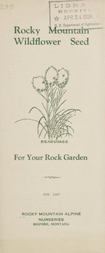

Search results from Open Library.
Recent natural events nearby
- Wildfire Deer Creek, Lincoln, MontanaWildfires · 2026-08-20 · 48 mi
- Wildfire Camp Creek, Powell, MontanaWildfires · 2026-08-21 · 63 mi
- Wildfire Dudley, Shoshone, IdahoWildfires · 2026-08-26 · 94 mi
- Wildfire Moose Mountain, Clearwater, IdahoWildfires · 2026-07-30 · 106 mi
- Wildfire Silver, Boundary, IdahoWildfires · 2026-08-23 · 125 mi
- Wildfire Parker Lake, Boundary, IdahoWildfires · 2026-08-23 · 130 mi
- Wildfire Black Bear, Ravalli, MontanaWildfires · 2026-08-01 · 133 mi
- Wildfire Nature Grove, Ravalli, MontanaWildfires · 2026-08-23 · 134 mi
Wildfires, storms and other events from NASA EONET (last 12 months, within 250 mi).
Ground air-quality sensors
Recently spotted species
Nearest stream gauge
Events
Gallery
Sources
- • Wikipedia
- • US Census Bureau (ACS 5-year estimates)
- • NOAA National Weather Service
- • Wikidata
- • USGS Earthquake Catalog (global feed)
- • NCES via Urban Institute Education Data Portal
- • GBIF (Global Biodiversity Information Facility)
- • CDC PLACES
- • Open-Meteo / sunrise-sunset.org
- • Wikipedia Pageviews API
- • Open Library
- • NASA EONET